
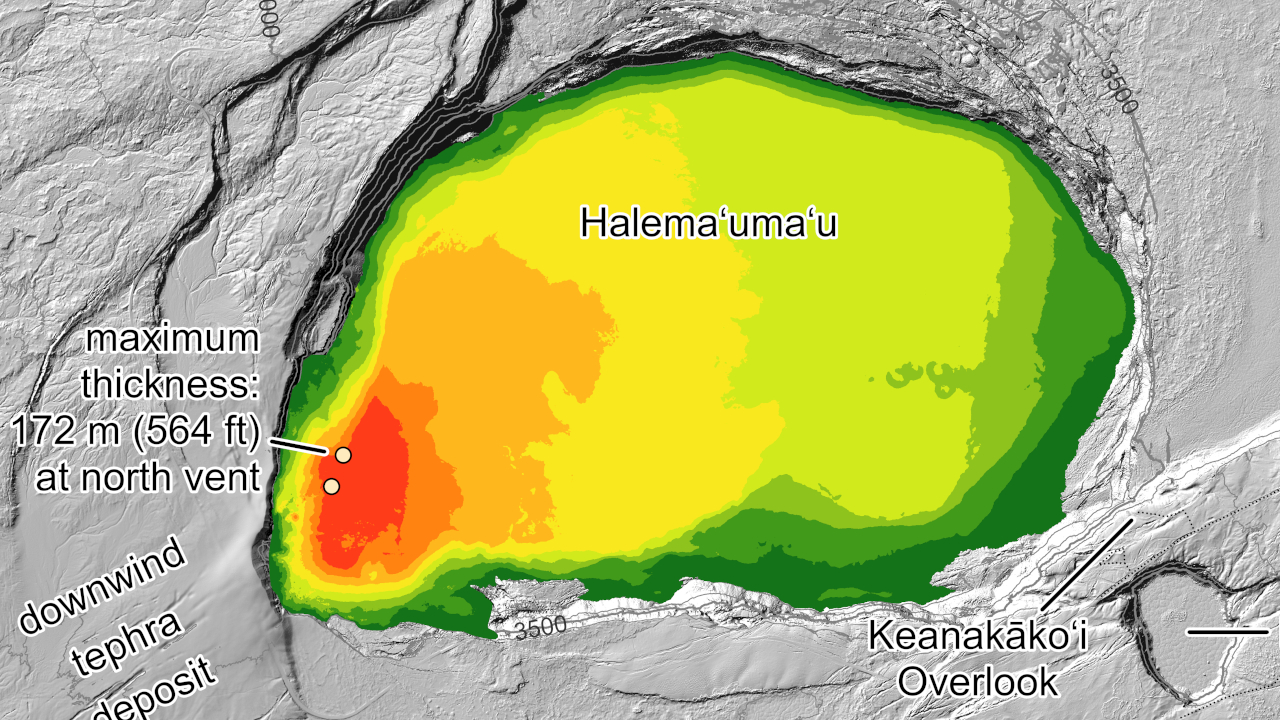

Inset of USGS map shows thickness values for lava flows within Halema‘uma‘u crater from the Kīlauea summit eruption that began on December 23, 2024. Full map below.

New Kīlauea Maps Chart Changes In Summit Eruption

Big Island Video News

Jul 13, 2026

STORY SUMMARY

HAWAIʻI VOLCANOES NATIONAL PARK - New eruption maps were published by the USGS on Monday, depicting the Kīlauea summit eruption within Halema‘uma‘u crater.

(BIVN) – The USGS Hawaiian Volcano Observatory on Monday published a two new maps of the Kīlauea summit area, charting the changes at the summit since the began on December 23, 2024. 

The ongoing eruption at the summit of Kīlauea is currently paused. The next episode of high lava fountaining, episode 51, is expected to occur soon, although recent deflation at the summit has likely delayed the event. 
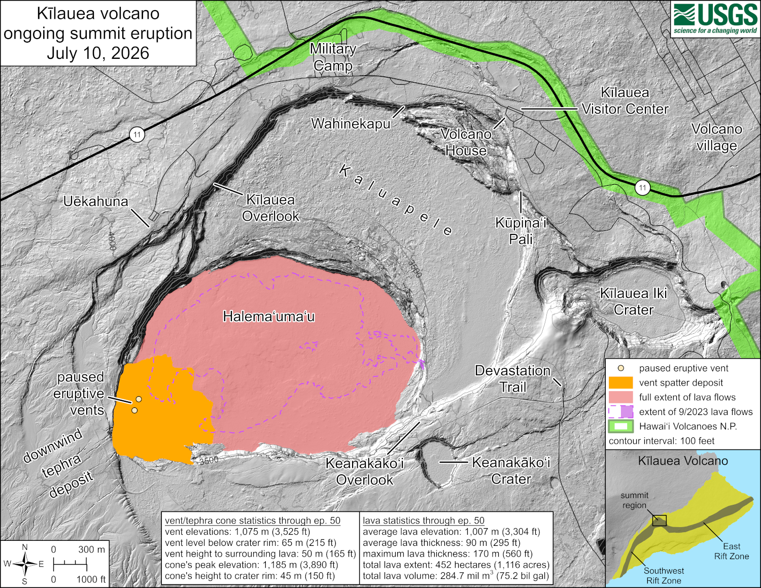
This reference map depicts the Kīlauea summit eruption within Halema‘uma‘u crater that began on December 23, 2024. Most of the data for this map were collected during a USGS Hawaiian Volcano Observatory helicopter overflight on June 30, 2026, so the provided statistics are reflective of the entire eruption through episode 50 on June 27.

The Observatory so the provided these statistics, which are reflective of the entire eruption, from the first episode through episode 50 on June 27, 2026. 

Eruptive vent and tephra cone statistics through episode 50:

  • Vent elevations: 1,075 meters (3,525 feet)
  • Vent level below crater rim: 65 meters (215 feet)
  • Vent height to surrounding lava: 50 meters (165 feet)
  • Cone’s peak elevation: 1,185 meters (3,890 feet)
  • Cone’s height to crater rim: 45 meters (150 feet)

Lava statistics through episode 50:

  • Average lava elevation: 1,007 meters (3,304 feet)
  • Average lava thickness: 90 meters (295 feet)
  • Maximum lava thickness: 170 meters (560 feet)
  • Total lava extent: 452 hectares (1,116 acres)
  • Total lava volume: 284.7 million cubic meters (75.2 billion gallons).
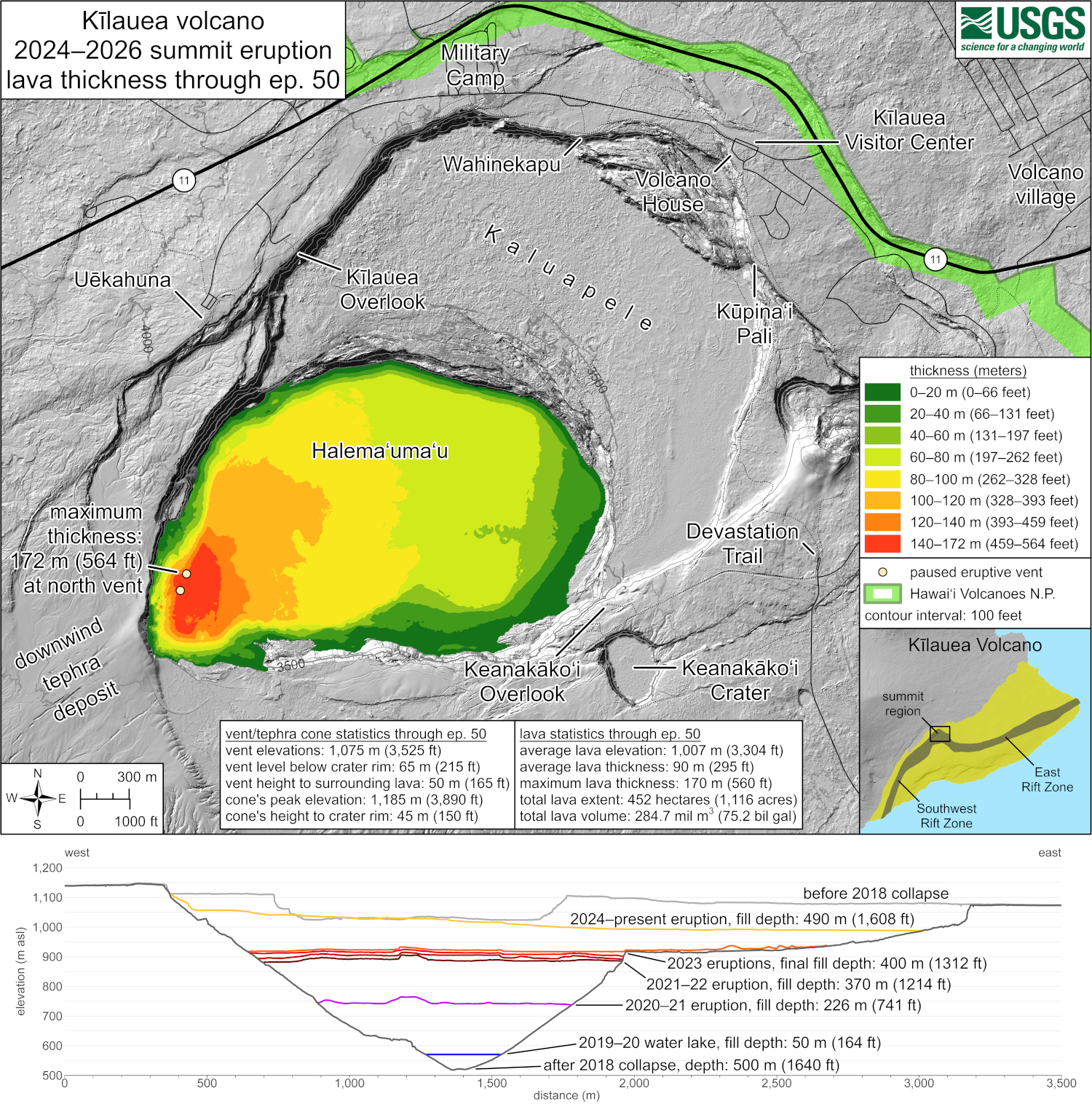
This map shows thickness values for lava flows within Halema‘uma‘u crater from the Kīlauea summit eruption that began on December 23, 2024. These values were calculated by topographic differencing between a digital elevation model collected on June 30, 2026—after eruptive episode 50—and one from before the eruption began. Also included here are west-to-east profiles across the summit caldera, depicting topographic changes since 2018. Profiles are provided for the periods before the 2018 caldera collapse, shortly after the 2018 collapse, following each of the five summit eruptions from 2020–2023, and for this eruption following the end of episode 50. Also shown is the maximum depth of the 2019–2020 Halema‘uma‘u water lake.

The USGS Volcano Alert Level for Kīlauea is ADVISORY.

About The Featured Image

Inset of USGS map shows thickness values for lava flows within Halema‘uma‘u crater from the Kīlauea summit eruption that began on December 23, 2024.


Image placeholder

Big Island Video News has been serving Hawaiʻi island since 2008.