This is a breaking news story that will be updated when more information become available.
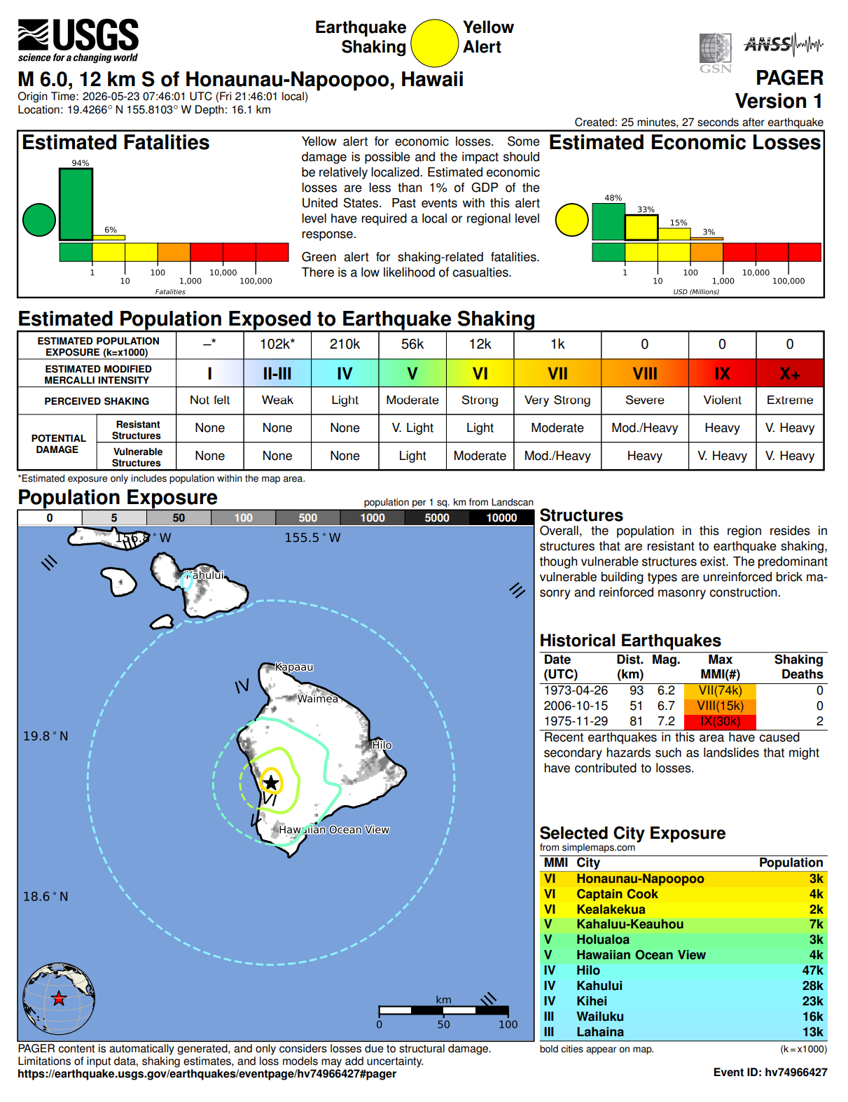
(BIVN) – A magnitude 6.0 earthquake (updated from 5.9) shook the State of Hawaiʻi at 9:46 p.m. on Friday night.
The Pacific Tsunami Warning Center says no tsunami is expected, but added that some areas may have experienced strong shaking.
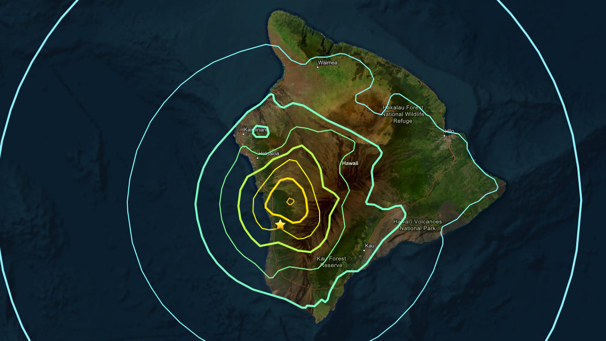
The earthquake was located on the western flank of Mauna Loa volcano, 7 miles south of Puʻuhonua o Hōnaunau National Historical Park in the South Kona district. The quake was measured at a depth of 22 km, or 13 miles.
“As in all earthquakes, be aware of the possibility of after-shocks,” said the Hawaiʻi County Civil Defense in an alert message. “If the earthquake was strongly felt in your area, check for any damages, including but not limited to structural and gas, water, and electrical utilities.”
“An earthquake at 9:46 p.m. HST was felt widely on the Island of Hawai’i, Maui, and Oahu,” said the USGS Hawaiian Volcano Observatory. “HVO is analyzing the event now and details on the magnitude, location, and depth will follow in an Information Statement within the hour.”
UPDATE – (11 p.m.) – The USGS Hawaiian Volcano Observatory issued an Information Statement on the earthquake at 10:42 p.m. HST. Scientists reported the event had no apparent impact on either Mauna Loa or Kīlauea volcanoes. The Observatory wrote:
The depth, location, and recorded seismic waves of the earthquake suggest that it was caused by stress due to bending of the oceanic plate from the weight of the Hawaiian island chain; the earthquake was not directly related to volcanic processes. Strong to very strong shaking was reported on the west side of the Island of Hawaiʻi during the earthquake that happened this evening and could have resulted in light to moderate damage to infrastructure. Please report any observed damage to the County of Hawaiʻi Civil Defense Agency. Several aftershocks from the earthquake that happened this evening have already occurred. Most have been smaller than magnitude-3. Aftershocks may continue to occur in the coming days but are unlikely to be large enough to be felt or cause damage. We appreciate the more than 2,500 residents and visitors who submitted felt reports to the USGS website for this event; such reports help USGS and other responding agencies to understand the affected area and potential impacts of earthquakes.
UPDATE – (11:13 p.m.) – The Hawaiʻi County Hazard Impact Map shows Napoʻopoʻo Road in South Kona was closed in both directions as of 11 p.m. HST, due to debris in the roadway.
Debris was also reported on Highway 11 near Hawaiian Ocean View Estates.
A Water Main Break was reported on Highway 11 in South Kona at 11:06 p.m. HST, with water on the roadway.
“There are reports of landslides along Highway 11 from Captain Cook to Ocean View,” the Hawaiʻi County Civil Defense said in a 11:20 p.m. message. “If you must get on the roads tonight drive with caution. Mahalo.”
Report any damage to Civil Defense via the Civil Defense webpage or by calling 808-935-0031.