
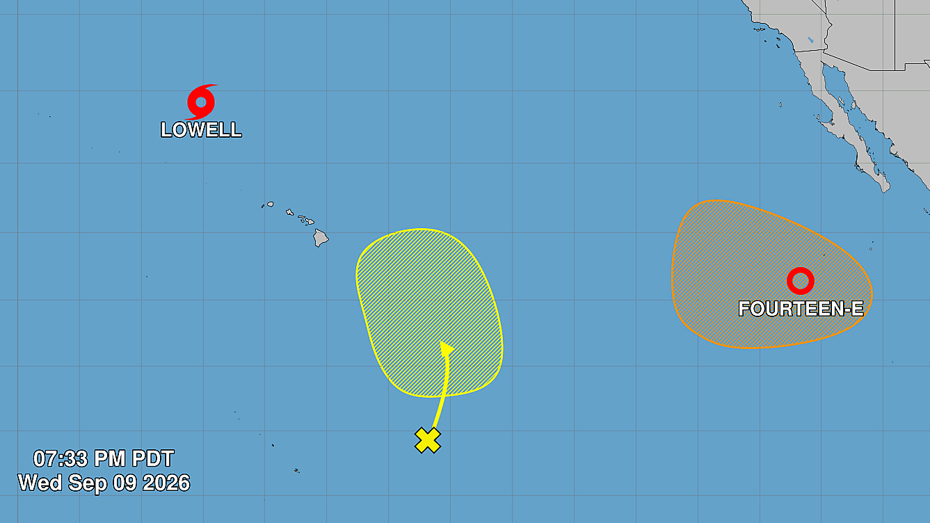

(BIVN) – Tropical Storm Lowell is departing Hawaiʻi, over 600 miles northwest of Lihue on Wednesday evening. Meanwhile, far to the east, a new tropical depression has formed, another reminder that this busy hurricane season is far from over.
The Flood Watch for Hawaiʻi Island has been discontinued, although remnant moisture from Lowell is still lingering across the Big Island. On Wednesday evening, a Flood Advisory was issued for an area of North and South Kohala.
“At 4:33 PM HST, Doppler radar indicated heavy rain over the Kohala districts,” the National Weather Service reported. “Rain was falling at a rate of 0.5 to 1.5 inches per hour with the heaviest rates over the slopes. Minor flooding i ongoing or expected to begin shortly in the advisory area.”
“Instability remains marginal tomorrow, but enough to warrant a slight chance of thunderstorms with locally heavier rainfall over the interior of the Big Island this afternoon and again Thursday afternoon,” the National Weather Service stated.
Under developing strong El Niño event, new storms are forming in the Pacific Ocean.
Tropical Depression Fourteen-E was 625 miles southwest of the southern tip of Baka California on Wednesday evening. The developing storm is moving west northwest at 12 mph, and is likely to become a tropical storm on Thursday.
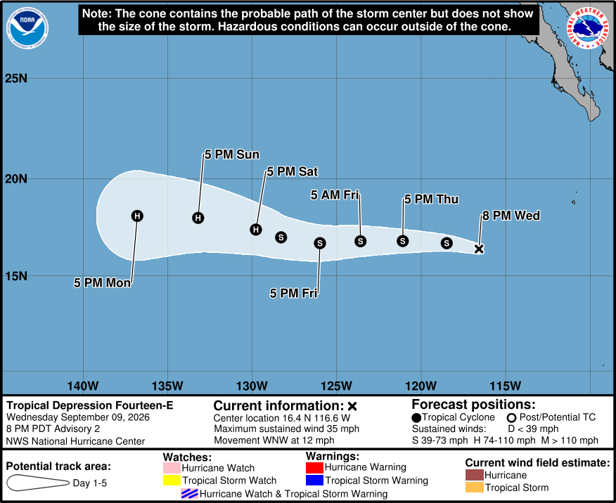
From the National Hurricane Center on Wednesday evening:
There has been no significant increase in the overall organization of the tropical cyclone over the past several hours. The system is producing vigorous deep convection well east of the estimated center location with cloud tops to -80 deg C or colder. These heavy showers and thunderstorms are not very well organized with little evidence of convective banding at this time. There is some westerly shear over the depression since the low-level center is near the western edge of the main cloud mass. Given that the system has not become much better organized since the previous advisory, the intensity is held at 30 kt for now. This is just a little below the subjective Dvorak estimate.
The center appears to have reformed in the low-level vorticity maximum on the northern side of the broad circulation, and is a little to the north of the previous track. A mid-tropospheric ridge should prevail to the north of the system for the next several days, which should keep the cyclone moving on a generally westward track. Late in the forecast period, the ridge shifts westward and builds a little. This could result in a gradual turn to the left around day 5. The official forecast is a little north of the previous NHC track and is close to the latest corrected consensus, HCCA, guidance.
The system is expected to be in a reasonably conductive environment for intensification in a few days. However, the current westerly shear could be an impediment to short-term strengthening. Also, some arc clouds have been seen emanating from the cyclone on visible satellite imagery, which is usually indicative of the presence of some dry mid-level air. However, these negative factors are expected to be short-lived, and the system is forecast to strengthen and eventually become a hurricane. The official intensity forecast is similar to the simple and corrected consensus intensity model predictions and is the same as in the previous advisory.
There is also broad trough of low pressure associated with disorganized showers and thunderstorms that has formed well to the south-southeast of the Hawaiian Islands. It has a low chance of forming a tropical depression in the next 7 days.
Another area of low pressure is forecast to form several hundred miles south of the southern tip of the Baja California Peninsula this weekend or early next week. The National Hurricane Center says this could form into a tropical depression early next week.
