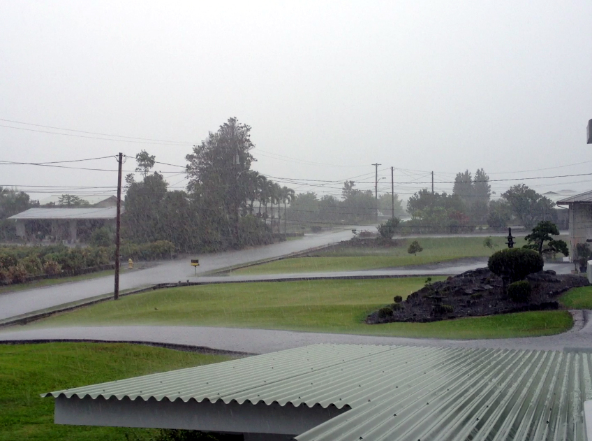
(ABOVE VIDEO) Footage of a thunderstorm soaking Hilo as it passes over Hawaii Island, taken at around 1 p.m. HST
NEWS BRIEFS
- Hawaii Island is under numerous weather advisories. As of 1 p.m., there was a Flood Advisory in effect, a Winter Weather Advisory, and Special Marine Warning off Hamakua and Ka’u.
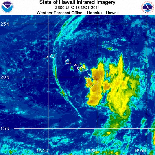
- At 12:18 p.m. HST, the National Weather Service (NWS) says a line of strong thunderstorms was located from North Kona to 13 miles east of Honaunau, to 7 miles west of Hawaiian Ocean View Estates. These storms were nearly stationary.
- In East Hawaii, thunderstorms rumbled and heavy rain soaked Hilo.
Forecasters warn of small hail, wind gusts to 40 mph, and frequent lightning. “Move indoors when a thunderstorm approaches,” states NWS.” Very heavy rain will fall from these storms… And will cause water to pond on roads and fill poor drainage areas.”
PRIMARY SOURCES
First the flood advisory:
The National Weather Service in Honolulu has issued a
* flood advisory for the Island of Hawaii in Hawaii County
* until 4:15 pm HST
* at 1:12 pm HST… Radar showed heavy rain along a line extending from 8 miles northeast of Kawaihae to Pepeekeo… Moving west at 20 mph. Additional heavy rain was located from Keahole Point to Milolii… And from Naalehu to Wood Valley. Both of these areas were nearly stationary.
* this advisory covers the entire Island of Hawaii.
Precautionary/preparedness actions…
Stay away from streams… Drainage ditches and low lying areas prone to flooding.
Rainfall and runoff will also cause hazardous driving conditions due to ponding… Reduced visibility and poor braking action.
Do not cross fast flowing or rising water in your vehicle or on foot. Turn around… Don’t drown.National Weather Service on Oct. 13 at 1:16 p.m. HST
Here’s what the WHS is saying for the summits:
Winter Weather Advisory in effect from noon today to 6 a.m. HST Tuesday…
The National Weather Service in Honolulu has issued a Winter Weather Advisory for snow… Which is in effect from noon today to 6 am HST Tuesday.
* locations… Big Island summits above 12000 ft.
* hazard types… Snow.
* accumulations… Up to 3 inches.
* timing… Snow showers and thunderstorms will develop this afternoon and continue into tonight.
* impacts… Hazardous driving conditions.
* winds… Southeast 10 to 15 mph increasing to 20 to 35 mph with gusts over 50 mph tonight.
* temperatures… In the lower 30s.
* visibilities… As low as 1 mile in snow showers.
Precautionary/preparedness actions…
A winter weather advisory means that periods of snow…Sleet…Or freezing rain will cause travel difficulties. Be prepared for slippery roads and limited visibilities… And use caution while driving.National Weather Service on Oct. 13