Big Island Video News

Serving Hawaii County

  • Hawaiʻi Island News Regions
    • Hamakua
      • Mauna Kea
    • Hilo
    • Kau
    • Kona
    • Kohala
    • Puna

Lava Ocean Entry Widens, Building Black Sand Beach
Avatar photo

by Big Island Video News
on Jul 30, 2016 at 4:02 pm

Subscribe to Big Island Video News (FREE)

* indicates required

STORY SUMMARY

HAWAII VOLCANOES NATIONAL PARK (BIVN) - The Kamokuna lava ocean entry continues and has widened since July 26, scientists say. The area where lava spills over the cliff now spans 787 feet.

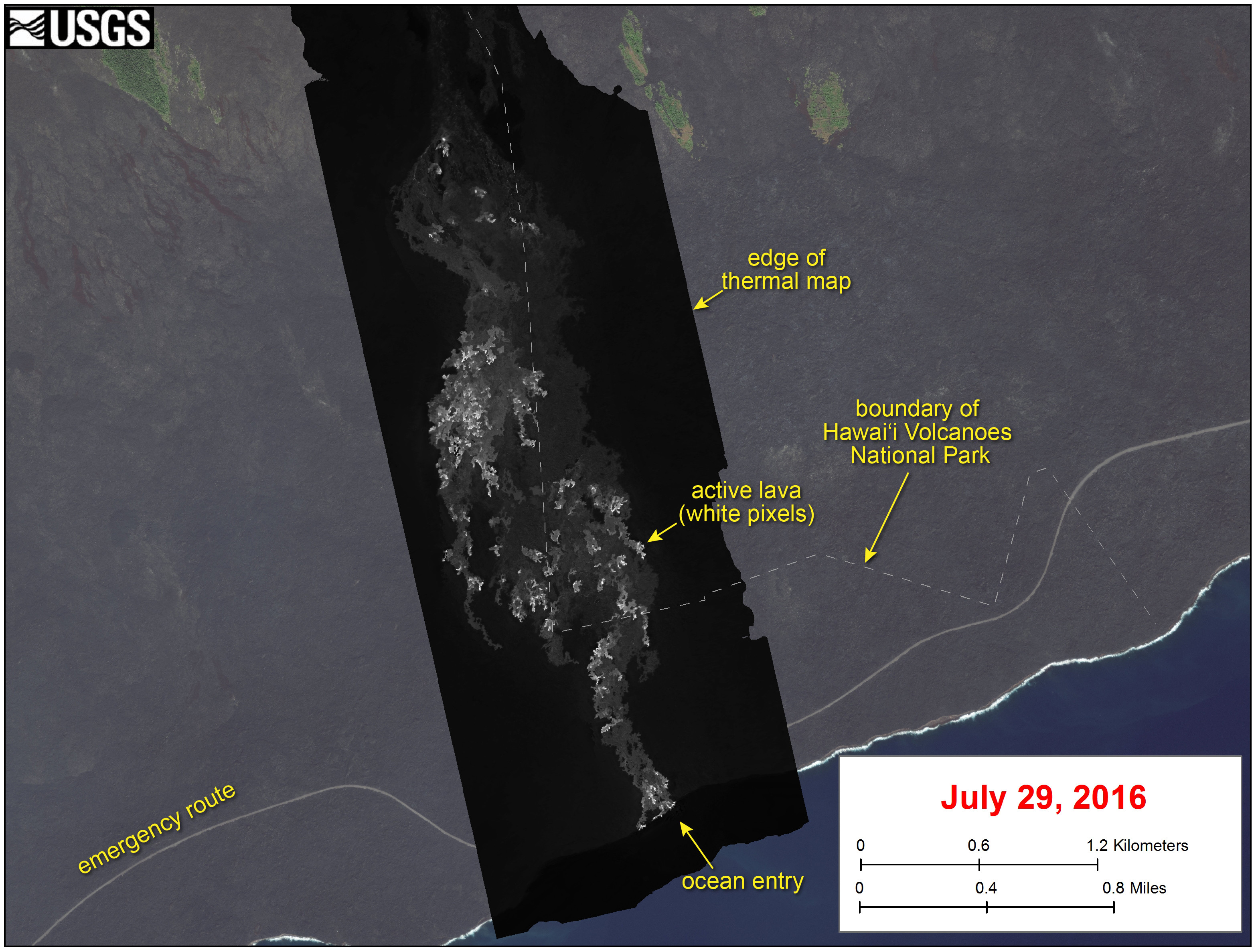
HAWAII VOLCANOES NATIONAL PARK – The lava ocean entry that began on July 26 is widening and is building new land.

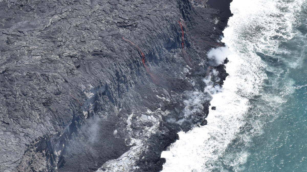
The Kamokuna entry is where the 61g lava flow from Puʻu ʻŌʻō meets the Pacific Ocean, and is within the boundaries of the Hawaii Volcanoes National Park. Since it first started five days ago, the area where the lava spills over the cliff into the sea has grown to span 787 feet.

Scientists with the USGS Hawaiian Volcano Observatory observed two entry points on Friday, seen in the photo below.

This USGS photo shows the two entry points observed Friday: the original one, where lava first entered the ocean on July 26 (near center of photo), and a smaller one to the west (far left side of photo).

This USGS photo shows the two entry points observed Friday: the original one, where lava first entered the ocean on July 26 (near center of photo), and a smaller one to the west (far left side of photo).

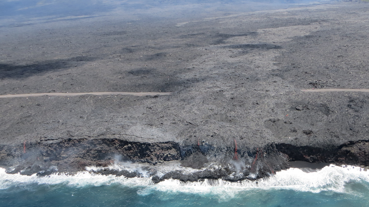
The ocean entries are adding lava to the rubble at the bottom of the sea cliff, scientists say.

A new “beach” is beginning to form below the cascading lava, as well. Black sand, “formed by the interaction of hot lava and cool seawater as well as by wave erosion of the rocky cliff,” scientists say, is accumulating along the coastline.

This USGS image shows a thermal map of the flow on the pali and coastal plain, created from airborne thermal images. White pixels are hot, and show areas of active surface breakouts. The background image is a satellite image collected before the current lava flow was active. The thermal map shows scattered pāhoehoe breakouts on the coastal plain, with a narrow lobe of lava crossing the gravel road and extending to the ocean.

This USGS image shows a thermal map of the flow on the pali and coastal plain, created from airborne thermal images. White pixels are hot, and show areas of active surface breakouts. The background image is a satellite image collected before the current lava flow was active. The thermal map shows scattered pāhoehoe breakouts on the coastal plain, with a narrow lobe of lava crossing the gravel road and extending to the ocean.

Worldwide attention was actually directed mauka, away from the ocean entry in the last day or so, thanks to the remarkable image of what looked like a smiley-face in a lava lake near the Puʻu ʻŌʻō vent. The footage, recorded by Mick Kalber aboard Paradise Helicopters, went viral on social media and TV newscasts.

“Whodathunkit,” Kalber said, “a smiley face that went viral!”


Filed Under: Breaking Tagged With: 61g flow, Hawaii Volcanoes National Park, Kamokuna ocean entry, Kilauea, lava

LATEST NEWS

Largest DLNR Recruit Class In History Commissioned

Shark Bite At Anaehoʻomalu Bay Sends Man To Hospital

VOLCANO WATCH: GeoScientists Promoting Accessible Collaborative Experiences

Kona Man Charged In Kopiko Street Burglaries

Suspect In Ocean View Shooting Indicted By Hilo Grand Jury

VIDEO: Bill Removes Power To Suspend Electronic Media During Emergency

About Big Island Video News

  • Privacy Policy

Copyright © 2023 · Dynamik-Gen on Genesis Framework · WordPress · Log in