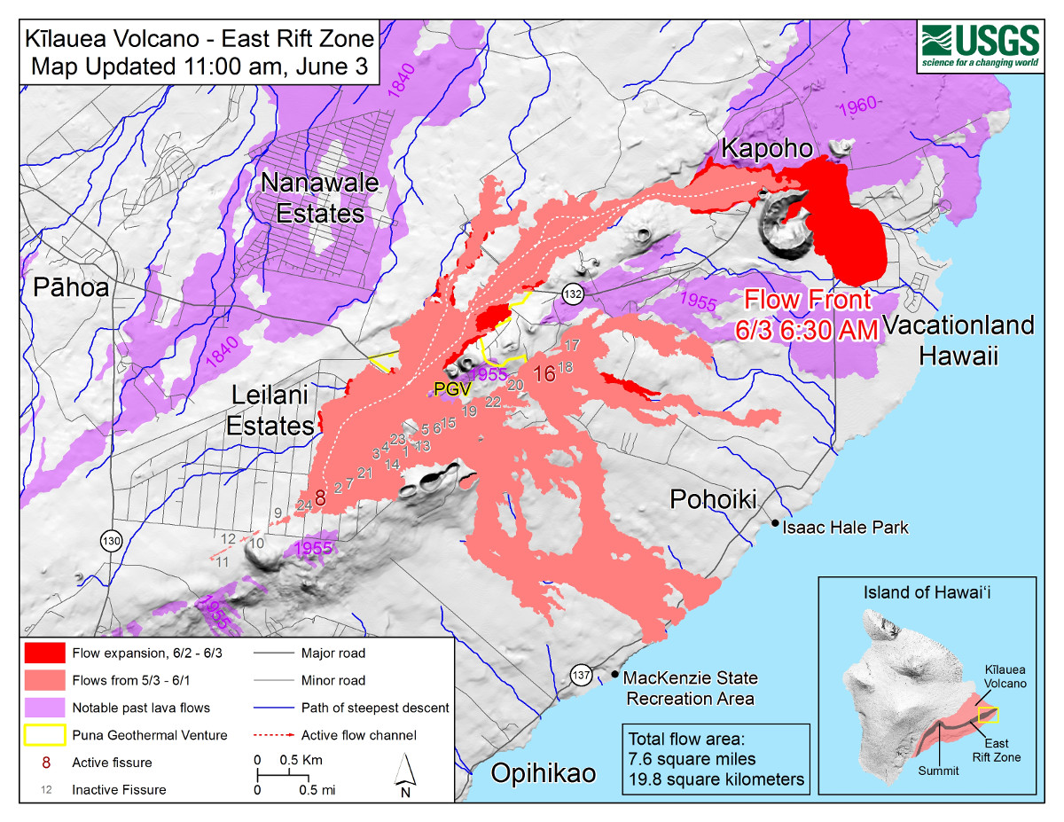
USGS MAP: Map as of 11:00 a.m. HST, June 3, 2018. Given the dynamic nature of Kīlauea’s lower East Rift Zone eruption, with changing vent locations, fissures starting and stopping, and varying rates of lava effusion, map details shown here are accurate as of the date/time noted. Shaded purple areas indicate lava flows erupted in 1840, 1955, 1960, and 2014-2015.
(BIVN) – A wide lava flow continues to travel downslope through Kapoho Beach Lots, and is about 400 yards from the ocean, officials say.
The lava flow, erupting from Fissure 8 in Leilani Estates, crossed Highway 137 on Saturday. Hawaii County Civil Defense says the following policies are in effect:
- There is no access to Kapoho, Vacationland, Highway 132, and Highway 137.
- First responders are conducting search and rescue missions in affected isolated areas today.
- Be aware of the laze hazard should lava hit the ocean and stay away from any ocean plume to prevent harmful health effects.
Government Beach Road, between Kahakai Boulevard and Papaya Farms Road, is open to Waa Waa and Papaya Farms Road residents only with official credentials. There is no curfew, civil defense says.
State Senator Kai Kahele once again provided video recorded earlier this morning over the lava flow from a military helicopter.
According to the USGS Hawaiian Volcano Observatory at 10:40 a.m. HST:
Fissure 8 fountaining persisted throughout the night, and the channelized flow continued to deliver lava northeast along Highway 132 to the Kapoho area. Lava is advancing along a 0.5-mile-wide front towards the ocean at Kapoho Bay between Kapoho Beach Road and Kapoho Kai Drive. As of 7:30 AM HST, the lava flow was about 430 yards from the ocean. Other branches of the Fissure 8 lava flow were inactive.
All other fissures are inactive, scientists say, “although Fissure 9 is steaming heavily.”
During an 11 a.m. media conference call, USGS Hawaiian Volcano Observatory seismologist Brian Shiro talked about the possibility of eruptive activity moving uprift, due to what is being observed at Fissure 9. He also talked about how the current activity on the lower East Rift Zone is being considered a separate eruption from the middle East Rift Zone eruption at Puʻu ʻŌʻō, which lasted over 35 years.
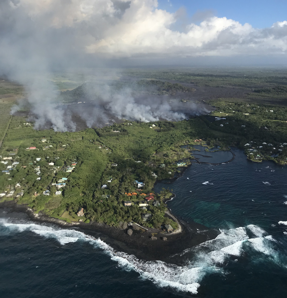
USGS: Overflight photo at 7AM HST from offshore looking up the flowfront. Nearly all of the front was active and advancing/spreading.

by Big Island Video News
on at
STORY SUMMARY
PUNA, Hawaii - The wide lava flow front is about 400 yards from the ocean, moving slowly through Kapoho Beach Lots / Vacationland.