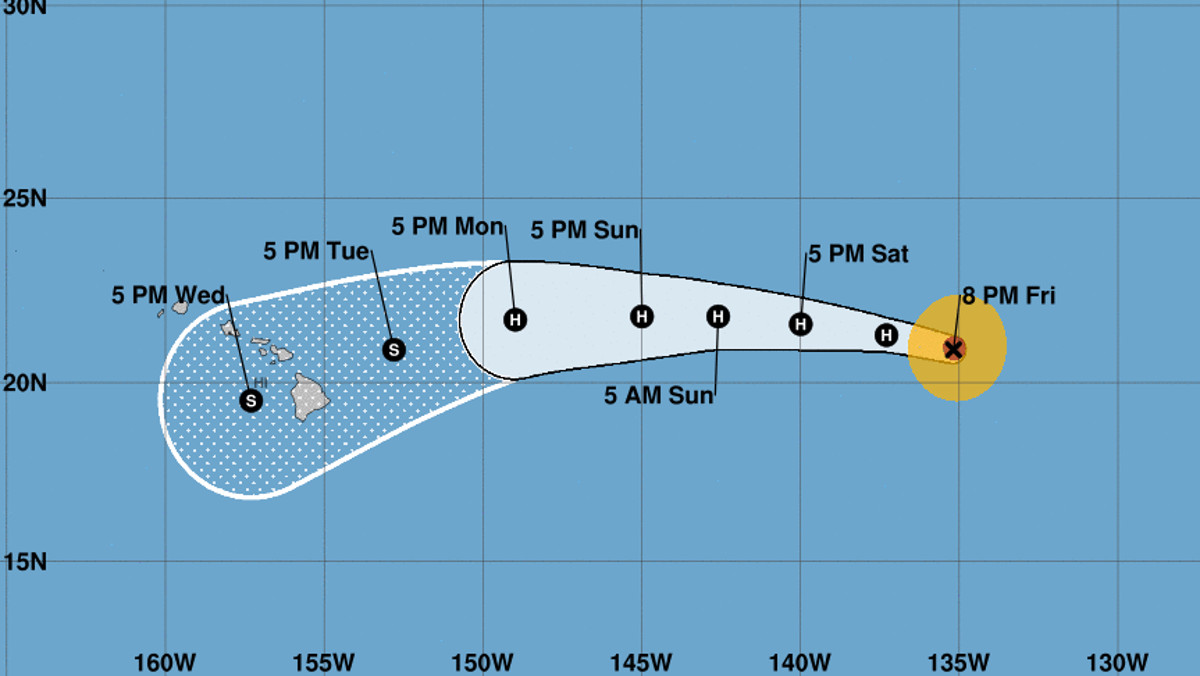
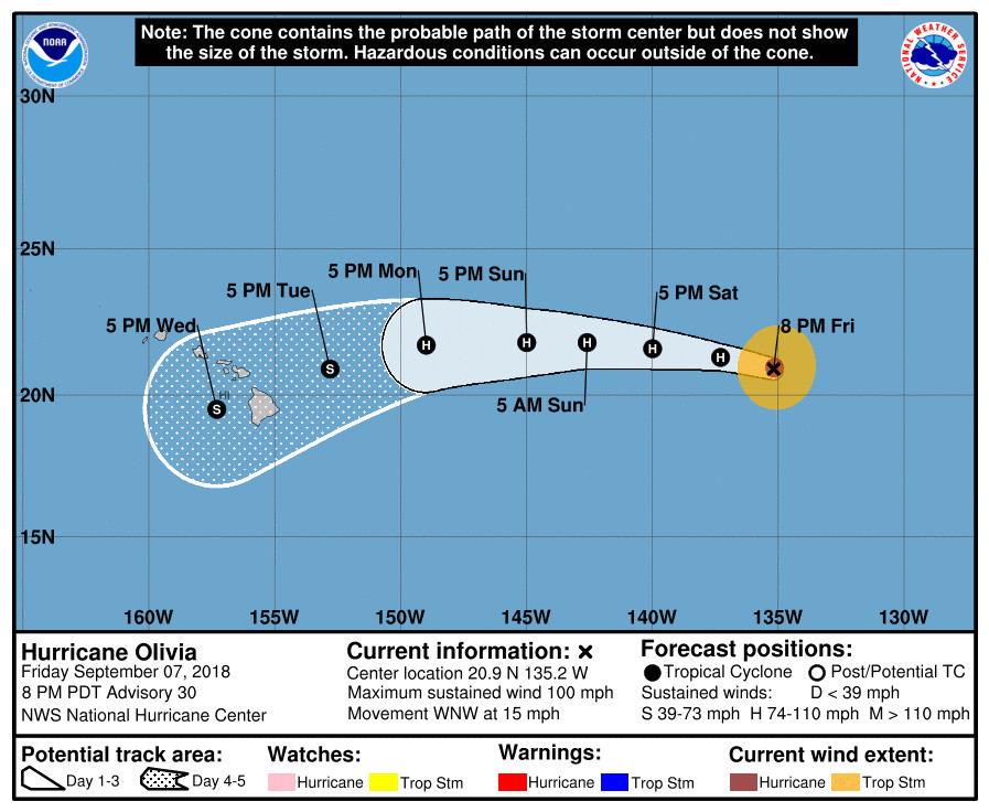
(BIVN) – Hurricane Olivia is gradually weakening, but its forecasted track has the storm approaching the Hawaiian Islands in 4 to 5 days.
Hurricane Olivia, with maximum sustained winds are near 100 mph, is 1,290 miles east of Hilo and is moving west-northwest near 15 mph. This general motion is forecast to continue through Saturday, at which time Olivia is expected to cross into the Central Pacific Basin. A gradual turn toward the west is expected Saturday night or Sunday, the National Hurricane Center says.
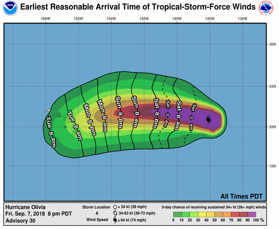
Interests in Hawaii should monitor the progress of Olivia this weekend and use this time to enact your hurricane action plan, the National Weather Service says.
The National Hurricane Center posted two “key messages” in its 5 p.m. discussion:
1. Olivia is forecast to approach the main Hawaiian Islands from the east early next week, but it is too soon to determine the exact location and magnitude of any impacts. Interests in Hawaii should monitor the progress of Olivia this weekend and use this time to enact your hurricane action plan.
2. Do not focus on the exact track or intensity forecast, or any specific landfall location, as errors can be large at extended time ranges. Tropical storm or hurricane conditions could be felt anywhere in the islands as significant impacts could extend well away from the center.
The weakening Tropical Storm Norman was about 380 miles north northeast of Hilo as of 5 p.m. HST, moving toward the north-northwest at around 10 mph. “Just about all of the heavy weather is to the north of the center, leaving an almost cloud free area to the south which also cover the main Hawaiian Islands,” forecasters noted today.
The High Surf Warning previously in effect has been discontinued and replaced by a High Surf Advisory, as the large east swell from Tropical Storm Norman continues to shift out of the northeast and subside from east to west across
the island chain tonight and Saturday, the National Weather Service says.