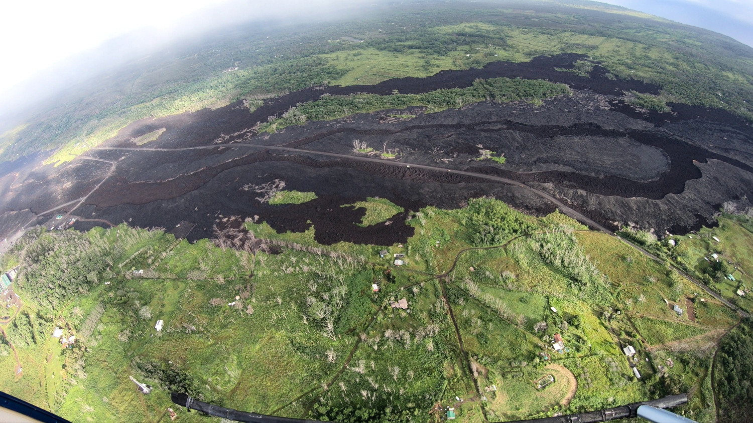
This wide-angle photo, taken during the overflight that led to the creation of the thermal map, shows the new path of Highway 132 through the fissure 8 lava channels. USGS photo by M. Patrick, 08-29-2019.
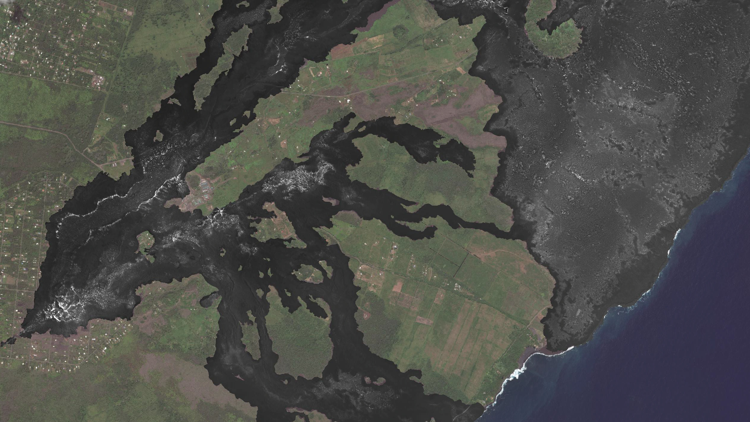
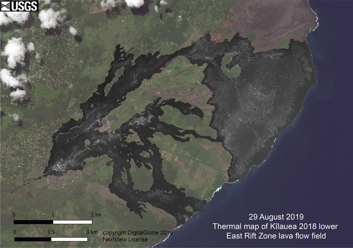
(BIVN) – A new thermal map of Kīlauea Volcano’s lower East Rift Zone has been published to the USGS Hawaiian Volcano Observatory maps page.
The preliminary thermal map shows relative surface temperatures across the 2018 lava flow field in lower Puna. “In general,” USGS HVO wrote, “the surface temperatures correlate with lava flow thickness—compare this map to the lava flow thickness map,” posted on February 19, 2019. “Thicker areas of the lava flows have more residual heat in their interiors, which sustains higher temperatures on the surface.”
For example, in the Kapoho area, where the flow is over 100 feet thick in places, scientists say “there are scattered, small hotspots with surface temperatures greater than 100 degrees Celsius (212 degrees Fahrenheit). However, most of the lava surface is much cooler than that.”
The high temperatures have presented a challenge for the County as it works to complete recovery Highway 132, which was inundated by lava during the 2018 eruption. Temperatures were measured at over 800 degrees Fahrenheit, in some places, which exceeds the recommended levels for installing an asphalt-treated base, the County says. The Highway 132 recovery must be finished by October 5 in order for the County to receive a full reimbursement for the project cost from the Federal Highway Administration. The County is seeking a time extension.
The new USGS HVO thermal map was constructed from 2,700 individual thermal images collected during a helicopter overflight on August 29. The map is preliminary, scientists say, “so small alignment issues are present in some areas.”
USGS HVO thermal map published on August 29, 2019.

by Big Island Video News
on at
STORY SUMMARY
HAWAIʻI VOLCANOES NATIONAL PARK - Scientists with the USGS Hawaiian Volcano Observatory recently conducted an overflight of the lower East Rift Zone flow field to create a thermal map.