(BIVN) – The Hawai’i Department of Transportation announced on Wednesday that special sensors have been installed along East Hawaiʻi highways that will help optimize traffic signal timing and improve traffic flow.
From the Hawaiʻi DOT news release:
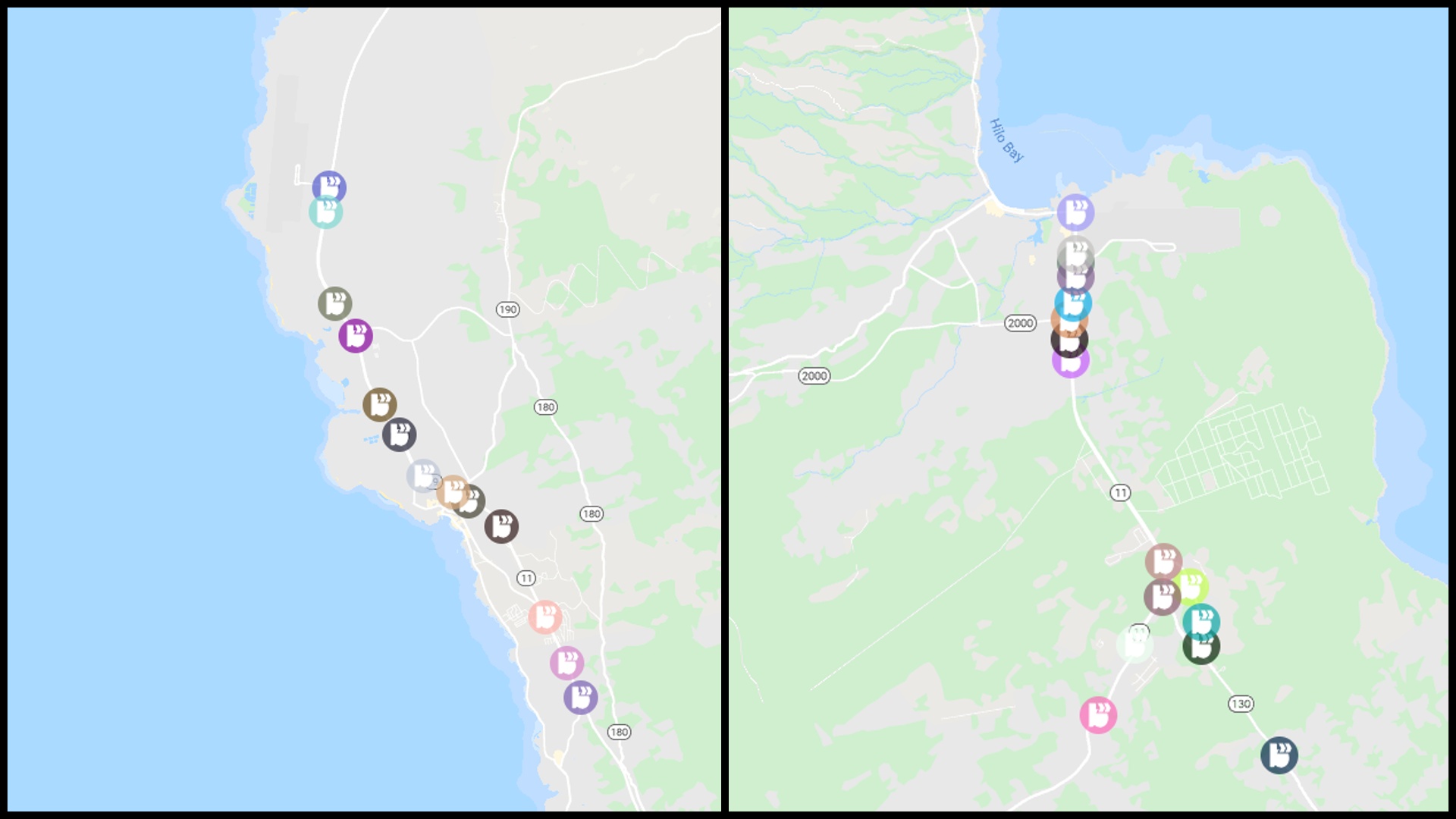
The Hawaii Department of Transportation (HDOT) is pleased to announce the installation of Blyncsy Intersect Connected Vehicle units on the 16 state-owned traffic signals in East Hawaii in cooperation with Elemental Excelerator. These connected vehicle sensors calculate travel times between units by anonymously collecting data from Bluetooth-enabled devices in passing vehicles. HDOT and the County of Hawaii will use data from the units to optimize traffic signal timing.
Hawaii Island drivers can access this traffic data for the following East Hawaii corridors here.
Route 11, Hawaii Belt Road – Between Route 19 (Kamehameha Avenue) and Hunia Road
Route 130, Keaau-Pahoa Road – Between Milo Street and Shower Drive
Installation of connected vehicle sensors on the remaining 14 state-owned traffic signals in West Hawaii is anticipated to be complete in late November. Total cost for the installations is $57,700.
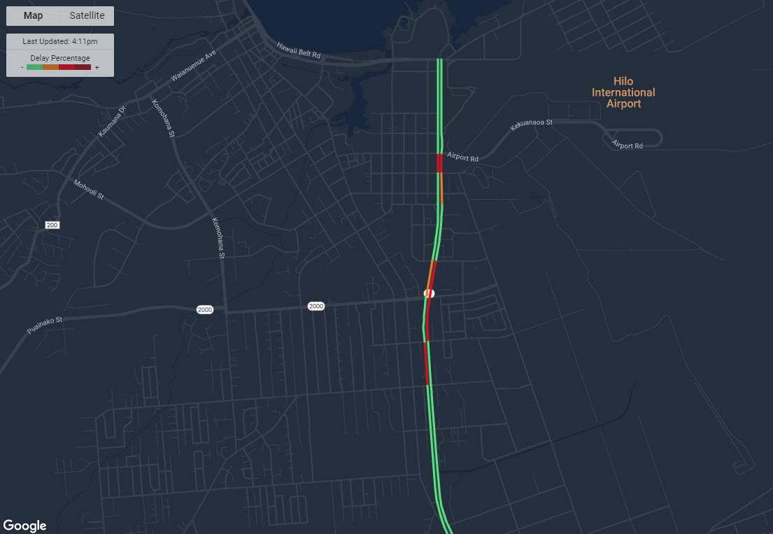
Data from the connected vehicle sensors is similar to traffic information currently available from navigation apps like Google and Apple Maps, but is more accurate as it captures data from units installed directly on traffic signals. The dashboard also allows users to view information such as speeds along the corridor and current delays. Percentage of Typical is the default layer as it compares current travel time to historical travel time for the same hour of the day. This helps users understand the difference between current conditions and typical traffic.
Blyncsy was chosen by Elemental Excelerator, a Hawaii-based startup accelerator, to help transportation agencies solve traffic issues using big data and anonymized location analytics.
Bluetooth data from the Blyncsy sensors is anonymized through a process where the data is encrypted and randomly assigned unique IDs that aren’t connected to any personal information.
HDOT anticipates the data available through the connected vehicle sensors will make corridor management more efficient by providing real-time information that was previously only available through timed drives through subject corridors. The installation of the Blyncsy Intersect Connected Vehicle units is the first step in preparing Hawaii Island roads for connected autonomous vehicles. Units are currently broadcasting travel times between sensors to vehicles enabled to receive DSRC (Dedicated Short Range Communications).