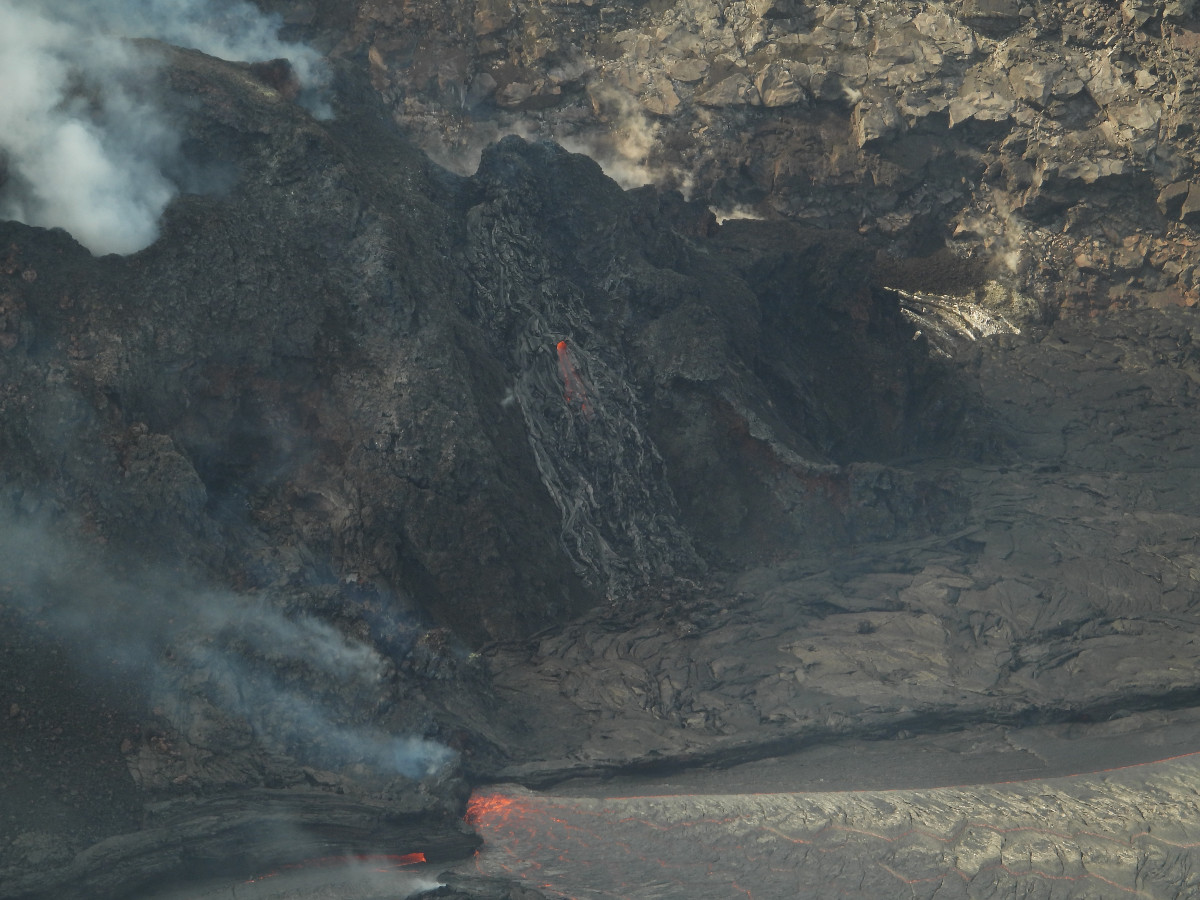
This photo shows a view of the western fissure, feeding the lava lake in Halema‘uma‘u at the summit of Kīlauea. The inlet zone, where lava is entering the lake, is visible at the bottom of the photo. Near the center of the photo, an area of lava driblets can be seen running down the flank of the western fissure’s cone. (USGS photo by M. Patrick)
(BIVN) – Kīlauea Volcano continues to erupt at the summit area within Halemaʻumaʻu, although the vigor of the activity continues to decrease.
Observations made by the USGS Hawaiian Volcano Observatory Monday afternoon “indicated lava effusion continues at the western fissure, but is weaker and slower. The lava rapidly develops a thin crust while flowing outwards towards the east with occasional crustal foundering between the vent and main island, but not beyond the island. A thin surface crust has started forming around 3 small pieces of the spatter cone that have been in the lake and are very close to the vent.”
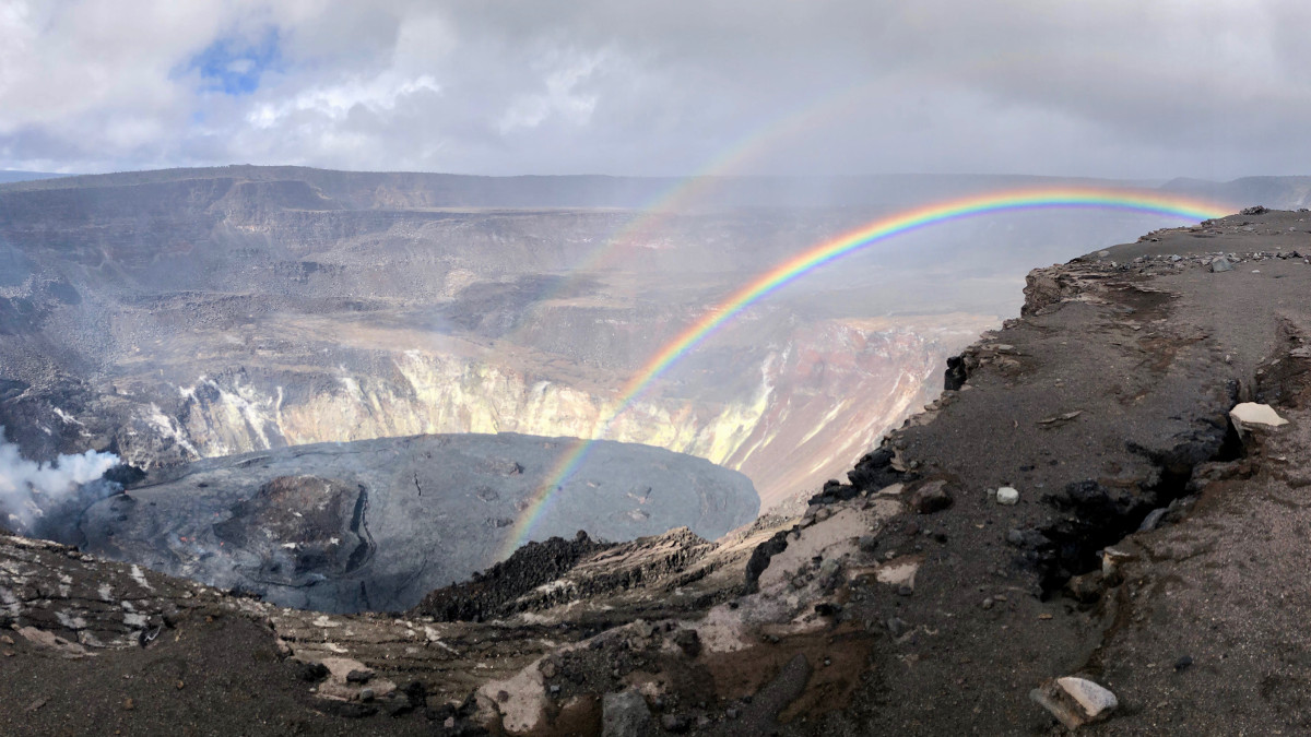
The solidified lake crust that covers the stagnant, eastern half of the lake and is slowly growing westward around the main island. The active portion of the lake was reported to be 216 m (712 ft) deep as of Tuesday morning.
The most recent sulfur dioxide emission rate measurements were the lowest since the current eruption began in December. HVO says that on February 22, rates were at about 600 t/d and continue to gradually drop. This rate is lower than the emission rates from the pre-2018 lava lake, which were around 5,000 t/d.
We will update this story with Wednesday’s update when it is posted by USGS.
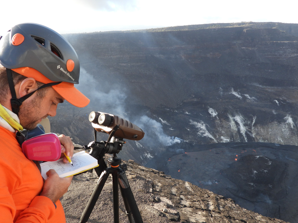
An HVO geologist uses a sketch in their fieldbook to note the location of laser rangefinder measurements of the lava lake in Halema‘uma‘u crater, at the summit of Kīlauea. Using the laser rangefinder, HVO geologists can derive the elevation of various spots on the lava lake surface, and are able to track how the elevation of features within the lava lake change over time. Field measurements on February 22 indicated that the lava in the western (active) portion of the lake in Halema‘uma‘u has filled 216 m (712 ft) of the crater. USGS photo by M. Patrick.
UPDATE – (11:30 a.m.) – From the USGS Hawaiian Volcano Observatory on Wednesday:
Activity Summary: Kīlauea Volcano is erupting. Lava activity is confined to Halemaʻumaʻu with lava erupting from a vent on the northwest side of the crater. Field measurements as of February 23 indicate the lava in the western (active) portion of the lake in Halema‘uma‘u is 215 m (708 ft) deep. Webcams show intermittent crustal foundering. The eastern portion of the lava lake has a stagnant and solidified surface crust. SO2 emission rates remain elevated; measurements on February 23 were 800 t/day.
Summit Observations: The most recent sulfur dioxide emission rate measurements from February 23 are about 800 t/d — this rate is lower than the emission rates from the pre-2018 lava lake (around 5,000 t/d). The summit tiltmeters show the inflationary trend of the recent DI event started after midnight on the morning of February 23. Seismicity remains stable, with elevated tremor and two minor earthquakes.
East Rift Zone Observations: Geodetic monitors indicate that the upper portion of the East Rift Zone (between the summit and Puʻu ʻŌʻō) contracted while the summit deflated at the onset of this eruption, but is currently stable. There is no seismic or deformation data to indicate that additional magma is currently moving into either of Kīlauea’s rift zones. SO2 and H2S emissions from Puʻu ʻŌʻō were below instrumental detection levels when measured on January 7.
Halemaʻumaʻu lava lake Observations: Lava from the west vent continues to supply the lava lake within Halema‘uma‘u crater.
The active western half of the lava lake was approximately 215 m (708 ft) deep as measured by field crews in the afternoon of February 23, 2021. The decrease in lava lake depth coincides with the recent deflationary part of a DI event.
Observations yesterday afternoon indicated lava effusion continues at the western fissure. The lava rapidly develops a thin crust while flowing outwards towards the east with occasional crustal foundering between the vent and main island, but not beyond the island. A thin surface crust has started forming small pieces of the spatter cone that have been in the lake and are very close to the vent.
Stagnant (i.e. solidified) lake crust covers the eastern half of the lake and is slowly growing westward around the main island. The position and dimensions of the main island and smaller islands have not changed due to the solidified crust. Some minor talus debris is accumulating on the lava surface around one or two of the islands as their edges cool, crack, and begin to crumble.
Near-real time webcam views of the lava lake can be found here.
Hazard Analysis: High levels of volcanic gas, rockfalls, explosions, and volcanic glass particles are the primary hazards of concern regarding this new activity at Kīlauea’s summit. Large amounts of volcanic gas—primarily water vapor (H2O), carbon dioxide (CO2), and sulfur dioxide (SO2)—are continuously released during eruptions of Kīlauea Volcano. As SO2 is released from the summit during this new eruption, it will react in the atmosphere with oxygen, sunlight, moisture, and other gases and particles, and within hours to days, convert to fine particles. The particles scatter sunlight and cause the visible haze that has been observed downwind of Kīlauea, known as vog (volcanic smog), during previous summit eruptions. Vog creates the potential for airborne health hazards to residents and visitors, damages agricultural crops and other plants, and affects livestock operations. Rockfalls and minor explosions, such as the ones that occurred during the 2008–2018 lava lake eruption at Kīlauea summit, may occur suddenly and without warning. This underscores the extremely hazardous nature of Kīlauea caldera rim surrounding Halemaʻumaʻu crater, an area that has been closed to the public since late 2007. Pele’s hair and other lightweight volcanic glass fragments from the lava fountains within Halemaʻumaʻu will fall downwind of the fissure vents and lava lake, dusting the ground within a few hundred meters (yards) of the vent. High winds may waft lighter particles to greater distances. Residents are urged to minimize exposure to these volcanic particles, which can cause skin and eye irritation similar to volcanic ash.
Vog information can be found at vog.ivhhn.org.
Please see this Hawaii Volcanoes National Park Press Release “How to Safely View the New Eruption in Hawaiʻi Volcanoes National Park”.
The Hawaiian Volcano Observatory (HVO) continues to closely monitor Kīlauea’s seismicity, deformation, and gas emissions, and maintains visual surveillance of the summit and the East Rift Zone. HVO will continue to issue daily updates and additional messages as needed.

by Big Island Video News
on at
STORY SUMMARY
HAWAIʻI VOLCANOES NATIONAL PARK - Sulfur dioxide emission rates are down and lava effusion at the western fissure are weaker and slower, scientists say.