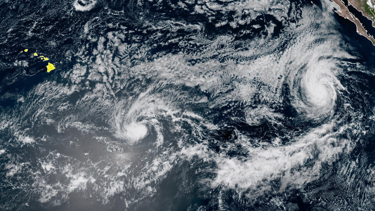
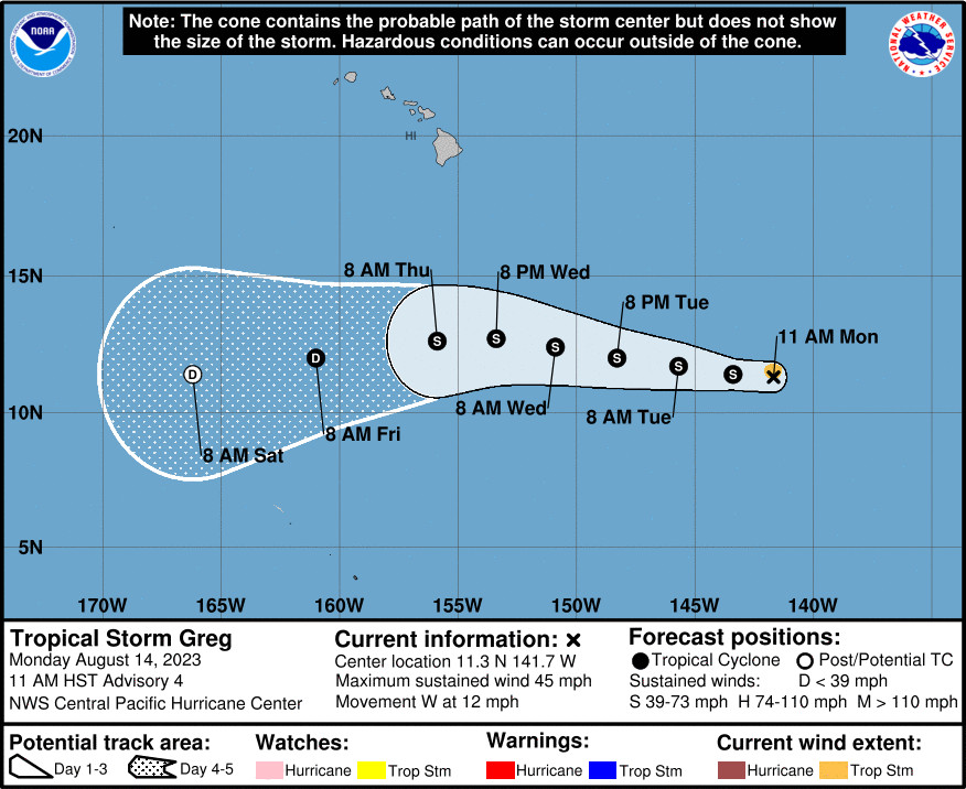
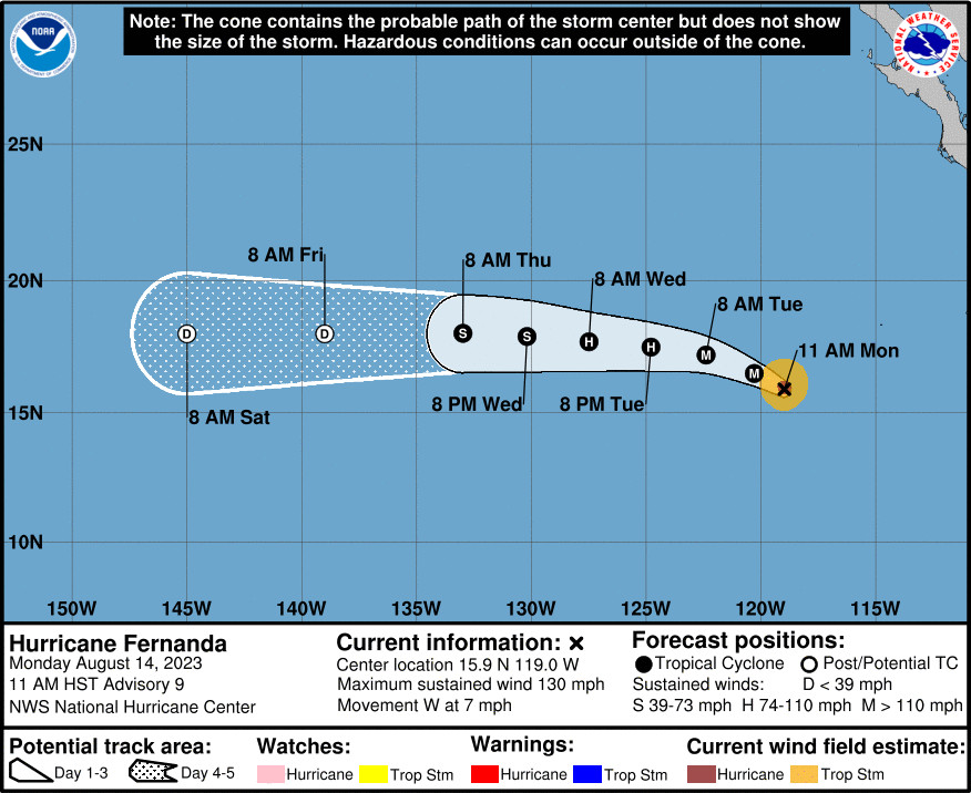
(BIVN) – Tropical Storm Greg has formed in the Central Pacific and is about 1,050 miles east-southeast of Hilo, while Hurricane Fernanda maintains its category 4 strength in the Eastern Pacific, about 2,380 miles east-southeast of Hilo.
Tropical Storm Greg is expected to gain some strength over ther next few days at it moves west, and appears to be tracking far to the south of Hawaiʻi island.
The Hawaiʻi County Civil Defense says Tropical Storm Greg “is expected to have no impact on Hawaii Island.”
From the National Weather Service in Honolulu:
The trades are expected to strengthen to breezy levels Tuesday through Thursday as the pressure gradient tightens in response to a strengthening high north of the state and a Tropical Storm Greg passing westward well south of the islands. As the previous discussion mentioned, it is important to note that, while an increase in trade wind speeds is expected mid-week, this scenario appears significantly different than what was experienced last week. The winds are expected to be much weaker, as high pressure will be displaced much farther north, inversion heights will not be as low, and Tropical Storm Greg will not be nearly as strong as Hurricane Dora was. The trades are forecast to ease back into the light to moderate range Friday through the weekend as the pressure gradient relaxes once again.
The National Hurricane Center says Hurricane Fernanda has likely reached its peak intensity, and should remain in a favorable sea surface temperature and atmospheric thermodynamic environment until Monday night, “so some additional short-term strengthening is possible.” But, after about 12 hours, “the influences of drier air and cooler waters should begin to take their toll, so the official forecast shows a steady weakening trend in 1 to 4 days.”
“Please remember that hurricane season for the Central Pacific Basin is from June 1 to November 30,” the Hawaiʻi County Civil Defense said. “Take this time to review your family emergency plan and your emergency kit. You can visit the Tropical Cyclone Resources at the Civil Defense website for more information.”