(BIVN) – Kīlauea volcano is not erupting, and recent signs of unrest have settled down. Rates of seismicity are now at background levels, and the USGS Alert Level remains at ADVISORY.
The USGS Hawaiian Volcano Observatory in a Thursday update said that although rates of earthquakes and ground deformation have decreased, they could increase again at any time.
Over the past few months there has been a pattern of increases and decreases in unrest beneath the Kīlauea summit, south caldera, and upper East Rift Zone. The volcano appears to be in another waning phase.
From the May 23 update by the USGS HVO:
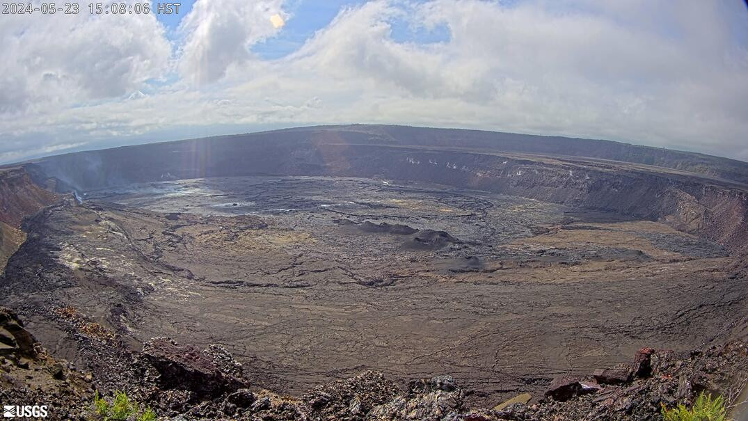
Summit Observations and Upper East Rift Zone Observations: Over the past day, rates of seismicity in the summit, south caldera, and upper East Rift Zone regions have been at background levels. Earthquake depths have averaged 1–3 km (0.6–1.9 miles) beneath the surface, and magnitudes have been below M2.0. Ground deformation continues beneath Halemaʻumaʻu and the south caldera region. The Uēkahuna tiltmeter northwest of the summit recorded minor inflation over the past day. The Sand Hill tiltmeter southwest of the summit also recorded minor inflation. Sulfur dioxide (SO2) gas emission rates remain low. An SO2 emission rate of approximately 61 tonnes per day was recorded on May 21.
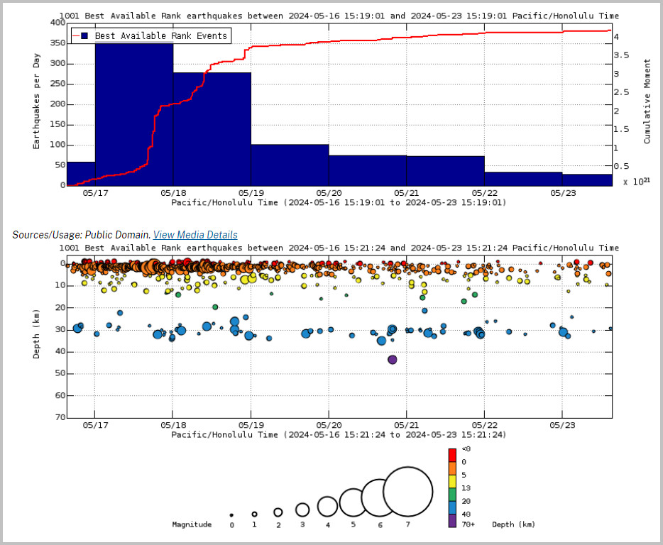
From USGS: Earthquake Rates and Depths on Thursday afternoon. Above Top: Number of earthquakes per day during the past week (blue bars). The red line is the cumulative moment (energy) release. Bottom: Depth of earthquakes during the past week in the area shown on the map above. Depth is reported relative to sea level, which is equal to a depth of zero on the above plot. On both figures, circle-size represents magnitude, and color indicates depth.
Rift Zone Observations: Rates of seismicity beneath the upper and middle East Rift Zone regions have decreased over the past several days and are currently at background levels. Seismicity in in the southwest Rift Zone is low. Measurements from continuous gas monitoring stations downwind of Puʻuʻōʻō in the middle East Rift Zone remain below detection limits for SO2, indicating that SO2 emissions from Puʻuʻōʻō are negligible.
Analysis: Magma has been pressurizing the system beneath Halemaʻumaʻu and the south caldera region, activating seismicity in the upper East Rift Zone, and in the caldera south of Halemaʻumaʻu. At this time, it is not possible to say whether this increase in activity will lead to an intrusion or eruption in the near future, or simply continue as seismic unrest at depth. Changes in the character and location of unrest can occur quickly, as can the potential for eruption. Rates of seismicity and ground deformation have decreased over the past several days but could increase again at any time.
The USGS Hawaiian Volcano Observatory says it will continue to provide daily updates while Kīlauea is in a heightened state of unrest.

by Big Island Video News
on at
STORY SUMMARY
HAWAIʻI VOLCANOES NATIONAL PARK - Unrest beneath the Kīlauea summit, south caldera, and upper East Rift Zone has waned over recent days.