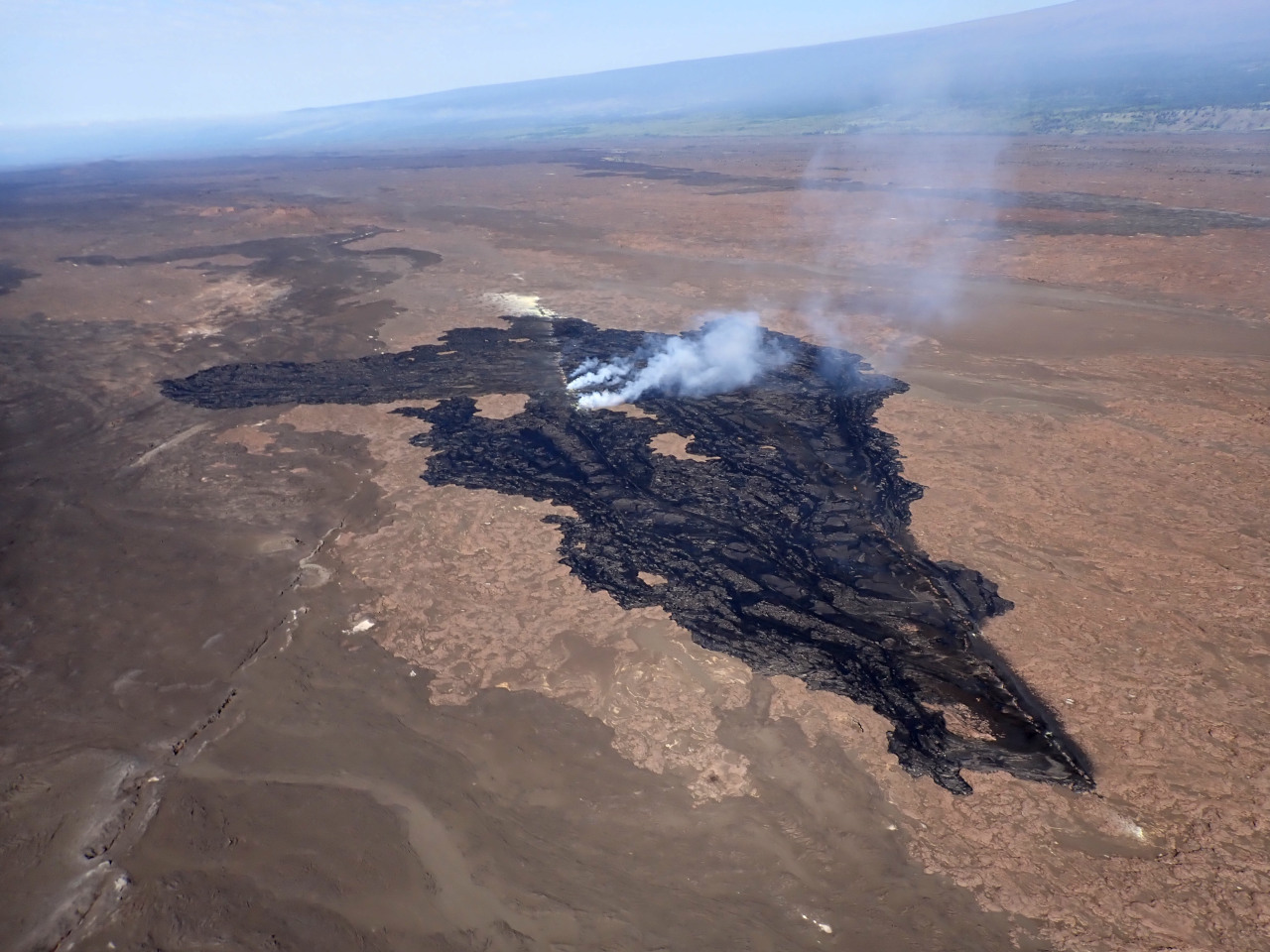
USGS: “During the Kīlauea Southwest Rift Zone eruption on June 3, fissures 3 and 4—located farther to the southwest than fissures 1 and 1— erupted the larger volumes of lava and continue to exhibit elevated gas emissions. Hazards associated with active or recent lava flows include hot and glassy (sharp) surfaces that can cause serious burns, abrasions, and lacerations upon contact with unprotected or exposed skin; uneven and rough terrain can lead to falls and other injuries; hot temperatures that can cause heat exhaustion or dehydration, or in heavy rain can produce steamy ground-fog that can be acidic, severely limiting visibility and sometimes causing difficulty breathing.” (USGS photo by A.R. Nalesnik)
(BIVN) – Kīlauea volcano is not erupting, and with the USGS Alert Level at ADVISORY, Hawaiʻi Volcanoes National Park has reopened some- but not all – areas that were closed during the June 3rd fissure eruption on the upper Southwest Rift Zone.
The National Park Service announced on Friday that Hilina Pali Road, Kulanaokuaiki Campground, the Footprints Exhibit and Pepeiao Cabin are now open.
The coastal campsite at Kaʻaha, Devastation Trail and Keanakākoʻi were reopened earlier this week.
However, Maunaiki Trail and Kaʻū Desert Trail past the Footprints Exhibit remain closed, officials say, due to elevated gases and other volcanic hazards that remain at the eruption site.
“Visitors should plan ahead and check the park website for updates before entering the park,” the National Park Service said.
Elevated volcanic gas emissions, ground subsidence and severe earth cracks formed during the short-lived eruption, officials say. “These cracks have unstable edges and could continue to widen,” HVNP warned.
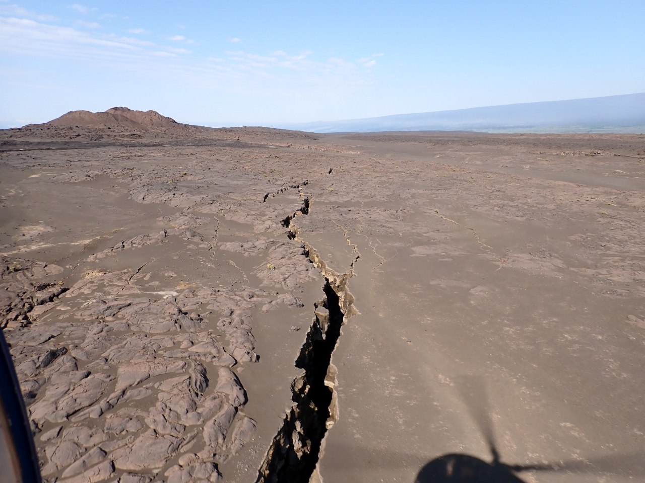
USGS: “In addition to elevated volcanic gas emissions, other significant hazards also remain around the recent eruption site on the upper Southwest Rift Zone of Kīlauea. Minor to severe ground fractures and subsidence features that formed during the June 3 eruption may continue to widen and offset, may have unstable overhanging edges, and should be avoided. Most cracks that formed during the June 3 Kīlauea Southwest Rift Zone eruption are several inches (2 to 5 centimeters) wide with some extending to up to 6.5 feet (2 meters) wide. In this photo, a crack extends towards Pu‘ukoa‘e in the background.” (USGS photo by A.R. Nalesnik)
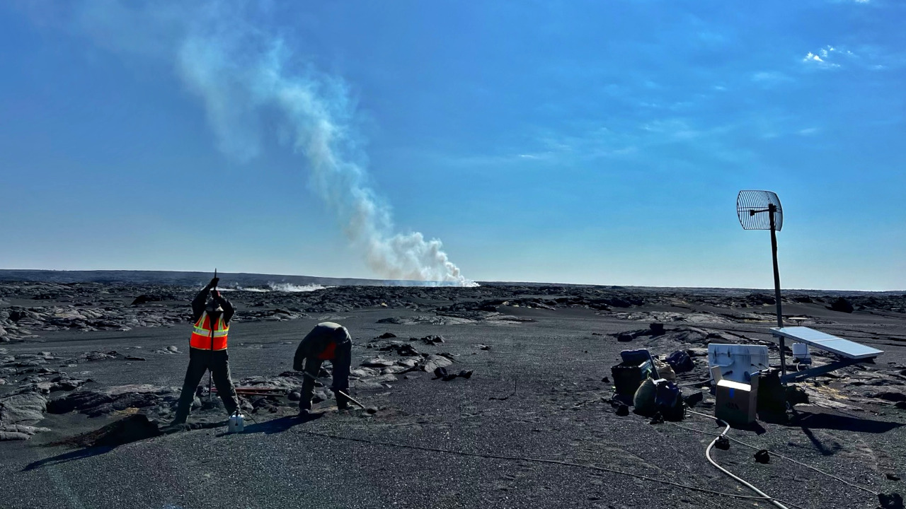
The USGS Hawaiian Volcano Observatory on Friday said volcanic gas emissions at the eruption site are approaching background levels, with the total sulfur dioxide emission rates for the summit and eruption site now at 400 t/d. Seismic activity remains low at the eruption site.
Scientists also noted that earthquake counts in the summit region increased over the past day. At of 10:22 a.m. on Friday, the USGS HVO reported more than 120 earthquakes occurred over the past 24 hours.

by Big Island Video News
on at
STORY SUMMARY
HAWAIʻI VOLCANOES NATIONAL PARK - While some areas in the park have reopened, the Maunaiki Trail and Kaʻū Desert Trail past the Footprints Exhibit remain closed.