Big Island Video News

Serving Hawaii County

  • Hawaiʻi Island News Regions
    • Hamakua
      • Mauna Kea
    • Hilo
    • Kau
    • Kona
    • Kohala
    • Puna

USGS image taken Wednesday morning from a temporary research camera positioned near Maunaulu, looking northwest toward the upper East Rift Zone of Kīlauea.

Kīlauea Volcano Update for Wednesday, August 14
Avatar photo

by Big Island Video News
on Aug 14, 2024 at 6:51 am

Subscribe to Big Island Video News (FREE)

* indicates required

STORY SUMMARY

HAWAIʻI VOLCANOES NATIONAL PARK - Over the last few days, the rates of seismicity have increased beneath the upper and middle East Rift Zone.

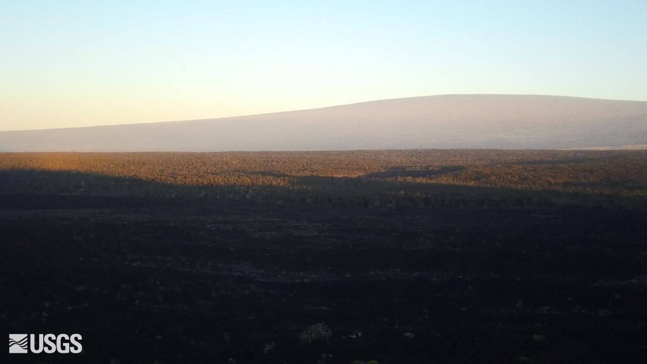
(BIVN) – Kīlauea is not erupting, and after a week of decreased seismicity at the Hawaiʻi island volcano, the number of earthquakes is now increasing beneath the upper and middle East Rift Zone.

The USGS Volcano Alert Level for Kīlauea remains at ADVISORY.

Inflation continues in the middle East Rift Zone, but at a lower rate than 7 microradians last week that prompted an information statement from the Hawaiian Volcano Observatory. 


Ground deformation signals indicate the center of deformation remains west of Puʻuʻōʻō, scientists say.

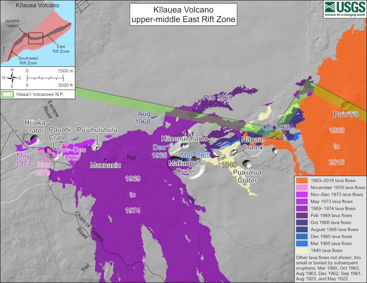
“Measurements from continuous gas monitoring stations downwind of Puʻuʻōʻō in the middle East Rift Zone – the site of 1983–2018 eruptive activity – remain below detection limits for SO2, indicating that SO2 emissions from this area are negligible,” the USGS HVO wrote on Tuesday. “Rates of seismicity and ground deformation beneath the lower East Rift Zone and Southwest Rift Zone remain low.”

USGS: “This reference map depicts the features on Kīlauea’s middle East Rift Zone, much of which is within Hawaiʻi Volcanoes National Park. Pit craters and lava flows are evidence of a long history of magma moving along this rift zone pathway. Numerous eruptions took place in this region during the 1960s–1970s. Most eruptions in this area during that timeframe lasted less than one day to about two weeks, though there were long-lived eruptions at Maunaulu (1969–1971 and 1972–1974) and Puʻuʻōʻō (1983–2018). The most recent eruption in this area took place over 35 years at and near the Puʻuʻōʻō vent (shown in orange on the map).”

From the August 13th analysis by HVO:

Pulses of earthquakes and ground deformation beneath Kīlauea’s upper East Rift Zone from July 22–25, 2024, represented stages of an intrusion between Pauahi Crater and Maunaulu. The intrusive event is over, and magma has been repressurizing the storage system beneath Halemaʻumaʻu and the south caldera region. MERZ earthquakes and ground deformation observed since the intrusion indicate that magma is accumulating beneath the ground in the area of Makaopuhi Crater and Napau Crater, a well-known magma storage region in Kīlauea’s remote middle East Rift Zone. Additional earthquake swarms may occur with little or no warning and result in either intrusion of additional magma or eruption of lava in these regions.


Filed Under: Volcano

LATEST NEWS

VOLCANO WATCH: Kīlauea “Gas Pistoning” Explained

Pāhala Wastewater Collection System Construction Starts Monday, July 7

High Bacteria Advisories Issued For Two South Kona Shorelines

Cessna Aircraft Crash Lands On Kona Beach Road

New Interstellar Object Detected By Hawaiʻi Telescope

Man Shoots Female Intruder At Ocean View Home

About Big Island Video News

  • Privacy Policy

Copyright © 2025 · Dynamik-Gen on Genesis Framework · WordPress · Log in