file image using USGS elements
(BIVN) – A new USGS data release provides chronological geospatial data for the most recent eruption of Mauna Loa in 2022.
Scientists announced the data release on Thursday in a short website post.
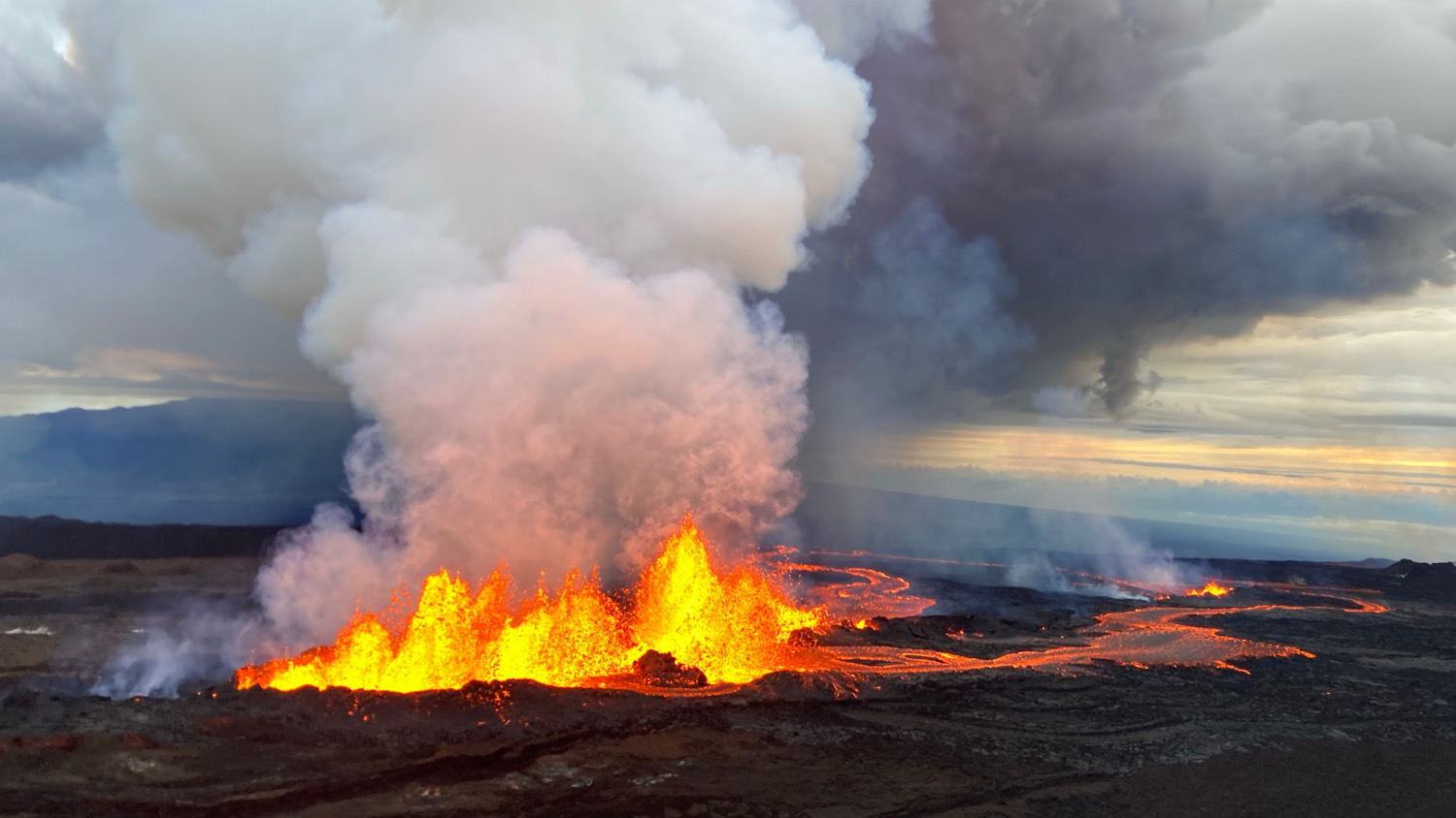
The 12-day event, which began inside Mokuʻaweoweo caldera at the summit, was the first eruption at Mauna Loa in 38 years.
From the USGS Hawaiian Volcano Observatory:
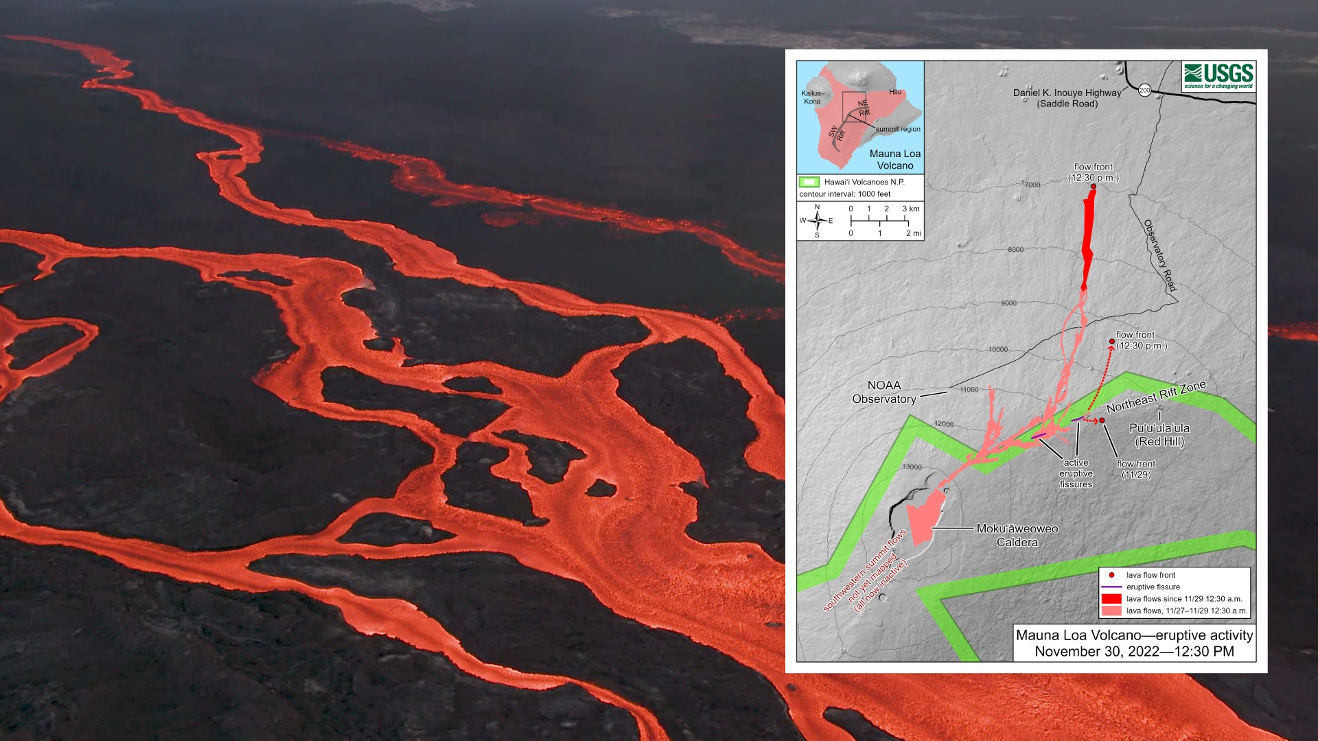
Within a few hours of Mauna Loa’s eruption start on November 27, 2022, lava had covered most of the caldera floor, and several fissures just outside caldera sent short lava flows up to 3 kilometers (2 miles) to the southwest.
Later in the morning of November 28, summit effusion ceased, and the eruption moved into the volcano’s Northeast Rift Zone. Several rift zone fissures were initially active, but by November 30 effusion had focused at a vent known as fissure 3.
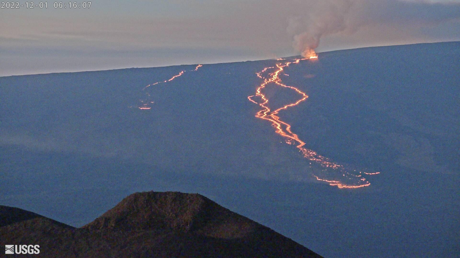
USGS webcam image from December 1, 2022, showing the eruptions on Mauna Loa’s Northeast Rift Zone, as seen from Mauna Kea
For another 10 days, fissure 3 fountained and fed lava flows that eventually stretched 18 kilometers (11 miles) to the north, threatening but not reaching the Daniel K. Inouye Highway across the island’s interior. Effusion from fissure 3 began declining overnight December 7–8 and ceased on December 10, by which time the eruption had covered approximately 36 square kilometers (14 square miles) of Mauna Loa with new lava.
In this USGS Data Release, the authors have sought to chronicle this sequence of events using geospatial data in the form of an Esri file geodatabase, Esri shapefiles, and Google Earth KMZs, as well as rapid response orthomosaic and thermal map rasters.
Reference: Zoeller, M.H., Patrick, M.R., Bard, J.A., Trusdell, F.A., Parcheta, C.E., Wessels, R.L., Carbo, C.L., Mosbrucker, A.R., and Robinson, J.E., 2024, Geospatial database of the 2022 summit and Northeast Rift Zone eruption of Mauna Loa volcano, Hawaiʻi: U.S. Geological Survey data release, https://doi.org/10.5066/P1KES7F4.

by Big Island Video News
on at
STORY SUMMARY
ISLAND OF HAWAIʻI - In the latest USGS data release, authors chronicle the most recent eruption of Mauna Loa using geospatial data in the form of various digital files.