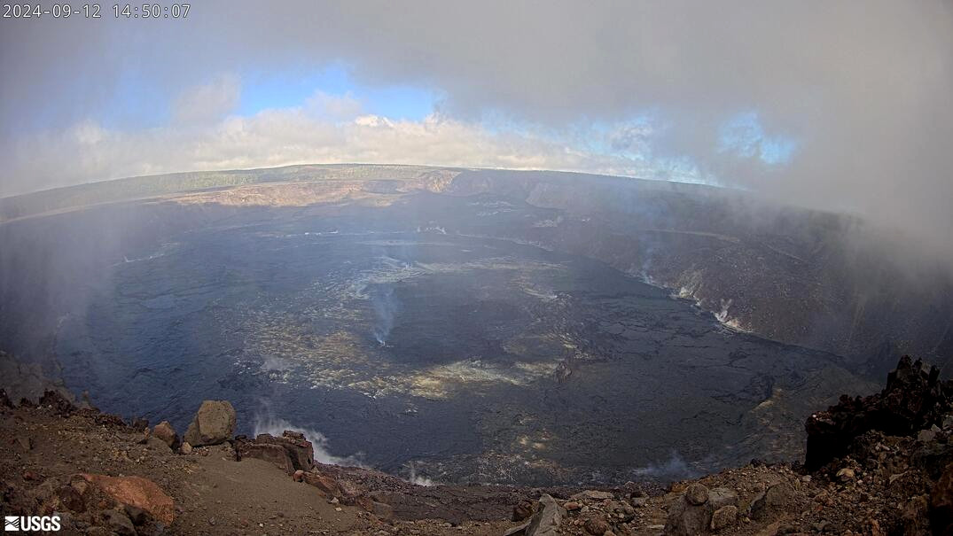
(BIVN) – Kīlauea is not erupting. Scientists say there has been “a definite increase” in earthquakes recorded beneath Kīlauea’s upper East Rift Zone over recent days.
The Volcano Alert Level for Kīlauea remains at ADVISORY. Seismicity “is still far below the levels of activity seen during episodes of unrest,” the USGS Hawaiian Volcano Observatory reported on Thursday.
The USGS HVO continues to say additional pulses of unrest in the upper to middle East Rift Zone “are possible and may evolve quickly.”
The number of earthquakes shot up on Wednesday and slightly increased activity continued into Thursday.
There are currently no closures within Hawaiʻi Volcanoes National Park due to Kīlauea unrest.
From the USGS HVO update on Thursday:
Summit Observations: 75 earthquakes were detected beneath Kīlauea’s broader summit region over the past 24 hours, most were below magnitude-2 and at depths between 1 km – 3 km (0.6 mi – 1.9 mi) below the surface. Rates of deformation at the summit remain relatively low, with slightly fluctuating tilt at summit tiltmeters over the past day. An overall inflationary trend has been measured by GPS instruments in recent months. The most recent measurement of SO2 emission rate was 75 tonnes per day on August 20, 2024.
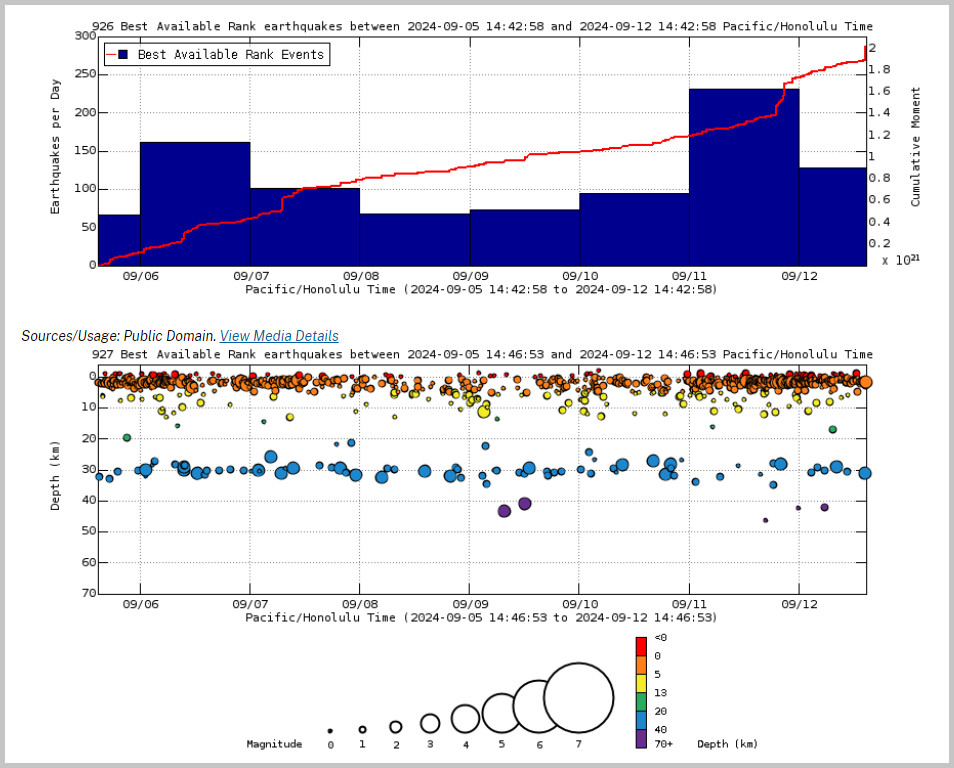
Rift Zone Observations: Over the past 24 hours, there have been 123 earthquakes recorded beneath Kīlauea’s UERZ region, extending from Puhimau Crater southeast to Maunaulu, as well as 30 earthquakes recorded within Kīlauea’s south flank. This is a definite increase over recent days, but still far below the levels of activity seen during episodes of unrest. Rates of deformation have remained stable over the past 24 hours.
Activity in the middle East Rift Zone (MERZ) remains low. There were no significant changes at tiltmeter POC, located at Puʻuʻōʻō (the site of 1983–2018 eruptive activity) during the past day. GPS instruments have recorded periods of inflation in portions of the the MERZ uprift of Puʻuʻōʻō during the past month. Measurements from continuous gas monitoring stations downwind of Puʻuʻōʻō in the MERZ remain below detection limits for SO2, indicating that SO2 emissions from this area are negligible.
Elevated seismicity or ground deformation has not been detected beneath the lower East Rift Zone, and Southwest Rift Zone activity remains low.