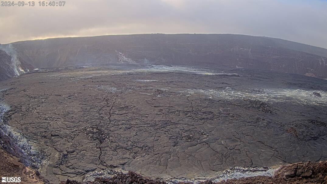
(BIVN) – Kīlauea is not erupting and the USGS Volcano Alert Level remains at ADVISORY.
Over the past 24 hours, scientists have recorded the highest number of earthquakes beneath Kīlauea’s upper East Rift Zone in a week. A similar number has been observed so far today.
Still, the number of earthquakes has been “below the levels of activity seen during episodes of unrest”, the scientists said.
“Additional pulses of unrest in the upper to middle East Rift Zone are possible and may evolve quickly,” the USGS Hawaiian Volcano Observatory stated. Activity in the middle to lower East Rift Zone remains low.
From the USGS HVO on Friday, September 12:
Summit Observations: 89 earthquakes were detected beneath Kīlauea’s broader summit region over the past 24 hours, most were below magnitude-2 and at depths between 1 km – 3 km (0.6 mi – 1.9 mi) below the surface. Rates of deformation at the summit remain relatively low, with slightly fluctuating tilt at summit tiltmeters over the past day. An overall inflationary trend has been measured by GPS instruments in recent months. The most recent measurement of SO2 emission rate was 75 tonnes per day on August 20, 2024.
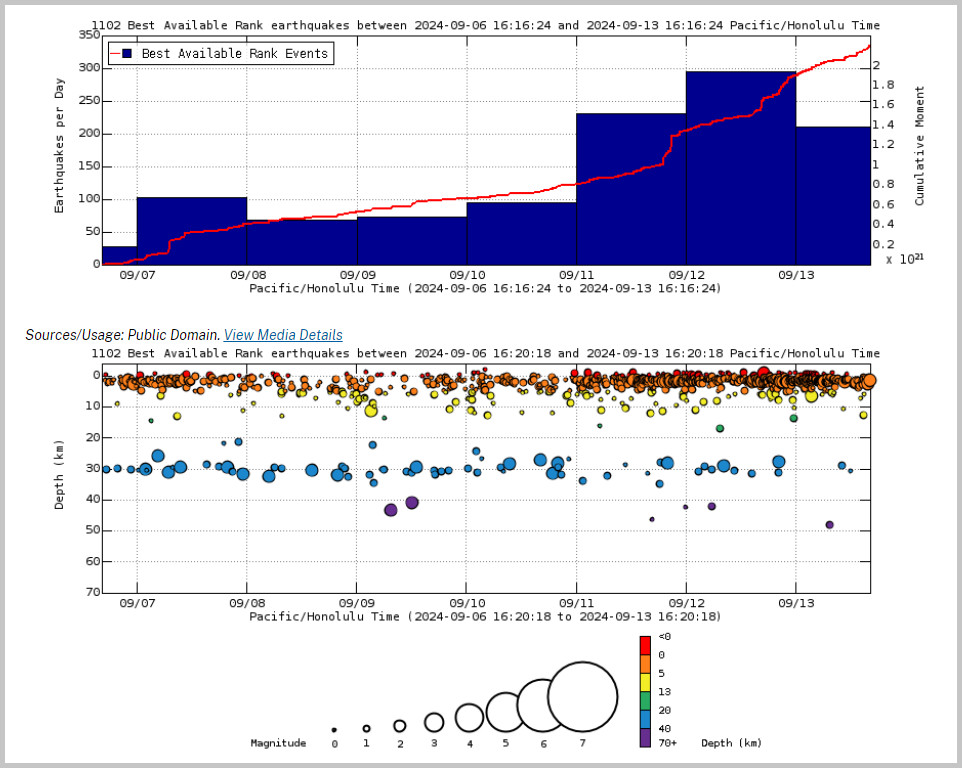
Above Top: Number of earthquakes per day during the past week (blue bars). The red line is the cumulative moment (energy) release. Bottom: Depth of earthquakes during the past week in the area shown on the map above. Depth is reported relative to sea level, which is equal to a depth of zero on the above plot. On both figures, circle-size represents magnitude, and color indicates depth. (USGS graphs)
Rift Zone Observations: Over the past 24 hours, there have been 188 earthquakes recorded beneath Kīlauea’s UERZ region and 34 earthquakes recorded within Kīlauea’s south flank. This is similar to earthquake counts from yesterday and still below the levels of activity seen during episodes of unrest. Rates of deformation have remained stable over the past 24 hours.
Activity in other parts of the East Rift Zone remains low. There were no significant changes at tiltmeter POC, located at Puʻuʻōʻō (the site of 1983–2018 eruptive activity) during the past day. GPS instruments have recorded periods of inflation in portions of the the middle East Rift Zone (MERZ) uprift of Puʻuʻōʻō during the past month. Measurements from continuous gas monitoring stations downwind of Puʻuʻōʻō in the MERZ remain below detection limits for SO2, indicating that SO2 emissions from this area are negligible.

by Big Island Video News
on at
STORY SUMMARY
HAWAIʻI VOLCANOES NATIONAL PARK - Over the past 24 hours, there have been 188 earthquakes recorded beneath Kīlauea’s upper East Rift Zone region.