Big Island Video News

Serving Hawaii County

  • Hawaiʻi Island News Regions
    • Hamakua
      • Mauna Kea
    • Hilo
    • Kau
    • Kona
    • Kohala
    • Puna

image from interactive USGS map showing the location of the earthquake off Hawaiʻi island

Magnitude 3.9 Earthquake Offshore Hawaiʻi island
Avatar photo

by Big Island Video News
on Apr 7, 2025 at 7:29 am

Subscribe to Big Island Video News (FREE)

* indicates required

STORY SUMMARY

ISLAND OF HAWAIʻI - The earthquake occurred at 2:54 a.m. on Monday morning, and was located near the Kamaʻehuakanaloa seamount.

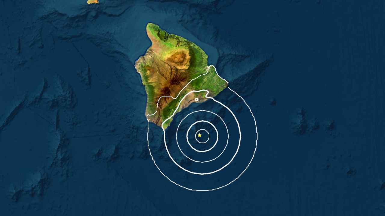
(BIVN) – A magnitude 3.9 earthquake occurred early Monday morning off the southern coast of Hawaiʻi island.

The earthquake occurred at 2:54 a.m. on April 7, and was located offshore, nearly 30 miles east southeast of Naʻalehu in Kaʻū.

There were no felt reports for the event, according to the USGS event information page.


The earthquake was located in the vicinity of Kamaʻehuakanaloa (formerly named Lō‘ihi Seamount), the active volcano built on the seafloor south of Kīlauea. There were a few smaller earthquakes in this area prior to this morning’s magnitude 3.9 event.


Filed Under: Hawaii

LATEST NEWS

Hawaiʻi County Blesses Four More New Ambulances

Coconut Rhinoceros Beetle Breeding Sites Found In Kona

Report Of Unexploded Ordnance On Old Saddle Road

Fatal House Fire In Puna Under Investigation

Kīlauea Volcano Eruption Update for Monday, July 7

Governor Green Issues Final Veto List

About Big Island Video News

  • Privacy Policy

Copyright © 2025 · Dynamik-Gen on Genesis Framework · WordPress · Log in