(BIVN) – The ongoing eruption at the summit of Kīlauea remains paused, with the next episode of activity expected to occur at any time.
The USGS Volcano Alert Level is at WATCH, with all activity forecasted to remain within the summit caldera at Hawaiʻi Volcanoes National Park.
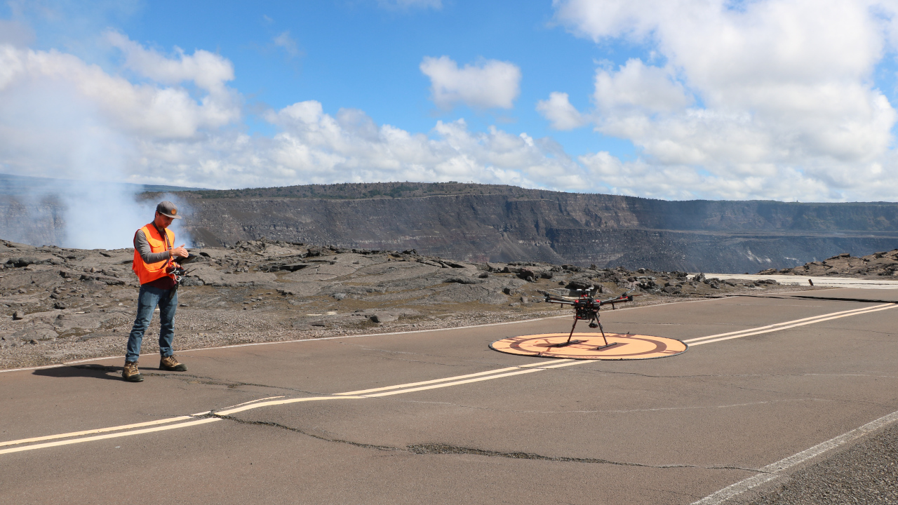
On Tuesday, the USGS Hawaiian Volcano Observatory conducted UAS (uncrewed aircraft systems) flights into Halemaʻumaʻu to monitor the situation.
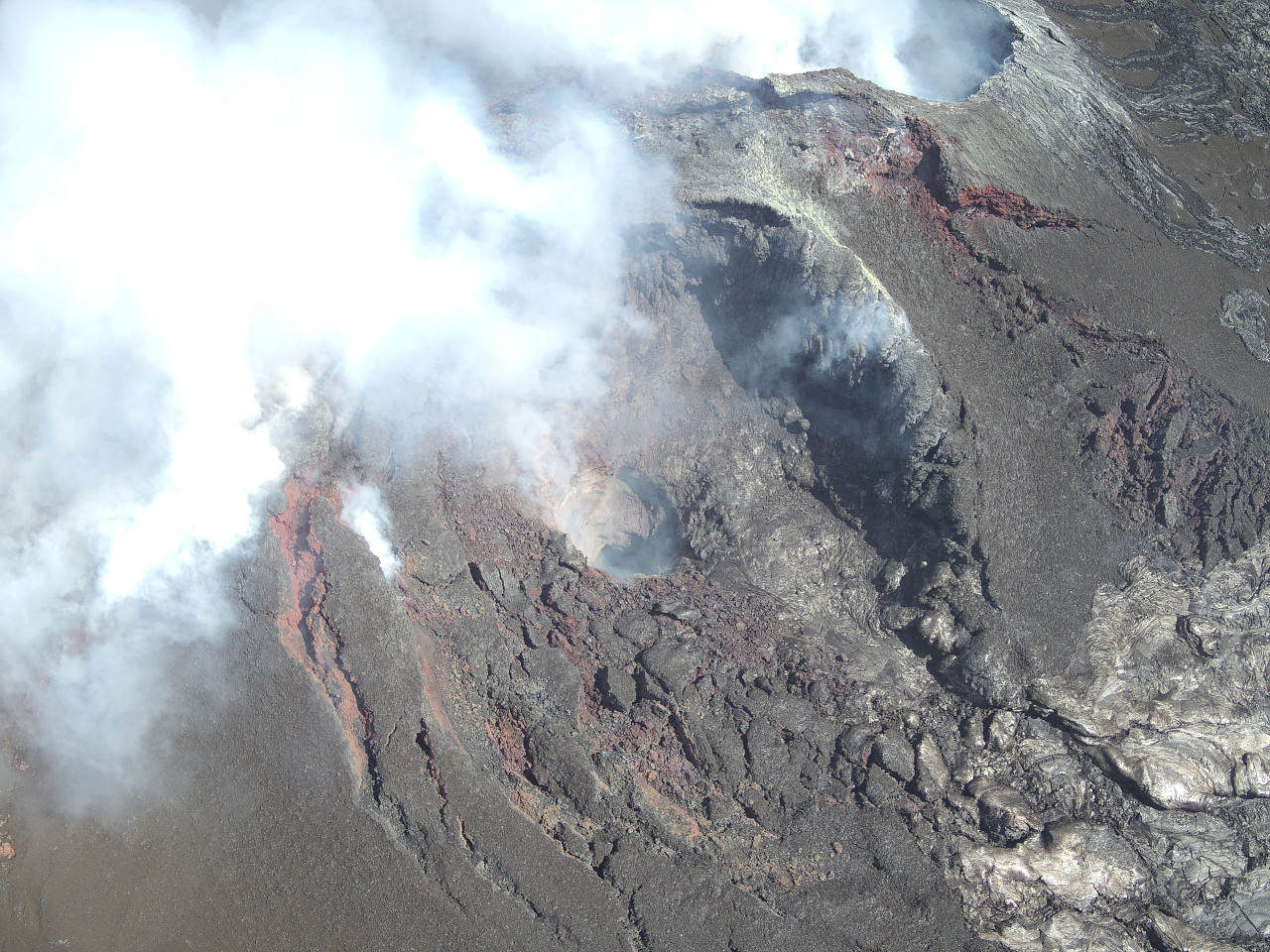
During the overflight, scientists say the north vent “was not emitting as much volcanic gas as its southern counterpart, and it did not glow as hot in thermal images. However, faint incandescent glow was visible in the western portion of the vent cone”.
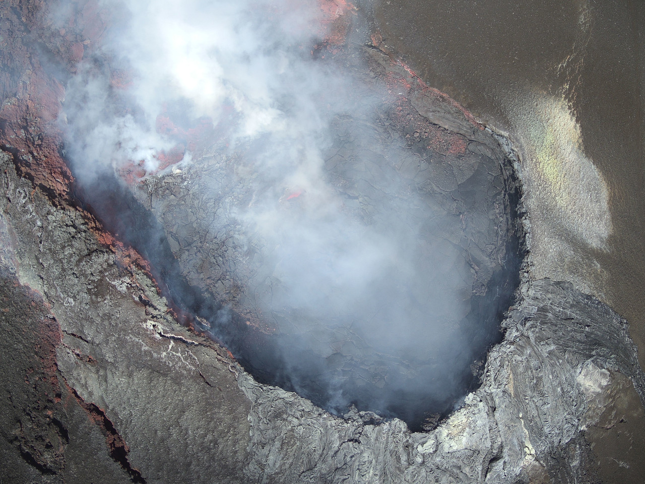
Over the south vent, the UAS flight showed “an absence of active lava, although the opening in the base of the vent cone (center) was vigorously emitting volcanic gases and glowed hot in thermal images.”
Yesterday, the Observatory reported seismic tremor “increased just before midnight on April 14,” and stated: “Cyclic tremor patterns with 30-60 minute periods began at this time and continue to the present. These tremor patterns are reminiscent of cyclic patterns due to gas pistoning seen prior to episodes 14 and 15 but are longer period.”
The last sulfur dioxide (SO2) emission rate measured on April 10 was approximately 1,200 tonnes per day. “Typical levels of Sulfur dioxide (SO2) emission have been about 1,000 tonnes per day during previous pauses,” the Observatory said.
The USGS HVO noted that the UAS flights “were conducted with the permission of Hawaiʻi Volcanoes National Park, owing to the USGS Hawaiian Volcano Observatory’s mission to monitor active volcanoes in Hawaii, assess their hazards, issue warnings, and advance scientific understanding to reduce the impacts of eruptions.”
The USGS also reminded that “unauthorized launching, landing, or operating of a UAS from or on lands and waters administered by the National Park Service” is prohibited.