(BIVN) – A new tropical storm has formed in the Eastern Pacific, and is expected to become a hurricane as it tracks west.
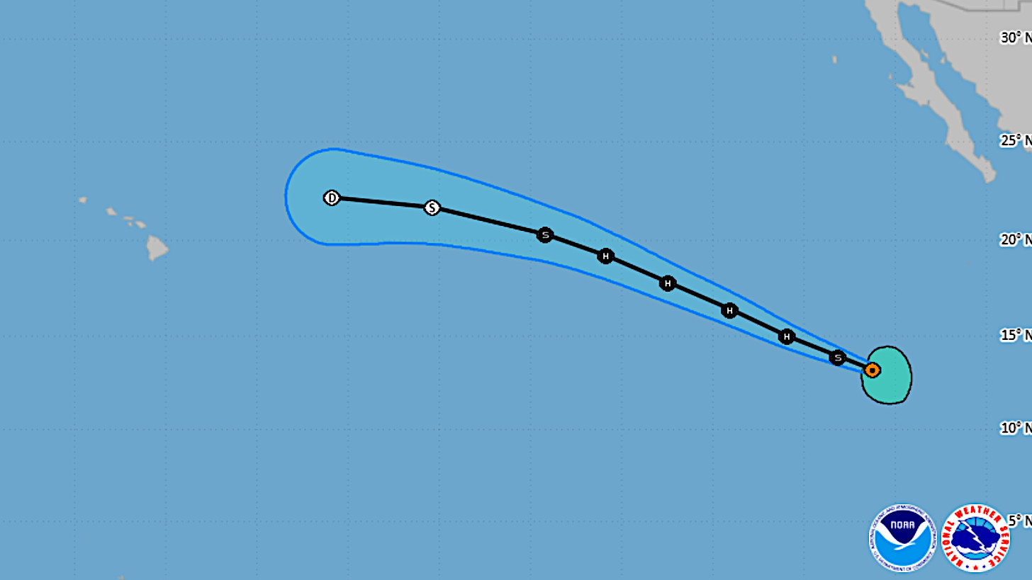
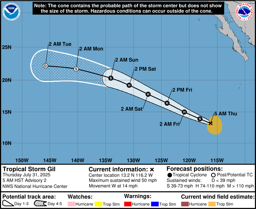
Tropical Storm Gil is about 785 miles south-southwest of the southern tip of Baja California, heading west at 14 mph. The storm is 2,610 miles east-southeast of Hilo.
“A turn to the west-northwest is expected later today and this motion with some acceleration is forecast during the next couple of days,” the National Hurricane Center reported on Thursday morning. “Maximum sustained winds have increased to near 50 mph (85 km/h) with higher gusts. Strengthening is forecast during the next couple of days, and Gil is forecast to become a hurricane on Friday.”
It appears Gil will become a post-tropical cyclone as it crosses into the Central Pacific, based on the forecast track.
From the 5 a.m. forecast discussion by the National Hurricane Center:
Gil continues to become better organized this morning. Geostationary infrared imagery show steady bursts of embedded deep convection with cloud top temperatures less than -80 degrees Celsius. Objective and subjective satellite intensity estimates have increased this cycle and range between 35 to 46 kt. The initial intensity is raised to 45 kt, closest to the TAFB and UW-CIMSS DPRINT estimates.
The storm is moving at 280/12 kt along the southern side of a subtropical ridge. This mid-level ridge will steer Gil generally west-northwestward for the next few days, with some increase in forward motion. By day 4, the weaker, more shallow cyclone is expected to turn more westward in the low-level flow. The track guidance envelope remains tightly clustered and only minor changes were made to the latest NHC track forecast.Atmospheric and oceanic conditions appear generally conducive for Gil to continue strengthening. Statistical indicators even suggest an above average possibility of strong-to-rapid intensification in the next day or so. Thus, the predicted peak intensity has been raised to 75 kt in 36 h based on these factors and an overall increase in the model intensity guidance. Gil is still expected to reach cooler waters and a dry, stable airmass in a couple of days which will cause steady weakening. The latest NHC intensity forecast now shows Gil becoming a post-tropical cyclone by day 4, when global model show the cyclone will lose all convection.

by Big Island Video News
on at
STORY SUMMARY
HONOLULU, Hawaiʻi - Tropical Storm Gil is expected to become a hurricane on Friday, and there is the possibility of strong-to-rapid intensification in the next day or so.