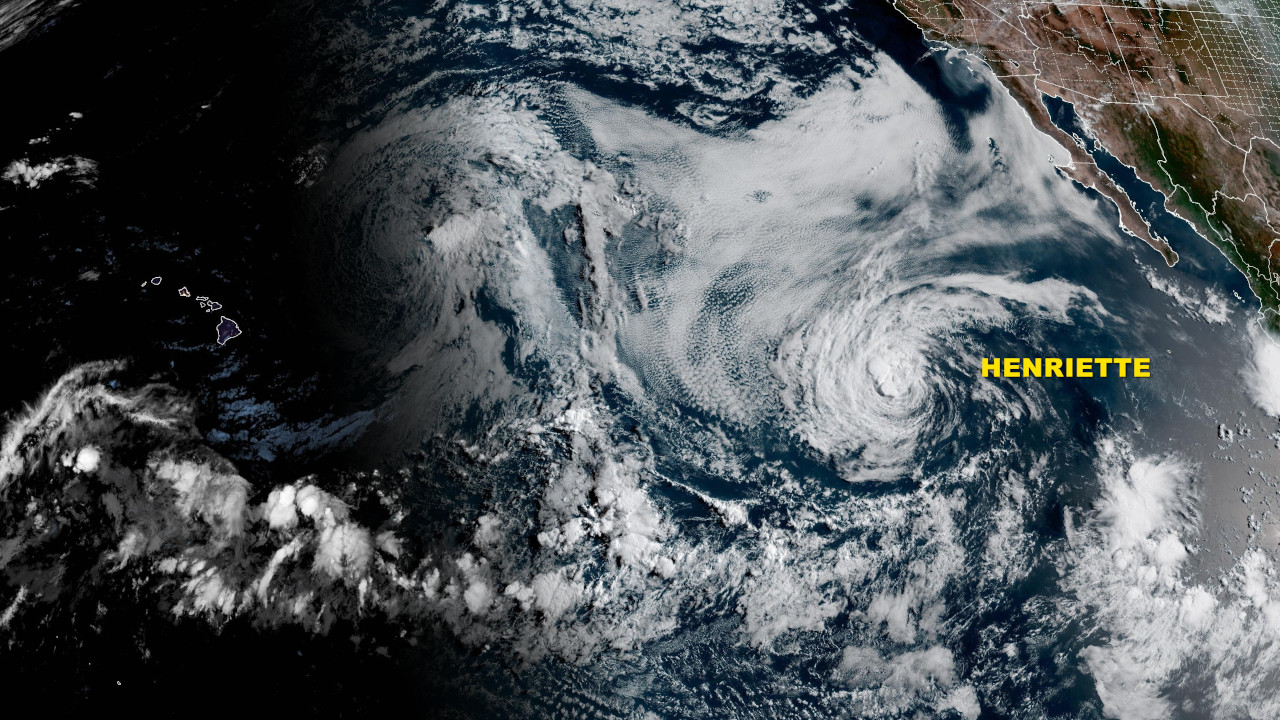
(BIVN) – Tropical Depression Eight-E developed into Tropical Storm Henriette on Monday, as it moves west-northwest over the Pacific.
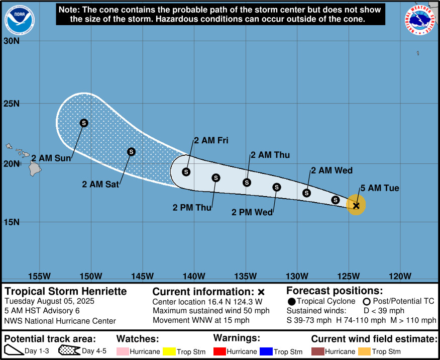
Although the forecasted track and intensity of Henriette is likely to be adjusted over time, the National Hurricane Center currently expects to see little change in strength over the next few days, followed by gradual weakening toward the end of the week while the cyclone passes to the east-northeast of the Hawaiian Islands.
“Long range global models and National Hurricane Center forecasts show another tropical system, currently Tropical Storm Henriette, passing just north of the islands from Sunday through Monday, once again disrupting trade winds and producing warm and very humid weather,” the National Weather Service in Honolulu stated on Tuesday morning. “Stay tuned for weather forecast updates as the track and intensity of Henriette will likely change over time.”
From the National Hurricane Center at 5 a.m. HST:
Henriette’s cloud pattern has deteriorated a bit overnight. Modest southeasterly shear, evidence of a slight southeast to northwest tilt with height in a 0638 UTC GPM microwave image, and an increasingly inhibiting thermodynamic environment continue to impede strengthening. Based on a compromise of the Dvorak intensity estimates from TAFB, SAB, and recent CIMSS SATCON objective intensity analysis of 46 kt, the initial intensity is held at 45 kt.
Little change in strength is expected during the next few days due to the above mentioned adverse atmospheric conditions, and Henriette traversing slightly cooler oceanic temperatures. Only the HAFS-B hurricane model suggests an increase to 50 kt during the 24-36 hrs. Of course, a 5 kt increase isn’t out of the question. Beyond day 3, toward the end of the week, the thermodynamic environment is expected to become even more stifling while Henriette moves over the subtropical central Pacific waters. Subsequently, gradual weakening is noted in the official forecast. The NHC intensity forecast is near the previous one and is hedged toward the IVCN intensity consensus, and is just above the Decay-SHIPS statistical aid.Henriette’s initial motion is estimated to be west-northwestward, or 290/13 kt. A general west-northwestward or westward motion is expected through day 4 while a strong subtropical ridge remains to the north of the cyclone. Toward the end of the period, Henriette is forecast to gradually turn northwestward in response to an amplifying mid- to upper-tropospheric trough approaching the Hawaiian Islands from the central north Pacific. The track forecast is essentially an update from the previous advisory and lies between the HCCA corrected consensus model and the ECMWF control.
Henriette’s wind radii were adjusted based on a 0839 UTC Oceansat-3 Scatterometer overpass.
Meanwhile, the remnants of former Tropical Cyclone Gil will pass just north of the Hawaiian Islands on Wednesday and Thursday, bringing warm and humid conditions with an increase in island shower activity, forecasters say.

by Big Island Video News
on at
STORY SUMMARY
HAWAIʻI - Tropical Storm Henriette is expected to weaken while the cyclone passes to the east-northeast of the Hawaiian Islands.