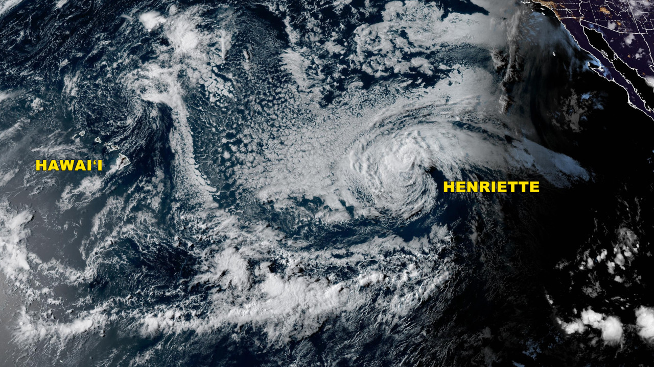
(BIVN) – Tropical Storm Henriette is 1,555 miles east of Hilo, and moving west at 16 mph. The cyclone is expected to take a northward turn in the next couple of days, keeping the center well to the north of the Hawaiian islands.
“In a few days, a trough approaching from the west will turn Henriette toward the northwest, taking the tropical cyclone north of Hawaii,” stated the National Hurricane Center at 11 a.m. HST. “The various deterministic and global ensemble models are all in good agreement on the forecast, so confidence in the track forecast is fairly high.”
The passage of Henriette to the north of the islands is expected to weaken trade winds, “bringing a period of muggy conditions for the weekend,” the National Weather Service in Honolulu stated.
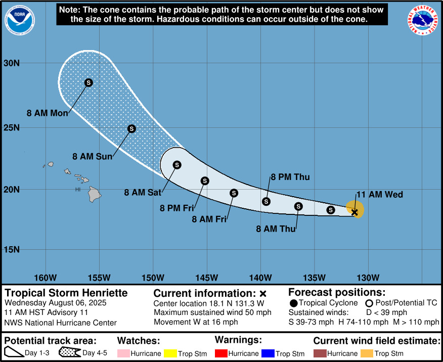
“The tropical storm is still forecast to slowly weaken during the next few days while it moves over cool (sea surface temperatures) near 24C. However, once Henriette moves north of Hawaiʻi, it will move over warmer waters,” the National Hurricane Center said. “Upper-level difluent flow associated with a mid-latitude trough to the northwest may also provide additional support for intensification.”
Farther east, Tropical Storm Ivo has formed about 195 miles south-southeast of Acapulco, Mexico. It is expected to strengthen into a hurricane before it dissipates into a remnant low in the Eastern Pacific.

by Big Island Video News
on at
STORY SUMMARY
HAWAIʻI - Forecast models are in good agreement, showing the tropical cyclone will pass north of Hawaiʻi this weekend.