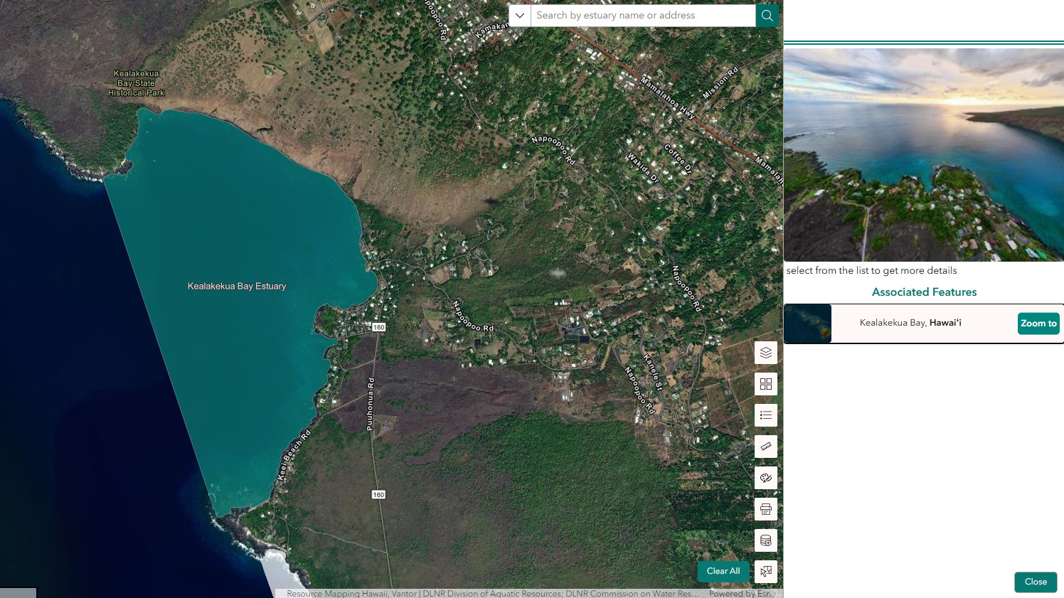
(BIVN) – The first statewide, publicly accessible map of Hawaiʻi’s estuaries – places where fresh water from streams and springs meets salt water from the ocean – has been released.
The Hawaiʻi Office of Planning and Sustainable Development introduced the Hawaiian Estuaries Viewer in a recent news letter.
“These rich, productive ecosystems support cultural practices, provide nurseries for marine and freshwater fish, and offer vital habitat for native and endemic waterbirds,” the Office stated. “More than 120 fish species rely on Hawaiian estuaries during their life cycles.”
“Despite their importance, Hawaiʻi has never had a complete, authoritative map of its estuaries,” the newsletter continued. “Without knowing where these habitats are, it’s difficult for agencies and communities to protect them from development pressures, water diversion, and other threats.”
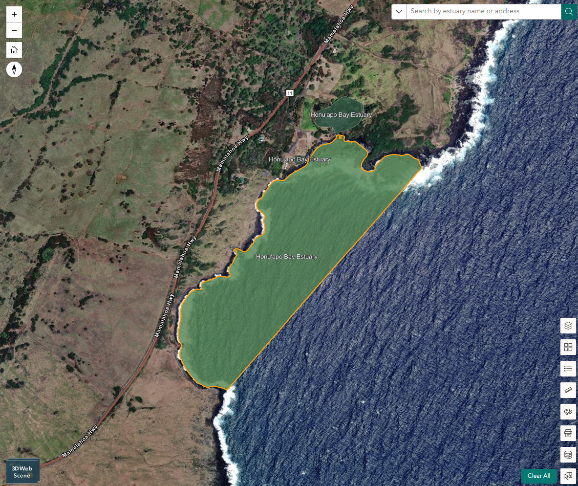
Honuʻapo Bay Estuary, as seen in the Hawaiian Estuaries Viewer
The viewer is the product of a partnership between the Office of Planning and Sustainable Development, Coastal Zone Management Program (OPSD‑CZM) and the Department of Land and Natural Resources, Division of Aquatic Resources (DLNR‑DAR).
The interactive map shows estuaries and their key features, offers search tools, place-based details, and even 3D viewing “for a more immersive look at each site.”
“The Hawaiian Estuaries Viewer strengthens our ability to protect these irreplaceable ecosystems,” the Office wrote, “ensuring that Hawaiʻi’s unique coastal habitats, native species and cultural practices can thrive for generations to come.”

by Big Island Video News
on at
STORY SUMMARY
HAWAIʻI - State officials say the viewer will strengthen their ability to protect the irreplaceable estuary ecosystems.