(BIVN) – The USGS Hawaiian Volcano Observatory issued an information statement on Tuesday night, after detecting shallow earthquakes and ground deformation on the south side of Kīlauea caldera.
Geologists say they are “detecting shallow earthquakes beneath the south rim of Halemaʻumaʻu crater, as well as localized ground deformation, in the south caldera region of Kīlauea summit.”
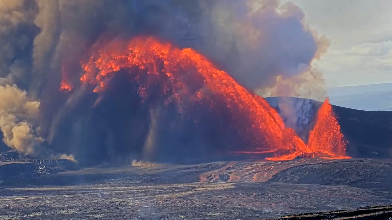
The ongoing eruption at the summit of Kīlauea is currently paused, although precursory lava activity began Monday night, raising the Volcano Alert Level from ADVISORY to WATCH, and the Aviation Color Code from YELLOW to ORANGE. Episode 45 high lava fountains could erupt at any time.
Due to the shallow earthquakes and ground deformation, the USGS HVO advised:
- Heed National Park Service guidance and do not enter the closed area, where potentially life-threatening hazards can occur. Be aware that significant hazards exist around Kīlauea caldera from Halemaʻumaʻu crater wall instability, ground cracking, and rockfalls that can be enhanced by earthquakes.
- If you are near the rim of Kīlauea caldera and feel the ground shaking, immediately move away from the edge.
The Observatory provided this summary in its information statement:
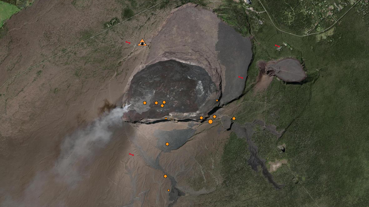
The USGS Hawaiian Volcano Observatory has detected small earthquakes beneath the south rim of Halemaʻumaʻu crater in the south caldera region of Kīlauea summit over the past few months. Over the past day, an additional 10 earthquakes magnitude-2 and smaller in this area have been detected at depths of 0.6–1.2 miles (1–2 km) below the surface. Most of these earthquakes are too small to be felt. Deeper earthquakes have also continued to occur beneath Kīlauea summit, but these have been observed typically throughout this eruption. HVO will continue to monitor this region closely as episode 45 of the ongoing Halema’uma’u eruption approaches and unfolds. Episode 45 lava fountaining is forecast to being between today, April 21, and April 26, 2026.
A separate and discrete swarm of 15 shallow magnitude-2 or smaller earthquakes occurred 0.6–1.2 miles (1–2 km) beneath the south rim of Halemaʻumaʻu crater in the south caldera region of Kīlauea summit during the final hours of episode 44 on April 9, 2026. Most of the earthquakes were too small to be felt; however, several earthquakes were felt by HVO staff monitoring the eruption from the rim of Halemaʻumaʻu crater. Ground deformation data show that an area of the south rim of Halemaʻumaʻu crater rose by several inches (centimeters), though the cause is uncertain. Due to a blanket of tephra that obscures visibility, HVO staff visiting the area after episode 44 did not observe any obvious ground cracks.
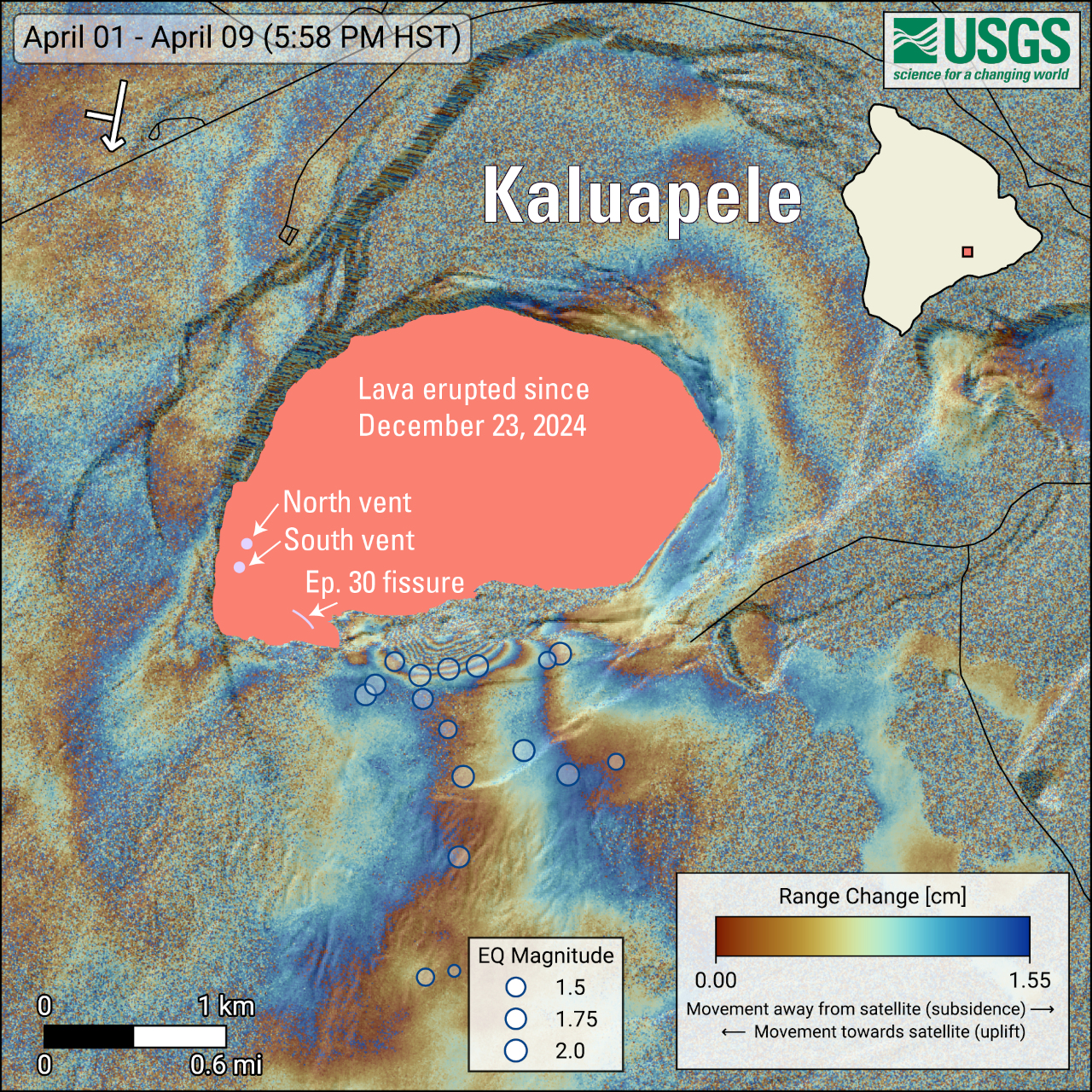
The patterns observed at the end of episode 44 are similar to patterns observed earlier in the eruption. During the start of episode 30 lava fountaining on August 6, 2025, earthquakes and ground deformation in this area of the south rim of Halemaʻumaʻu crater were associated with the opening of a new fissure on the south side of the crater, which erupted briefly only during episode 30. Earthquakes occurred minutes to hours before the new fissure began erupting in this area.
Additionally, this area on the south rim of Halemaʻumaʻu was affected by molten and hot tephra falling when the south vent lava fountain became suddenly inclined to the south during episode 38 on December 6, 2025, due to a change in the vent geometry. This molten material destroyed the original V3 livestreaming camera on the south rim of Halemaʻumaʻu. USGS Hawaiian Volcano Observatory monitoring cameras in this area provide situational awareness of hazards so that monitoring staff do not need to be in this hazardous area.
The activity “highlights the dynamic and hazardous nature of the closed area in Hawaiʻi Volcanoes National Park, where changes can occur quickly and can result in rapidly escalating hazards,” the Observatory says.
Unless there is a change at Kīlauea, episode 45 is forecast to occur at any time between now and Sunday, April 26th.