(BIVN) – The USGS Hawaiian Volcano Observatory has published a new set of materials documenting the most recent eruption at the summit of Kīlauea, including new footage, a video timelapse, a thermal map, and an updated photo compilation.
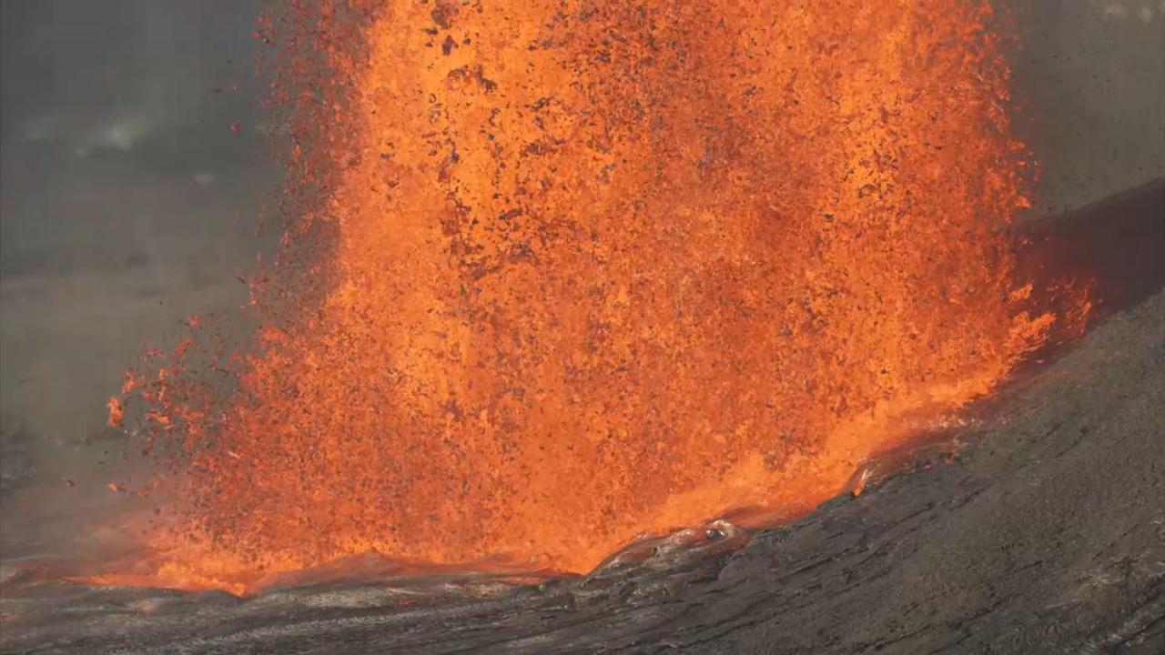
The footage offers a closer look at episode 45, the 8.5 hour lava eruption that began early in the morning on Thursday, April 23rd. Video recorded at around 3 a.m. shows lava fountains from the north vent reaching their peak heights of at least 700 feet, or 220 meters.
Including the fiery wisps at the tops of the fountains bring heights to over 1,000 feet, or 300 meters.
The video was recorded from a closed area within Hawaiʻi Volcanoes National Park. Observatory scientists are granted permission to enter the hazardous area to gather important data.
Scientists also captured tight views of the channelized lava flows that were created by the high fountains. The lava covered about half of the crater floor. The eruption saw an average lava effusion rate of 220 cubic yards per second – or 170 cubic meters.
A time lapse video was also uploaded by the Observatory, showing the event in its entirety. Summit tiltmeters recorded about 16 microradians of deflation during episode 45. When the episode ended, tilt switched back to inflation.
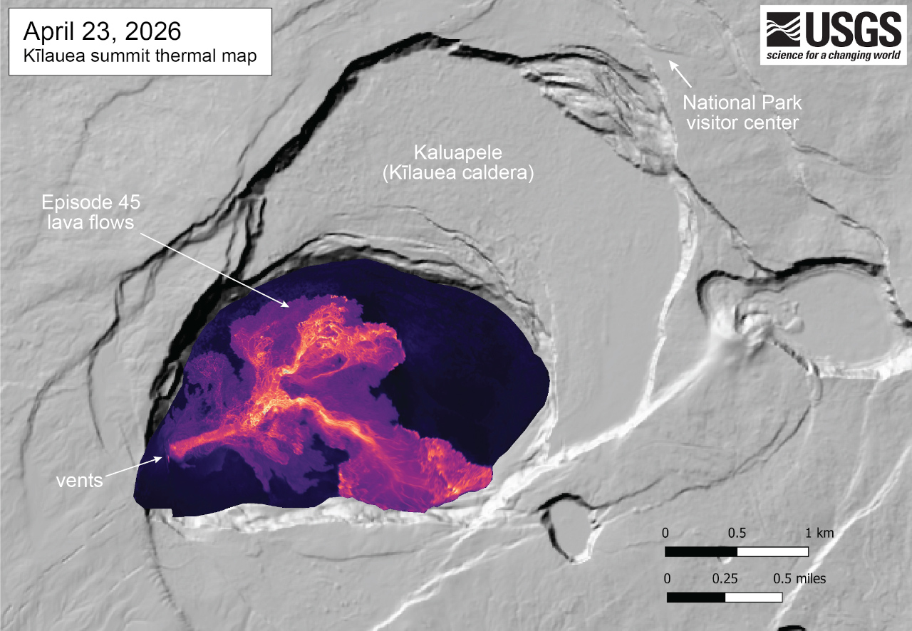
A new map was made from thermal images collected during an overflight immediately after the end of the episode. It shows a single channelized lava flow extending from the north vent, splitting into branching lava channels in the central part of the crater floor. From there, individual lobes of lava can be seen, extending out to the northeast and southeast, and into the eastern portion of the crater.
The Observatory says the forecast window for episode 46 to occur is between Saturday, May 2nd, and Wednesday, May 6th. When the next episode occurs, it will be added to the growing photo compilation produced by the observatory.
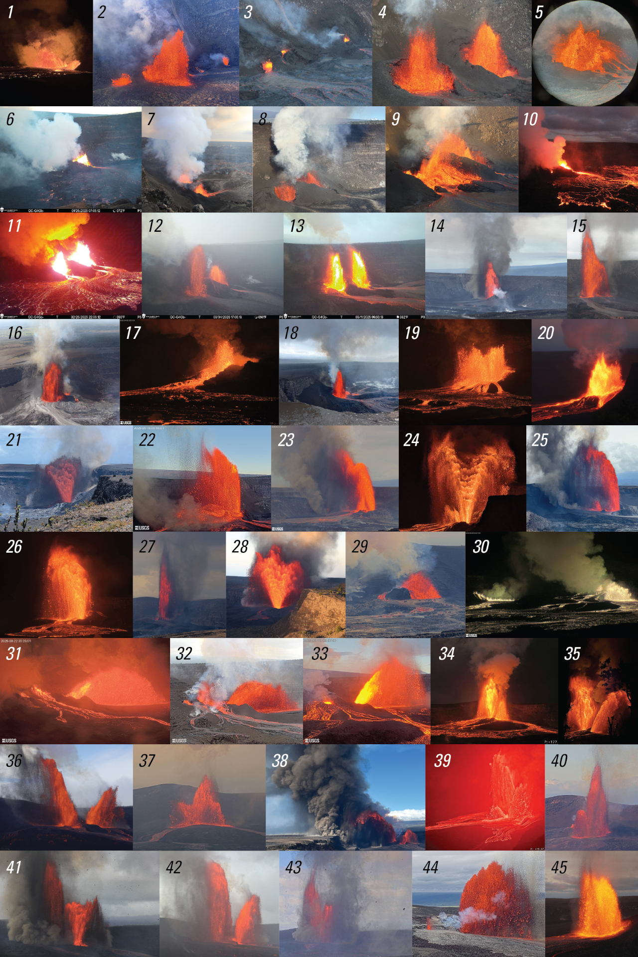
Kīlauea has been erupting episodically since December 23, 2024. Each episode has generally lasted for less than 12 hours. The lava fountains are separated by pauses that can be longer than three weeks. The time between recent episodes has seemingly gotten shorter, at least compared to the prolonged pause between episodes 43 and 44.
The USGS Volcano Alert Level for Kīlauea is at ADVISORY, and the Aviation Color Code is YELLOW.