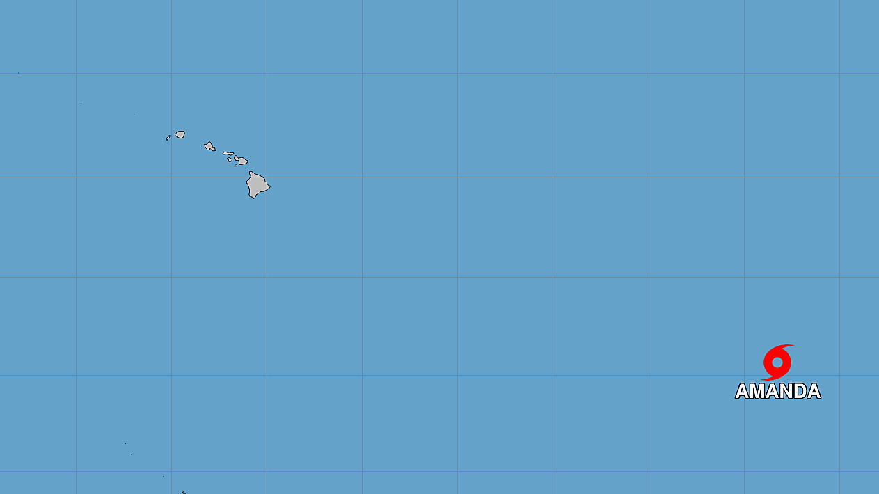
(BIVN) – Tropical Storm Amanda has formed over open waters, becoming the first cyclone of the 2026 Eastern Pacific hurricane season.
Amanda is not expected to be a threat to Hawaiʻi. The storm is forecast to strengthen in the next couple of days before weakening later this weekend.
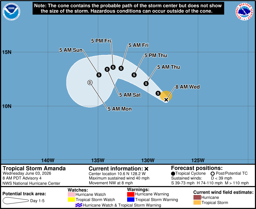
As of Wednesday morning, Amanda was located 1,475 miles west-southwest of the southern tip of Baja California, moving toward the northwest near 8 mph. The storm’s maximum sustained winds have increased to near 40 mph (65 km/h) with higher gusts.
The National Weather Service is predicting an above-normal hurricane season for the central Pacific basin this summer. There could be a total of 5 to 13 tropical cyclones across the region; tropical cyclones include tropical depressions, tropical storms and hurricanes. Strong El Niño conditions, forecast by the NOAA Climate Prediction Center, are typically associated with dramatically elevated levels of activity in the central Pacific.
The forecast for Tropical Storm Amanda was discussed by the National Hurricane Center this morning:
Deep convection has been increasing near and to the west of the low-level center of the system over the past 6-12 hours. Objective Dvorak satellite intensity estimates from UW-CIMSS are around 35 kt. Using these estimates and the latest satellite trends, the depression has been upgraded to Tropical Storm Amanda with the initial intensity set to 35 kt.
Amanda is moving a little faster to the northwest with an initial motion of 305/7 kt. The system is flanked by a mid-level ridge to the northeast and an upper-level low to the northwest, supporting a northwestward to west-northwestward motion through Friday. A turn toward the west then west-southwest with a slower forward motion is expected by this weekend as the ridge strengthens. The official forecast is similar to the previous in the short term, but has been nudged slightly farther south from the previous beyond Day 3, lying between the Google DeepMind and various consensus aids.
The storm has shown increasing organized convection this morning, and is embedded within a sufficiently saturated low- and mid-level environment. All model guidance supports steady strengthening over the next 36 h or so. It is noted that GFS and EC SHIPS RI model guidance are showing a 20 to 30 percent chance of rapid intensification during the next 24 to 36 h. The official NHC forecast maintains a peak intensity of 55 kt, which lies near the higher end of the model guidance. After 36-48 h, Amanda will move into a less-favorable environment with increasing shear and a drier mid-level airmass, supporting steady weakening through this weekend. Towards the end of the forecast period, the system will begin to struggle to produce convection. The official forecast now has the system becoming a post-tropical remnant low at Day 5, although some models suggest this could occur sooner than forecast.