
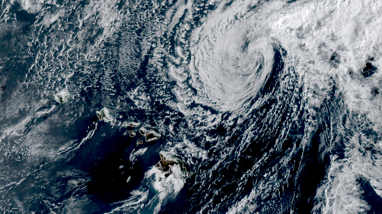

(BIVN) – As of 5 p.m. on Tuesday evening, Tropical Storm Fausto was located 255 miles north-northeast of Hilo, moving west northwest at 12 mph.
Fausto is still at tropical storm strength, but that is not expected to last for much longer. With maximum sustained winds near 40 mph, Fausto is expected to weaken into a tropical depression early on Wednesday, and a remnant low later that day, forecasters say.
A High Surf Warning remains in effect for east-facing shores of Hawaiʻi island. The County of Hawaiʻi reports all beach parks along the Keaukaha shoreline of Hilo remain closed. The swell will decline tonight through Wednesday as Fausto exits to the northwest.
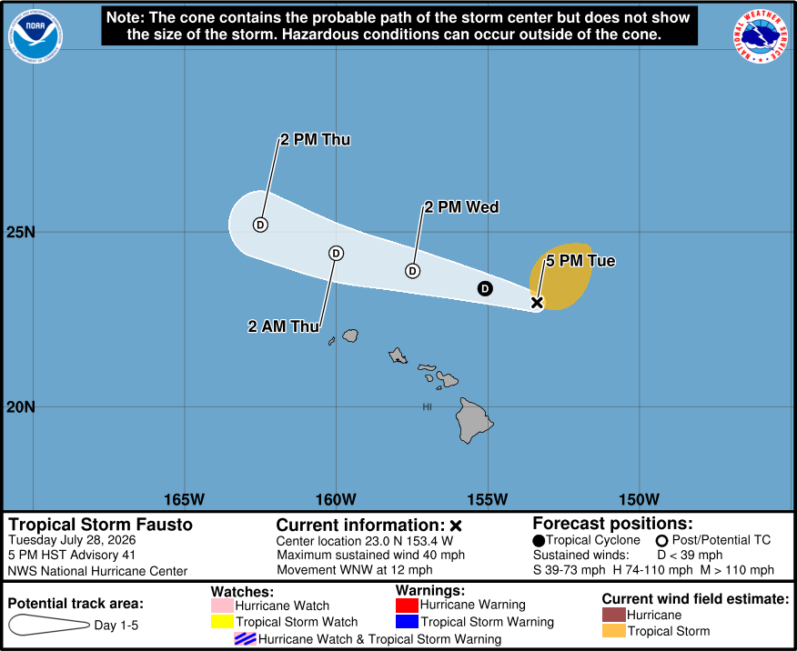
From the Central Pacific Hurricane Center at 5 p.m. HST:
Most of the deep convection associated with Fausto has been sheared well to the northeast of the low-level center. Reports from an Air Force Hurricane Hunter aircraft indicate that the storm’s maximum sustained winds have decreased to near 35 kt. The aircraft observations and earlier ASCAT-B and ASCAT-C scatterometer data show that tropical-storm-force winds are now confined to the northeastern quadrant of the circulation. The center of the cyclone will likely pass very near NOAA data buoy 51000 within the next few hours, and should provide additional information on the central pressure which is estimated to have risen to 1006 mb.
Center fixes from aircraft and satellite indicate that Fausto continues on a mainly west-northward track with an initial motion estimate of 285/10 kt. The steering winds associated with a weak low-level ridge should result in a continued general west-northwestward motion for the next couple of days. The official track forecast is on the southern side of the guidance envelope and similar to the previous NHC prediction.
Although Fausto is expected to remain over marginally warm ocean waters, the atmospheric environment is expected to be highly unfavorable, and become even less conducive for regeneration during the period. Strong upper-level westerlies should result in a further increase in vertical wind shear, and the system will be moving through an extremely dry low- to mid-level air mass. Therefore, continued weakening is likely, and Fausto is expected to degenerate into a post-tropical remnant low within the next day or so.
Key Messages:
1. Fausto is expected to continue weakening as it passes north of the Hawaiian Islands tonight through Wednesday night. Although the current forecast indicates that the strongest winds and heaviest rainfall will remain north of the islands, interests across the Hawaiian Islands should continue to monitor the progress of Fausto.
2. Surf generated by Fausto will continue to build westward across the Hawaiian Islands along exposed east-facing shores through tonight as Fausto begins to pass north of the islands. Large surf and strong currents will lead to dangerous conditions along exposed shores. Please consult products from your local weather office.
