
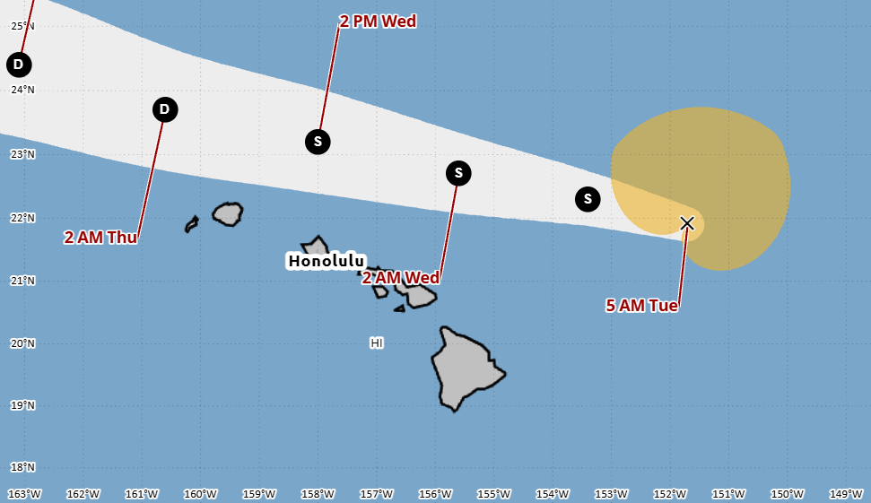

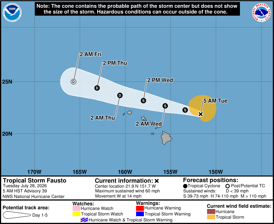
(BIVN) – Tropical Storm Fausto is 265 miles northeast of Hilo as of 5 a.m. HST on Tuesday morning, heading west at 14 mph. Fausto should pass north of the Hawaiian Islands tonight through late Wednesday.
The Central Pacific Hurricane Center reports Fausto’s maximum sustained winds are now near 60 mph (95 km/h) with higher gusts, with additional weakening forecast. Fausto is expected to remain a tropical storm as it passes north of the Hawaiian Islands.
Surf generated by Fausto will continue to build along exposed east-facing shores through today, as a High Surf Warning was issued by the National Weather Service for beaches on windward North Kohala, Hāmākua, Hilo, Puna, and Kaʻū.
On Monday, the Hawaiʻi County Civil Defense reported the following beach closures in the Keaukaha-area of Hilo:
- Onekahakaha Beach Park
- Kealoha Beach Park
- Carl Smith Beach Park
- Leleiwi Beach Park
- Waiolena Beach Park
- Waiuli Beach Park
- Richardson’s Ocean Park
- Lehia Beach Park
- Lalakea Beach Park
“Expect ocean water surging and sweeping across beaches, coastal benches, and lava flows creating the potential for impacts to coastal properties and infrastructure, including roadways,” the National Weather Service wrote. “Powerful longshore and rip currents will be present at most beaches. Large breaking waves and strong currents may impact harbor entrances and channels causing challenging boat handling. In addition, tides are running higher than predicted and in combination with surf along east shores may lead to more inundation and coastal flooding during the daily high tide this afternoon.”
From the Central Pacific Hurricane Center discussion at 5 a.m. HST:
Fausto is continuing to weaken due to the effects of 25 kt of southwesterly vertical wind shear. The low-level center is exposed to the southwest of the convective mass, and both scatterometer and synthetic aperture radar data indicate the circulation is becoming elongated. While the Hurricane Hunter aircraft previously in the storm did not re-sample the maximum winds to the northeast, it did report that the central pressure had risen to near 1004 mb. Based on this, decreasing satellite intensity estimates, and continuity from the previous advisory, the initial intensity is reduced to a possibly generous 50 kt.
The initial motion is now 280/12. As Fausto weakens, the low-level ridge to the north should steer the cyclone or its remnants generally west-northwestward for the next several days as shown by the track guidance. The new track forecast is similar to the previous forecast, but a little slower, and it lies near the southern edge of the track guidance envelope close to the HFIP Corrected Consensus (HCCA) and Google DeepMind forecasts. On the forecast track, Fausto should pass to the north of the Hawaiian Islands tonight through late Wednesday.
An already hostile environment is forecast to get more hostile, with the current strong shear over Fausto increasing during the next 72 h as the cyclone moves into a drier mid-level air mass. This combination should cause additional weakening, and all of the intensity guidance agrees with this. Fausto is expected to weaken to a depression by 48 h and then degenerate to a remnant low by 72 h. After that time, the circulation should weaken to a trough. The new intensity forecast has only minor adjustments from the previous forecast.
Key Messages:
1. Fausto is expected to continue weakening as it approaches the Hawaiian Islands this week. Although the current forecast indicates that the strongest winds and heaviest rainfall will remain north of the islands, interests across Hawaii should continue to monitor the progress of Fausto.
2. Surf generated by Fausto will continue to build westward across Hawaii along exposed east-facing shores through today as Fausto approaches and begins to pass north of the islands. Large surf and strong currents will lead to dangerous conditions along exposed shores. Please consult products from your local weather office.
