(ABOVE VIDEO) USGS Scientists Jim Kauahikaua and Matt Patrick present the latest info to the public.
Video by David Corrigan
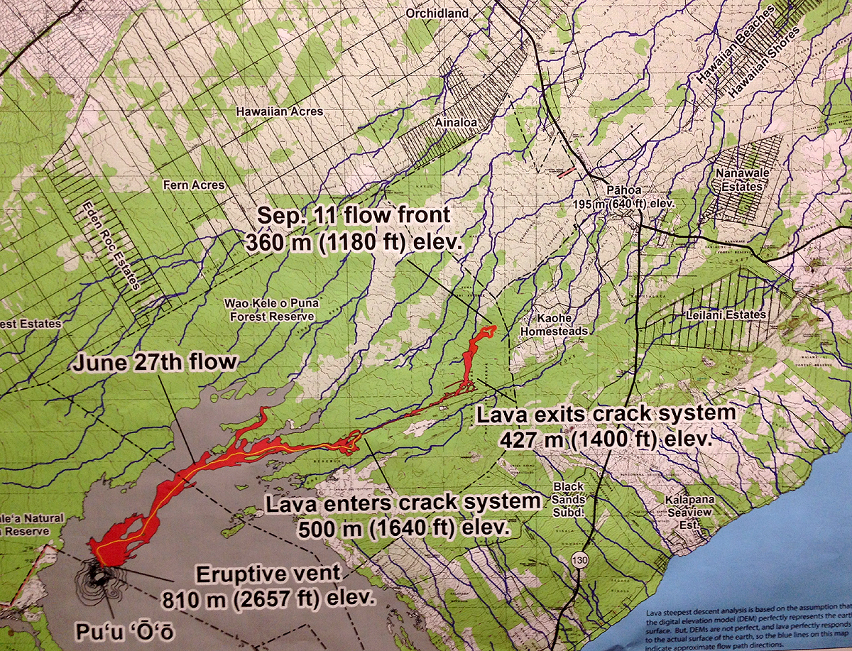
PAHOA, Hawaii – Spirits were crushed on Thursday night as an updated projection shows lava from the June 27 flow crashing into Pahoa town.
USGS Hawaiian Volcano Observatory Scientists presented the latest information during a public meeting at Pahoa High School, and the probable lava course doesn’t look good for the Puna village.
An overflight yesterday afternoon observed that the flow front had shifted towards a more northeast direction, bringing it closer to the western boundary of Kaohe Homesteads, USGS reported.
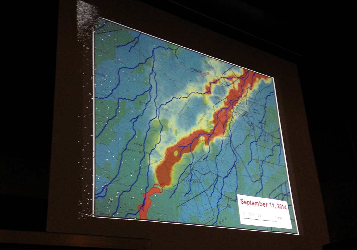
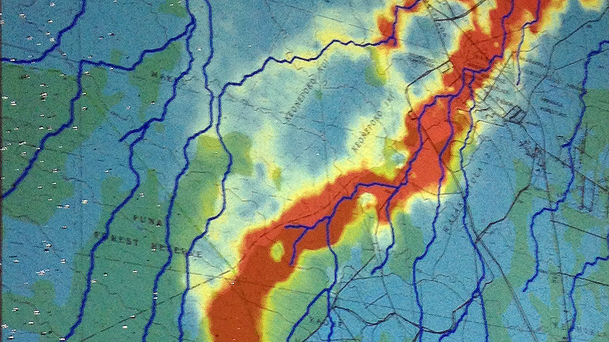
At Tuesday’s public meeting, scientists produced an image that projected the greatest probabilities of how the flow might move downhill, taking into account topography but also possible human mapping errors that could alter the forecasted direction. The result was two leading scenarios: a northern branch that bypasses the heart of Pahoa, and a southern branch that flows right through the town; the worst case scenario. On Thursday night, using new data and the lava flow’s current location a little further northeast, the two scenarios have coalesced into one. Its the worst-case scenario; the southern route through town.
The crowd – possibly numbering a thousand – seemed suddenly deflated, as if all hope had been lost.
On Thursday morning, Hawaii County Civil Defense said the flow does not pose an immediate threat to area communities, “however residents of the Kaohe Subdivision are advised to monitor the local radio broadcasts for further updates and for possible evacuation instructions if conditions change.”
We will have more from this meeting shortly.