Audio by Hawaii County Civil Defense, issued July 7, 2019.
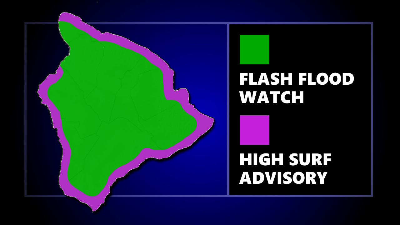
(BIVN) – The National Weather Service in Honolulu has issued a Flash Flood Watch for Hawaiʻi Island from this evening through late Monday night, as moisture associated with the remnant of Barbara moves over the island tonight.
With the moisture moving in from the east, the initial threat of heavy rainfall will be over windward areas, spreading to leeward areas on Monday, forecasters say.
A High Surf Advisory is also in place for most of the island. Surf along east facing shores of the Big Island will be 7 to 12 feet through tonight. A long period south- southwest swell is also producing surf heights of 5 to 8 feet along south facing shores through tonight.
“Expect strong breaking waves, dangerous shore break, and rip currents,” a morning Hawaiʻi County Civil Defense message warned. “Beach-goers, swimmers, and surfers know your limits, exercise caution, and heed all advice given by ocean safety officials.”
Civil Defense also had this message on the Flash Flood Watch:
- Moisture associated with the remnant of Barbara will move over Hawaii Island tonight.
- Flash Flooding is LIFE THREATENING.
- Do not cross fast flowing water.
- Those in flood prone areas, take action before nightfall to prepare for the possible affects of flash flooding and heavy rains.
- If you experience heavy rain or rising water, head to higher ground immediately.
The National Weather Service in Honolulu wrote in its morning discussion:
Model solutions are in good agreement indicating that the remnant low of Barbara will gradually spin down while tracking generally toward the W over the next several days. The expectation is that the low will remain intact as it passes just S of the Big Island on Monday before weakening to a surface trough by Tuesday as it moves W of the islands. Regardless of when the remnant low dissipates, latest UW-CIMSS MIMIC PWAT analysis depicts a significant slug of moisture headed our way, with values as high as 2.5″ N of the center. Satellite cloud top temperatures indicate this most of this moisture is confined below 15-20 thousand feet. Therefore, thunderstorms are generally not expected as the low passes, but terrain enhancement will bring a slight chance of thunderstorms to the Big Island on Monday.
With the low projected to pass S of the Big Island Monday, this deep moisture is expected to begin moving over the Big Island tonight, then spread to at least some of the other islands through Monday. Although the mid-level ridge will persist to the N, this amount of low- and mid-level moisture acts to destabilize the atmosphere, thus increasing the potential for heavy rain to develop, and a Flash Flood Watch (FFA) has been issued for the Big Island. There still remains some uncertainty as to how far N the moisture field will extend as it passes the longitude of the islands. Although all islands are likely to see some locally heavy rainfall, especially windward (as winds will continue to have an easterly component), the potential for flooding rainfall away from the Big Island appears less likely at this time – but expansions to the FFA are definitely a possibility.
As the low approaches, winds will back to the NE and increase to some degree, with locally windy conditions (most likely on the Big Island) potentially necessitating a Wind Advisory on Monday. Winds will veer to the E and SE as the low passes, then gradually diminish as the low departs on Tuesday. Drier air will move over the area from the E Tuesday night and Wednesday, and a fairly quiet trade wind weather pattern will prevail into next weekend, with moderate trade winds and the stabilizing mid-level ridge persisting. Long range guidance hints that the stabilizing ridge may break down somewhat next weekend with stronger trade winds, but much too soon to be confident.


by Big Island Video News7:36 am
on at
STORY SUMMARY
HAWAIʻI ISLAND - Moisture associated with the remnant of Barbara will move over the Big Island tonight, and then remain in place through Monday night before diminishing, forecasters say.