Hawaiʻi Department of Health maps
(BIVN) – New maps showing the general location of confirmed COVID-19 cases across the Hawaiian islands are now available on the Hawaiʻi Department of Health website.
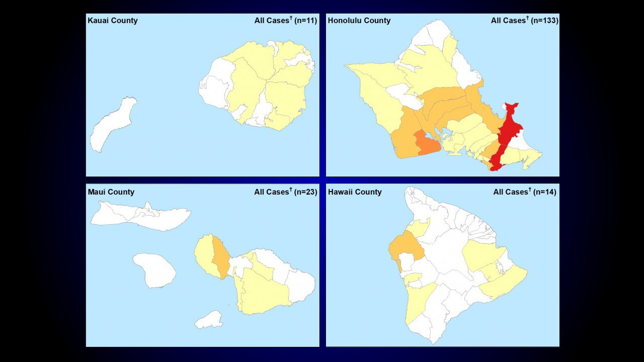
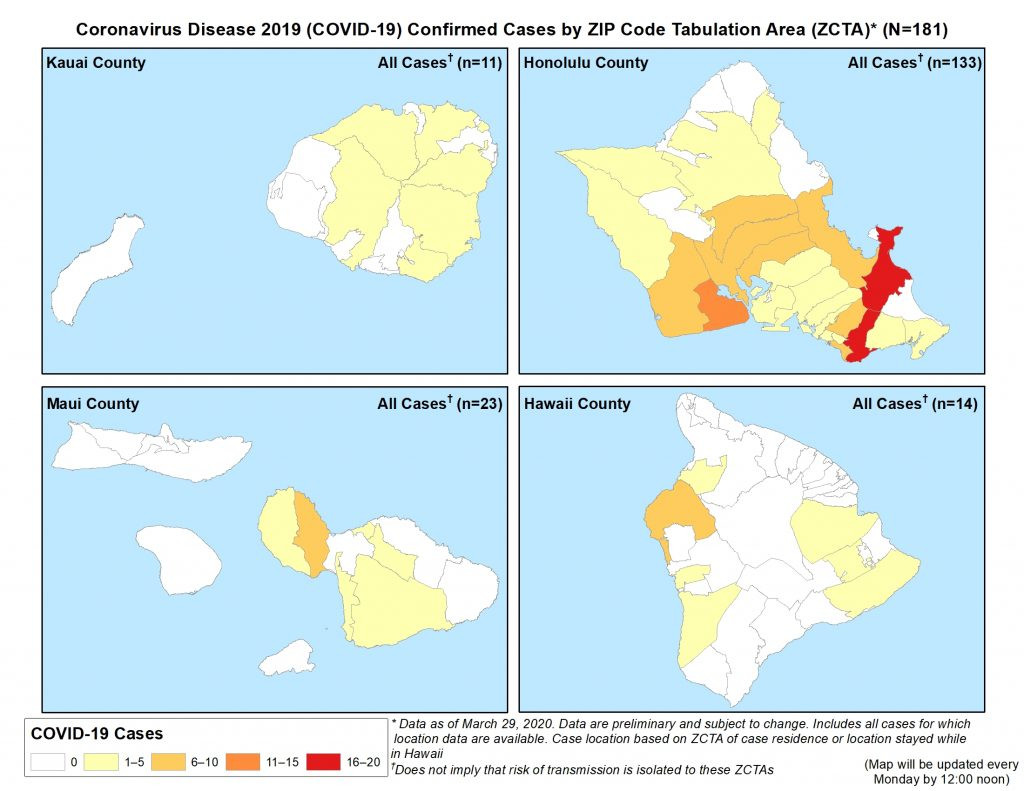
The maps use ZIP Code Tabulation Areas, or ZCTAs, to broadly indicate where the cases are found, and how many. For example, the first maps posted to the website – which uses data collected as of March 29 – show the 96740 ZCTA in Kona as having the highest number of cases (between 6 to 10) of the 14 confirmed cases that were identified on the Big Island at the time. A lesser number of cases were identified in Puna, South Hilo, South Kona, and South Kohala ZCTAs.
The Hawaiʻi DOH says the maps will be updated every Monday at noon.
“Data are preliminary and subject to change,” a map caption states.
The maps include “all cases for which location data are available,” the state says. The case location is based on the zip codes of the case residence or, if a visitor, location stayed while in Hawaiʻi.
The maps do “not imply that risk of transmission is isolated to these ZCTAs”, the Hawaiʻi health department wrote.

by Big Island Video News
on at
STORY SUMMARY
HONOLULU, Hawaiʻi - A new set of maps showing the confirmed coronavirus cases by zip code will be updated once a week, the state health website says.