Big Island Video News

Serving Hawaii County

  • Hawaiʻi Island News Regions
    • Hamakua
      • Mauna Kea
    • Hilo
    • Kau
    • Kona
    • Kohala
    • Puna

USGS photo shows a Unoccupied Aircraft System (UAS) unit staged for take-off on October 5, 2022. (USGS photo by N. Deligne)

UAS Flights Help Map Eruption At Kilauea Volcano Summit
Avatar photo

by Big Island Video News
on Oct 12, 2022 at 6:59 am

Subscribe to Big Island Video News (FREE)

* indicates required

STORY SUMMARY

HAWAIʻI VOLCANOES NATIONAL PARK - A new maps depicting the ongoign eruption at the summit of Kilauea have been published by the USGS, using data gathered by UAS flights.

USGS Kīlauea summit UAS thermal maps, produced from data gathered on October 5. “The active lake surface is limited to the western portion of the crater. The scale of the thermal map ranges from blue to red, with blue colors indicative of cooler temperatures and red colors indicative of warmer temperatures,” USGS says.

(BIVN) – The eruption continues at the summit of Kīlauea, with all activity confined to Halemaʻumaʻu crater inside Hawaiʻi Volcanoes National Park. Scientists say no significant changes have been observed at the summit or in either rift zone, and the current Volcano Alert Level remains at WATCH.

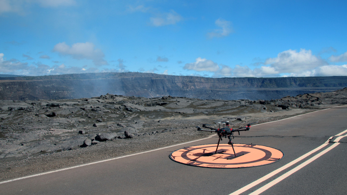
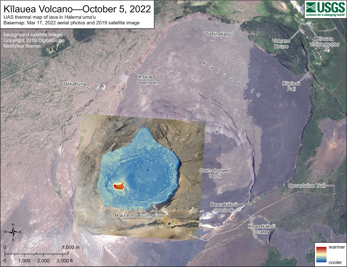
A new set of maps were recently produced by the USGS Hawaiian Volcano Observatory using data gathered during an October 5 Unoccupied Aircraft System (UAS) flight.

Scientists say they compare the detailed topographic maps constructed from routine overflights to monitor the effusion rate of lava into the summit crater. In the past, these overflights have been done using helicopters.

USGS reference map depicting the ongoing Kīlauea summit eruption on October 7, 2022. “One eruptive vent (orange) is active within Halema‘uma‘u, on the western side of the crater floor. An adjacent pond (purple) is feeding lava to a larger lake (red) via a crusted-over tube,” USGS says.

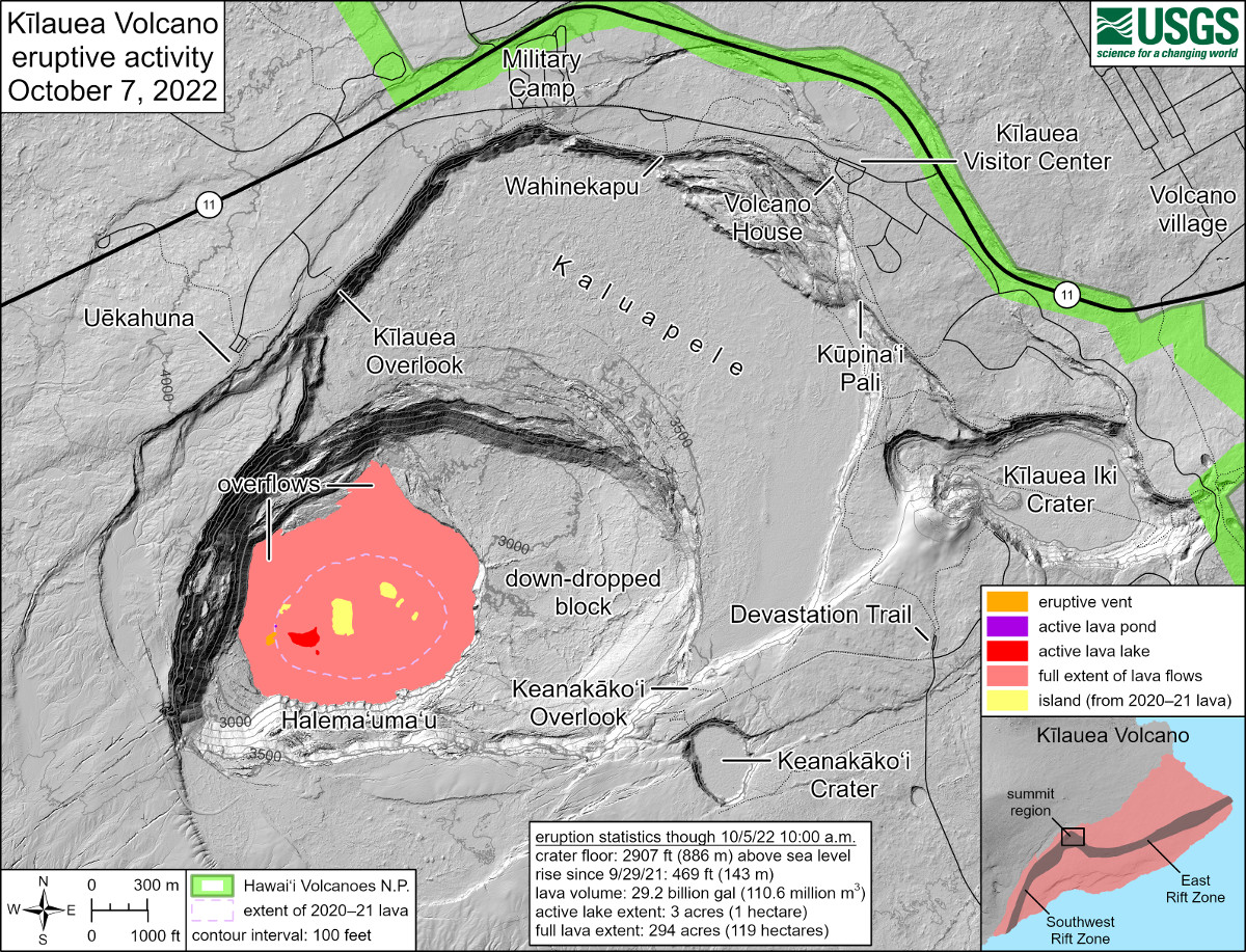
Scientists note that between September 12 and October 5, 2022, “there was a net decrease in the volume within Halema‘uma‘u, likely due to the lake draining and a nearby intrusion on September 20, 2022.” 

The USGS says the crater floor has seen “a total rise of about 143 meters (469 feet), and that 111 million cubic meters (29.2 billion gallons) of lava had been effused since the beginning of this eruption on September 29, 2021.”

The USGS says it needs special use permits from the National Park Service to conduct official UAS missions, and notes that, otherwise, “launching, landing, or operating an unmanned aircraft from or on lands and waters administered by the National Park Service within the boundaries of Hawaii Volcanoes National Park is prohibited under 36 CFR Closures & Public Use.”


Filed Under: Volcano Tagged With: Kilauea

LATEST NEWS

Critical Habitat Proposed For 12 Species Found Only On Hawaiʻi Island

Delays Reported In Kilauea Recovery Road, Waterline Projects

Hawaiʻi COVID-19 Update for Wednesday, March 29

Mass Dolphin Harrassment In Hōnaunau Under Investigation

East Hawaiʻi Police Officer, Firefighter Of The Year Named

Bathroom Burns Down At Old Airport Park In Kona

About Big Island Video News

  • Privacy Policy

Copyright © 2023 · Dynamik-Gen on Genesis Framework · WordPress · Log in