UPDATE – (3 p.m. on Tuesday, December 6)
- Lava from the eruption of Mauna Loa was about 1 and a half miles away from the Daniel K. Inouye Highway this afternoon, officials reported at 3 p.m. HST. The highway is currently open in both directions.
- For those planning on viewing the lava flow from the designated area on the Old Saddle Road, emergency officials warned Tuesday of possible severe weather. “The weather forecast for today calls for thunderstorms for the interior areas of Hawaii Island, to include Daniel K. Inouye Highway,” a Hawaii County Civil Defense message stated. “Fog and rain will make driving hazardous please drive with caution.”
From the USGS Hawaiian Volcano Observatory at 8:32 a.m. HST:
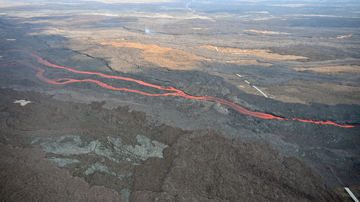
The Northeast Rift Zone eruption of Mauna Loa continues. One active fissure, fissure 3, is feeding a lava flow advancing slowly northward toward the Daniel K. Inouye Highway (Saddle Road). The lava flow has reached relatively flat ground causing it to slow down significantly over the past several days, as expected.
As of 5:00 a.m. today, December 6, the flow front was about 1.93 mi (3.1 km) from the Daniel K. Inouye Highway (Saddle Road). There continued to be several small overflows from main channels recorded over the past day and a brief surge at the flow front yesterday morning. During the past 24 hours, the lava flow advanced at an average rate of about 68 feet per hour (21 meters per hour), about twice the rate for the past several days. Over shorter periods, the advance rate varied from 62 to 90 feet per hour (18.8 to 27.4 m per hour). The lava flow remains active and is continuously supplied from the fissure 3 vent.
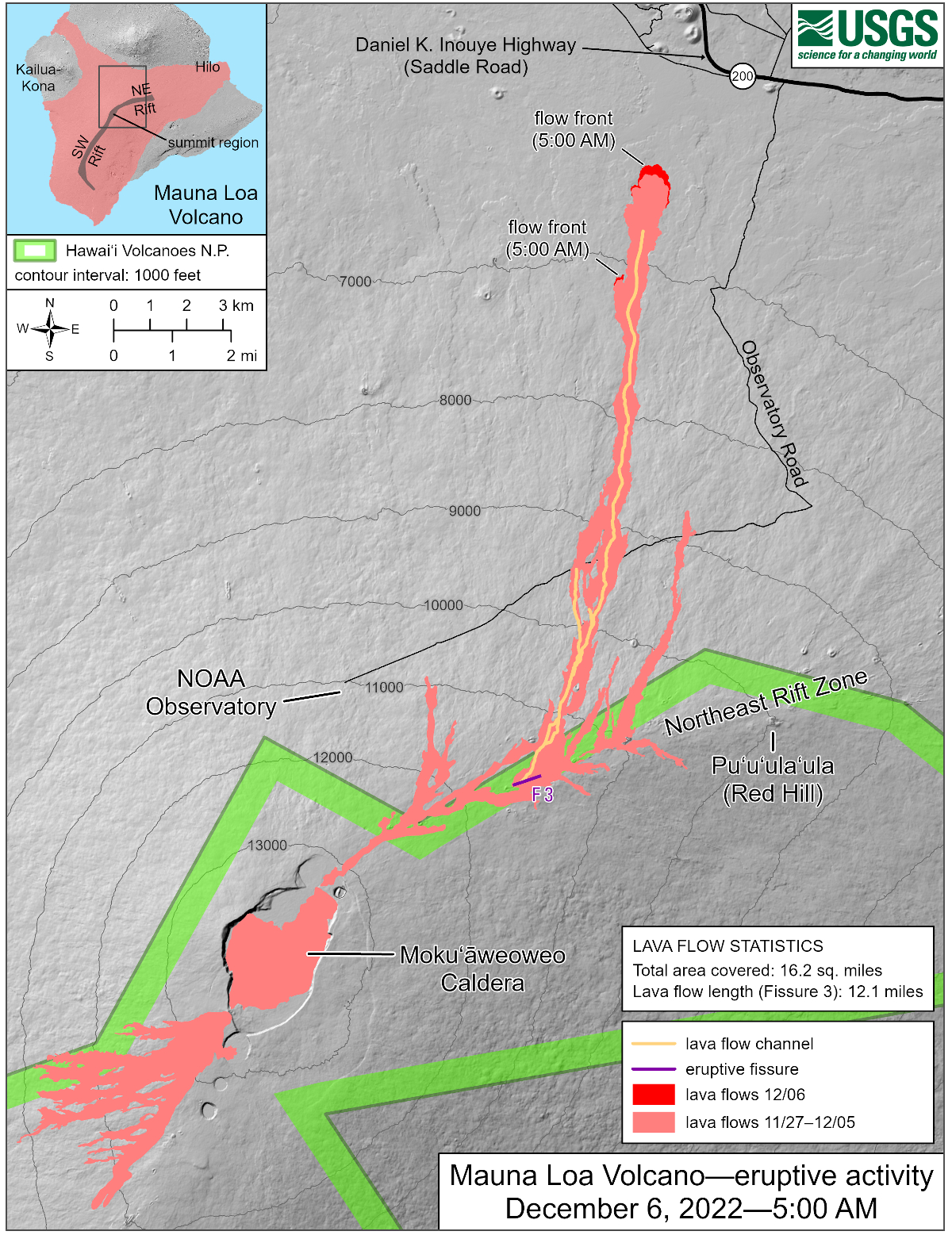
USGS: The Northeast Rift Zone eruption of Mauna Loa that began the evening of November 27, 2022, continues as of December 6, 2022 (ninth full day). One active fissure, fissure 3, is feeding a lava flow downslope to the north. HVO field crews and USGS analysts have accurately mapped some of the most active flows, displayed in red here, along with older flows further uprift, in part of Mokuʻāweoweo caldera, and in the upper summit region southwest of the caldera. Lava flow length was measured by tracing the continuous active channel shown in yellow here and then extending the measurement to the distal lava flow extent measured in satellite data. The increase in area covered by lava flows over the past 24 hours reflects better resolution mapping rather than actual flow expansion. Lava flow expansion over the past 24 hours is shown in red and amounts to 0.14 square miles (90 acres).”
Advance rates may be highly variable over the coming days and weeks. On the flat ground between Mauna Loa and Mauna Kea, lava flows advance more slowly, spread out, and inflate. Individual lobes may advance quickly, and then stall. Additional breakouts may occur if lava channels get blocked upslope. There are many variables at play and both the direction and timing of flow advances are expected to change over periods of hours to days, making it difficult to estimate when or if the flow will impact Daniel K. Inouye Highway.
Sulfur dioxide (SO2) emission rates of approximately 120,000 tonnes per day (t/d) were measured on December 4, 2022, and remain elevated at this time

by Big Island Video News
on at
STORY SUMMARY
HAWAII ISLAND - Lava is now less than two miles from the Daniel K. Inouye Highway, and is advancing at a faster rate compared to the slow crawl of the past few days.