This story appears in the above BIVN Update. The video will jump to the associated story when played. (A synthesized voice was utilized in the narration for this story)
(BIVN) – Kīlauea is not erupting, however the USGS Hawaiian Volcano Observatory reports the Hawaiʻi island volcano continues to show signs of heightened unrest.
The current USGS alert level for Kīlauea remains at ADVISORY. Summit seismicity remains elevated, but no unusual activity has been noted along Kīlauea’s East Rift Zone or Southwest Rift Zone, scientists say.
From the Thursday, June 1 update from the USGS HVO:
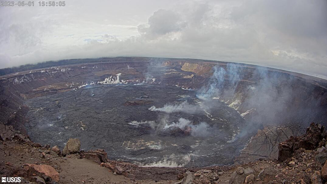
Summit Observations: Inflationary tilt and elevated seismicity continue at Kīlauea’s summit. Daily rates have been variable, but over the past several months, both deformation and seismicity have been elevated beyond observations preceding the January 5, 2023 summit eruption. Earthquake rates remain elevated beneath Kīlauea summit and Nāmakanipaio. Over the past 24 hours, 58 earthquakes were located beneath Kīlauea summit. Most of the earthquakes have been smaller than magnitude-2 and not reported felt. The most recent sulfur dioxide (SO2) emission rate of approximately 120 tonnes per day was measured on May 26, 2023.
Rift Zone Observations: No unusual activity has been noted along the East Rift Zone or Southwest Rift Zone; steady rates of ground deformation and seismicity continue along both. Measurements from continuous gas monitoring stations in the middle East Rift Zone—the site of 1983–2018 eruptive activity—remain below detection limits for SO2.
Hazard Analysis: Significant hazards around Kīlauea caldera include Halemaʻumaʻu crater wall instability, ground cracking, and rockfalls that can be enhanced by earthquakes within the area closed to the public. This underscores the extremely hazardous nature of the rim surrounding Halemaʻumaʻu crater, an area that has been closed to the public since early 2008.
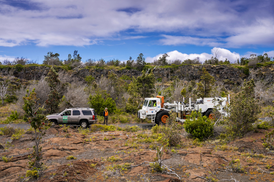
Meanwhile, the Kīlauea Seismic Imaging Project conducted during the month of May is winding down. The project’s Vibroseis truck, seen operating on the roads surrounding Kīlauea, has been generating seismic signals that scientists say “will help to provide a new detailed view of shallow subsurface structures and the magma system beneath Kīlauea volcano’s summit.”
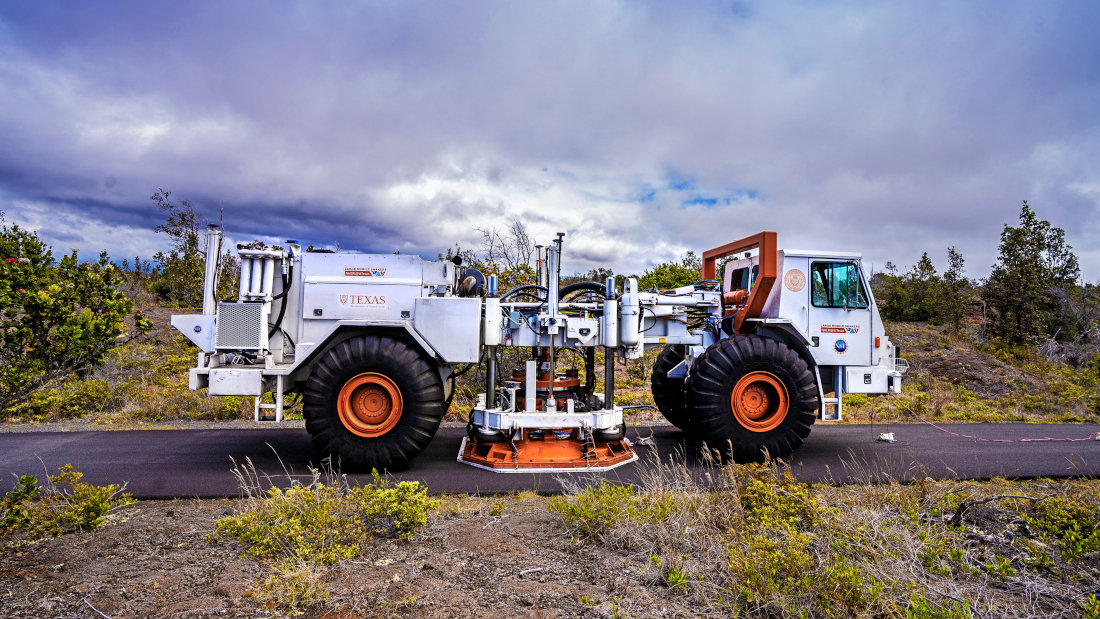
USGS: “The Vibroseis truck operating on Hilina Pali Road in Hawai‘i Volcanoes National Park on May 26, 2023.” (NPS Photo/J.Wei)
“The vehicle belongs to the Natural Hazards Engineering Research Infrastructure (NHERI) experimental facility at the University of Texas at Austin, which is supported with funding from the National Science Foundation,” the USGS says. “The truck was brought to Hawaii as part of the Kīlauea Seismic Imaging Project, funded by the Additional Supplemental Appropriations for Disaster Relief Act of 2019 (H.R. 2157) and the National Science Foundation.”
USGS: “The Vibroseis truck operating on Hilina Pali Road in Hawai‘i Volcanoes National Park on May 26, 2023.” (NPS Photo/J.Wei)

by Big Island Video News
on at
STORY SUMMARY
HAWAIʻI VOLCANOES NATIONAL PARK - Summit seismicity remains elevated, and tiltmeters have been showing continued inflation over the past day.