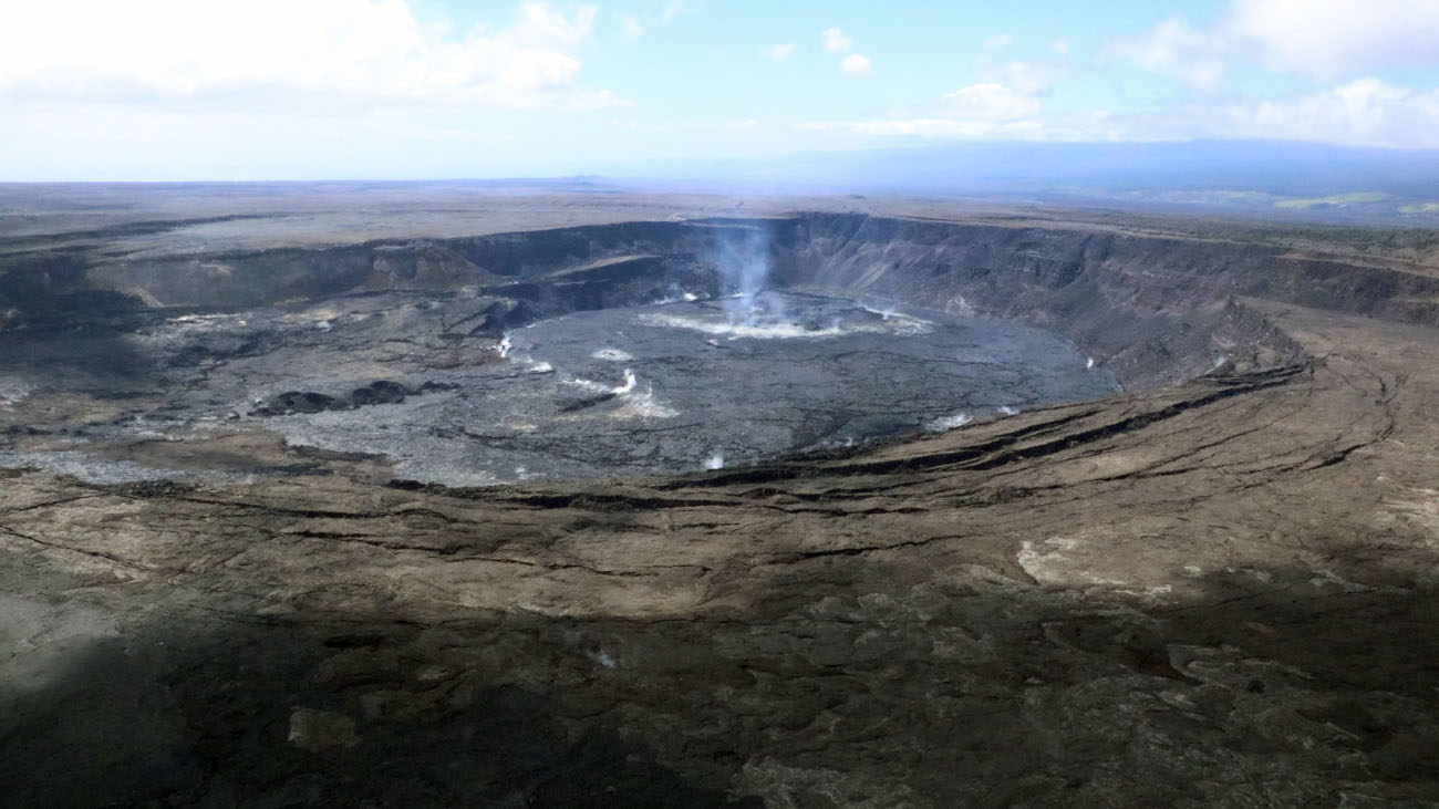
(BIVN) – Kīlauea volcano is not erupting, and the USGS Alert Level remains at ADVISORY.
Scientists with the USGS Hawaiian Volcano Observatory say low-level seismicity continues beneath the summit and Southwest Rift Zone, while rates of ground deformation remain low. No unusual activity has been noted along the East Rift Zone.
USGS graphs show seismicity appears to be on a downward trend.
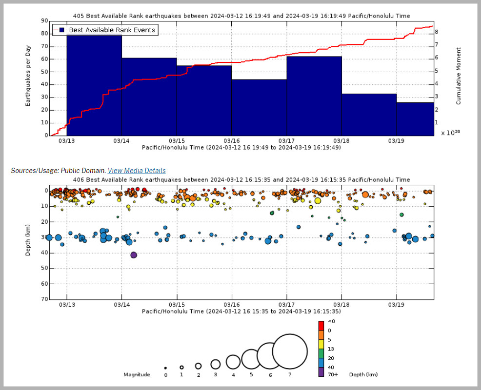
USGS graph shows earthquake rates and depths. From USGS HVO: “Above Top: Number of earthquakes per day during the past week (blue bars). The red line is the cumulative moment (energy) release. Bottom: Depth of earthquakes during the past week in the area shown on the map above. Depth is reported relative to sea level, which is equal to a depth of zero on the above plot. On both figures, circle-size represents magnitude, and color indicates depth. An interactive earthquake plot can be found on the HVO Earthquakes page.”
From the USGS Hawaiian Volcano Observatory’s weekly update posted on Tuesday, March 19:
Low levels of seismicity continue beneath Kīlauea’s summit. During the past week, the rate of earthquakes here saw a very slight increase over previous weeks, but daily earthquake counts remain well below those detected during the January–February intrusion or prior to recent summit eruptions. At this time, earthquake depths beneath the summit are 0.5–5 miles (1–8 kilometers) below the surface, and magnitudes are typically below M2.0.
Ground deformation continues at low rates across Kīlauea, with tiltmeters near Uēkahuna and Sand Hill—respectively northwest and southwest of the summit caldera—showing only modest changes over the past week.
Sulfur dioxide (SO2) gas emissions have remained at low, noneruptive levels since October 2023. An SO2 emission rate of approximately 85 tonnes per day was recorded on March 1.
The next update from the USGS HVO will be issued next Tuesday, unless events warrant an earlier statement.

by Big Island Video News
on at
STORY SUMMARY
HAWAIʻI VOLCANOES NATIONAL PARK - The rate of earthquakes below the summit slightly increased over previous weeks, but daily counts remain well below those detected during the recent magma intrusion to the southwest.