(BIVN) – As geologists await the start of the next eruptive episode at the summit of Kīlauea, which could occur at any moment, the USGS Hawaiian Volcano Observatory takes time to write about tsunami-generating earthquakes.
From this week’s Volcano Watch article:
Earthquakes and tsunamis in the news over the past few days are a reminder that we live on a dynamic planet with different hazards and associated response times. While tsunamis generated by large, distant earthquakes take hours to traverse the Pacific Ocean, it is important to remember that local earthquakes can also generate tsunamis—but with much less warning.
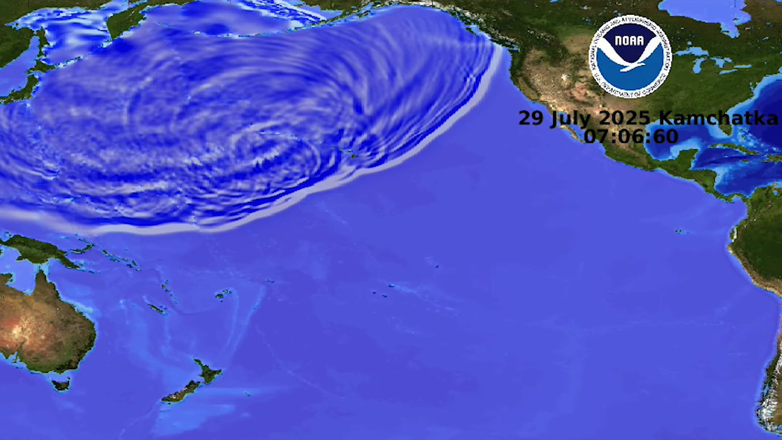
On July 29, 2025 at 1:24 p.m. HST, a magnitude-8.8 earthquake struck the Kamchatka Peninsula, Russia. A tsunami warning was issued for the State of Hawaii at 2:43 p.m. HST, and the Pacific Tsunami Warning Center (PTWC) issued a forecast for the first waves of a tsunami to arrive on Hawaiian shores a few minutes after 7:00 p.m. HST. With hours to prepare for the eventual arrival of tsunami waves, sirens sounded and cell phones received multiple alarms as coastal areas were evacuated. As PTWC modeled, tsunami waves began moving through the Hawaiian Islands after 7:00 p.m. HST and had a maximum measurement of 1.7 meters (5.7 feet) in Kahului, Maui. There was ultimately no significant damage in Hawaii and the warning was cancelled just before 11:00 p.m. HST.
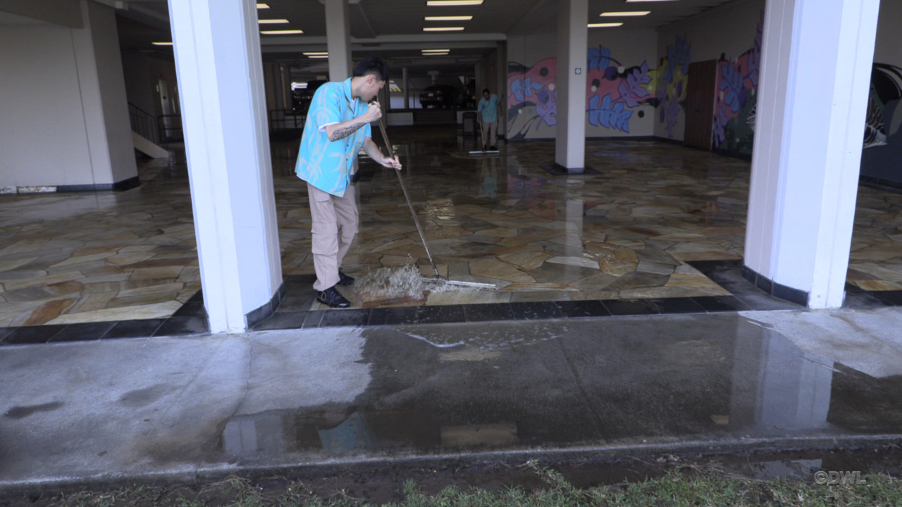
Cleanup after the tsunami flooded the breezeway of the Hilo Hawaiian Hotel (from video by Daryl Lee)
Large distant earthquakes in the past have generated tsunamis that caused significant damage and deaths in Hawaii. In 1946, a magnitude-7.9 Aleutian Islands, Alaska earthquake generated a tsunami that killed 159 people in the State of Hawaii, with a maximum wave run-up height of 16 meters (55 feet) measured at Pololū Valley on the Island of Hawaiʻi. In 1960, a magnitude-9.5 earthquake in Chile, South America generated a tsunami that killed 66 people in Hilo, with a maximum wave run-up height of 10.6 m (35 feet). Then in 2011, the magnitude-9.1 Tohoku, Japan earthquake generated a tsunami with maximum wave heights of about 3.6 m (12 feet) in Hawaii. Though there was significant damage in Hawaii from the Tohoku tsunami, there were no deaths locally.
Improved earthquake detection and tsunami monitoring, along with streamlined emergency communication techniques—such as the text alarms sent in Hawaii on July 29—reduce the risk of people being injured or killed by tsunamis. Another important factor is the response time; tsunami waves generated by distant earthquakes take hours to reach the Hawaiian Islands, which gives people time to evacuate vulnerable areas. Local tsunamis, however, do not need to travel far to reach our shores, which leaves residents and emergency management agencies a much shorter time to respond.
Large fault slips along the bases of Hawaiian volcanoes have historically produced damaging earthquakes that generated local tsunamis, and they will certainly do so again in the future. These events leave residents little time to evacuate to safety. Researchers from the University of Hawai‘i have modeled that a tsunami generated from the south flank of the Island of Hawai‘i can wrap around and reach Hilo Bay 4–5 minutes after the earthquake, before propagating through the Hawaiian Islands in less than an hour.
In 1868, an estimated magnitude-7.9 earthquake occurred beneath Mauna Loa volcano in the District of Kaʻū. It caused landslides and a local tsunami that affected the entire south coast of the Island of Hawaiʻi, killing nearly 100 people. In 1975, a magnitude-7.2 earthquake beneath the south flank of Kīlauea volcano generated a tsunami with maximum wave run-up heights of about 14 meters (47 feet). Two people were killed and many more were injured. Even the magnitude-6.9 earthquake beneath Kīlauea in 2018 generated a small local tsunami with a maximum wave height of 40 centimeters (15.7 inches) in Hilo.
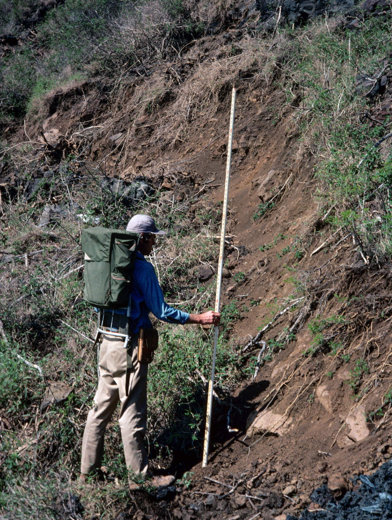
USGS: “A USGS Hawaiian Volcano Observatory geologist measures a scarp that formed on the south flank of Kīlauea during the magnitude-7.2 earthquake in 1975. In this area, near Poliokeawe Pali in Hawaiʻi Volcanoes National Park, the scarp is about 1.5 meters (5 feet) high.” (USGS photo by P. Lipman)
During these large local earthquakes, the southeast part of the Island of Hawaiʻi—called the Hilina Slump, with its toe beneath the ocean surface—shifts to the southeast and downwards. As this part of the island moves, it displaces ocean water, generating the damaging tsunamis that quickly inundate local shores.
If you are near the shore in Hawaii, be aware of your surroundings. If you feel strong shaking from a large earthquake, remember that the time you have to respond before the tsunami arrives could be minutes. Receding water could be a sign of an impending tsunami wave to follow. Do not wait for sirens or cell phone alarms, because the tsunami could occur before there is time for those alerts to be sent. Immediately head for higher ground, and wait for emergency management agencies to sound the all-clear before returning to the shoreline.

by Big Island Video News
on at
STORY SUMMARY
HAWAIʻI VOLCANOES NATIONAL PARK - Following the M8.8-earthquake off Russia, the USGS says it is important to remember that local earthquakes can also generate tsunamis, but with much less warning.