(BIVN) – A new tropical depression has formed in the Eastern Pacific.
Forecasters say Tropical Depression Four-E is expected to strengthen into a tropical storm before it dissipates a few days later.
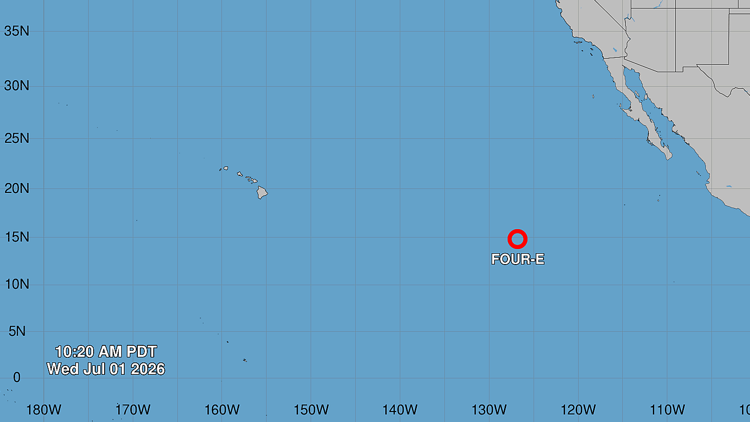
The weather system is currently far to the east of Hawaiʻi, about 1,230 miles west-southwest of the southern tip of Baja California. Maximum sustained winds are near 35 mph (55 km/h) with higher gusts.
From the National Hurricane Center discussion posted on Wednesday morning:
Deep convection has increased to the south and east of the center of Tropical Depression Four-E this morning as the system moves northward and out of the influence of the monsoonal trough/ITCZ. A microwave pass from earlier this morning suggested that the center was still somewhat elongated and farther south than previously thought, and the initial position has been shifted to reflect this. Subjective and objective Dvorak intensity estimates range from 28-34 kt, so the initial intensity has been maintained at 30 kt for this advisory.
The depression is moving toward the north around 5 kt, and this motion will continue into Thursday as a mid-level ridge prevails to the east in the central portion of the East Pacific. A gradual turn toward the northwest, then west-northwest is expected later this week and into this weekend as the system weakens and turns westward into the low-level flow. The latest NHC forecast has been shifted to the right of the previous track, and lies between the simple and corrected-consensus aids.
Four-E is embedded within a moist low and mid-level environment with low wind shear and warm SSTs. Some slight strengthening is forecast, and Four-E is expected to become a tropical storm later today or tonight, which is good agreement with the latest intensity aids. However, mid-level dry air to the west of the system will begin to wrap around the southern periphery of the system on Thursday as it moves northward into cooler waters. By Friday, increasing shear and decreasing upper-level divergence will likely inhibit organized deep convection, and the latest NHC forecast shows a post-tropical cyclone by 48 h, dissipating into an open trough by the end of the forecast period.
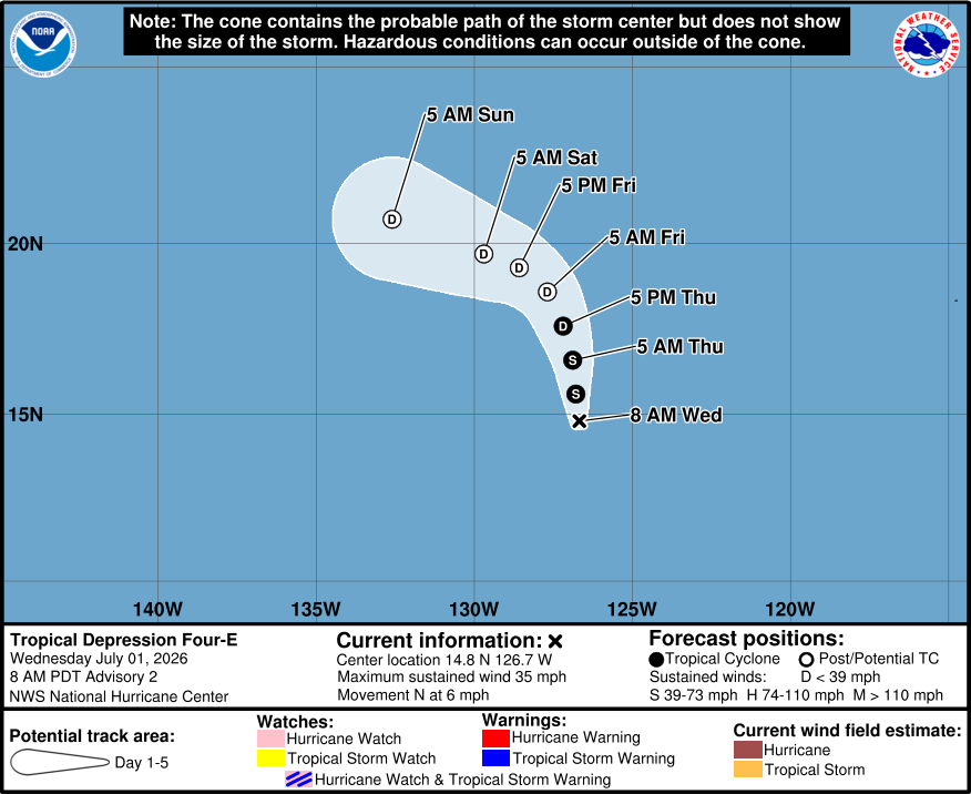
FORECAST POSITIONS AND MAX WINDS
INIT 01/1500Z 14.8N 126.7W 30 KT 35 MPH
12H 02/0000Z 15.6N 126.8W 35 KT 40 MPH
24H 02/1200Z 16.6N 126.9W 35 KT 40 MPH
36H 03/0000Z 17.6N 127.2W 30 KT 35 MPH
48H 03/1200Z 18.6N 127.7W 25 KT 30 MPH…POST-TROPICAL
60H 04/0000Z 19.3N 128.6W 25 KT 30 MPH…POST-TROPICAL
72H 04/1200Z 19.7N 129.7W 20 KT 25 MPH…POST-TROPICAL
96H 05/1200Z 20.7N 132.6W 20 KT 25 MPH…POST-TROPICAL
120H 06/1200Z…DISSIPATED