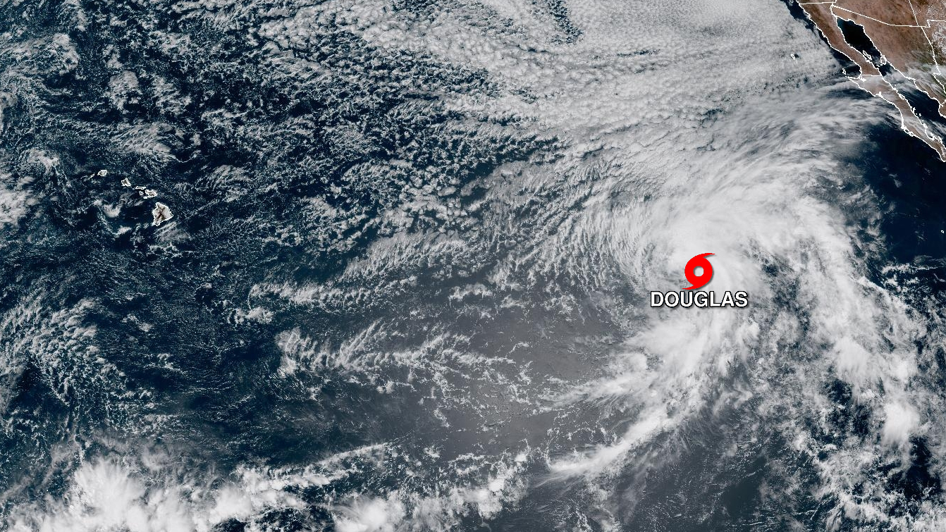
(BIVN) – Tropical Depression Four-E has strengthened into Tropical Storm Douglas over the Eastern Pacific.
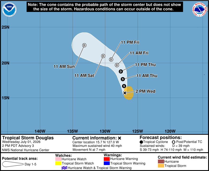
As of Wednesday before noon (Hawaiʻi time), the center of Tropical Storm Douglas was located near latitude 15.7 North, longitude 127.0 West, about 1,220 miles west-southwest of the southern tip of Baja California.
With maximum sustained winds near 40 mph, Tropical Storm Douglas is moving north near 7 mph. A gradual turn to the northwest is forecast late this week.
The National Hurricane Center in Miami, Florida says Douglas is expected to strengthen tonight, then gradually weaken starting on Thursday. Douglas is forecast to become post-tropical on Friday.
This storm does not appear to pose a cyclone threat to Hawaiʻi.
From an updated National Hurricane Center discussion:
A scatterometer pass from earlier this morning showed a well-defined, albeit slightly elongated center, with a few 30-33 kt wind vectors to the north and northwest of center. The subjective Dvorak estimate from TAFB was 35 kt, and various other objective estimates range from 31-35 kt. Based on these data and increasing banding features, the depression has been upgraded to Tropical Storm Douglas within an initial intensity set at 35 kt.
Douglas is moving northward at 350/6 kt. This motion will continue into Thursday as a mid-level ridge prevails to the east in the central portion of the East Pacific. The latest NHC track forecast has been shifted to the west for the first 24 h and lies in near HCCA, and between the previous forecast and Google DeepMind. Toward the end of the week, a slow turn toward the northwest, then west-northwest is expected as the system weakens and turns into the low-level flow. The forecast beyond 24 h has been shifted to the right and lies among various consensus aids.
The storm is embedded within a moist low and mid-level environment with low wind shear and warm SSTs. A favorable environment may allow for some slight strengthening through tonight, which is supported by HCCA and Google DeepMind. As the storm encounters increasing mid-level dry air, cooler waters and decreasing upper-level divergence Thursday and Friday, slow weakening is expected, and Douglas may struggle to produce organized deep convection by this weekend. The latest NHC forecast shows a post-tropical cyclone by 48 h, dissipating into an open trough by the end of the forecast period.
FORECAST POSITIONS AND MAX WINDS
INIT 01/2100Z 15.7N 127.0W 35 KT 40 MPH
12H 02/0600Z 16.7N 127.1W 40 KT 45 MPH
24H 02/1800Z 17.7N 127.3W 35 KT 40 MPH
36H 03/0600Z 18.8N 127.6W 30 KT 35 MPH
48H 03/1800Z 19.7N 128.2W 25 KT 30 MPH…POST-TROPICAL
60H 04/0600Z 20.5N 129.1W 25 KT 30 MPH…POST-TROPICAL
72H 04/1800Z 21.0N 130.3W 20 KT 25 MPH…POST-TROPICAL
96H 05/1800Z 22.5N 133.2W 20 KT 25 MPH…POST-TROPICAL
120H 06/1800Z…DISSIPATED