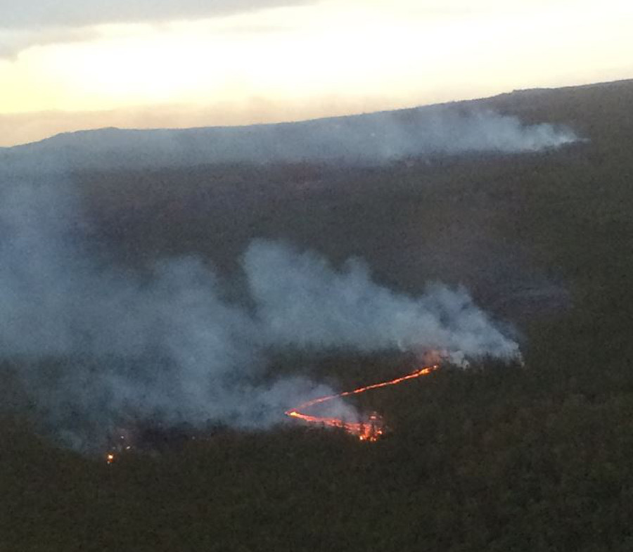
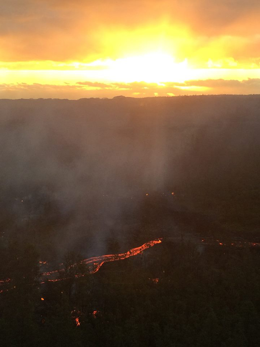
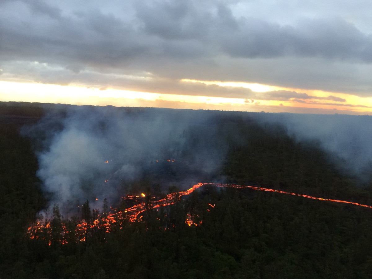
(ABOVE PHOTO) Picture taken early this morning (Dec. 1) by Hawaii County Civil Defense.
NEWS BRIEFS
- v advancing at its fastest speed since the stall of the former flow front in Pahoa. Civil defense snapped a series of photos during its overflight on Monday morning. The new flow front moved 400 yards since yesterday, and is now 2.9 miles upslope of the Highway 130 and Pahoa Village Road intersection.
- Civil defense says current activity does not pose an immediate threat to area communities and Civil Defense and Hawaiian Volcano Observatory personnel are maintaining close observations of flow activity.
INSIGHTS
Here is the audio from Monday’s media conference call. On the line is Darryl Oliveira, administrator of Hawaii County Civil Defense, and scientists with the USGS Hawaiian Volcano Observatory.
PRIMARY SOURCES

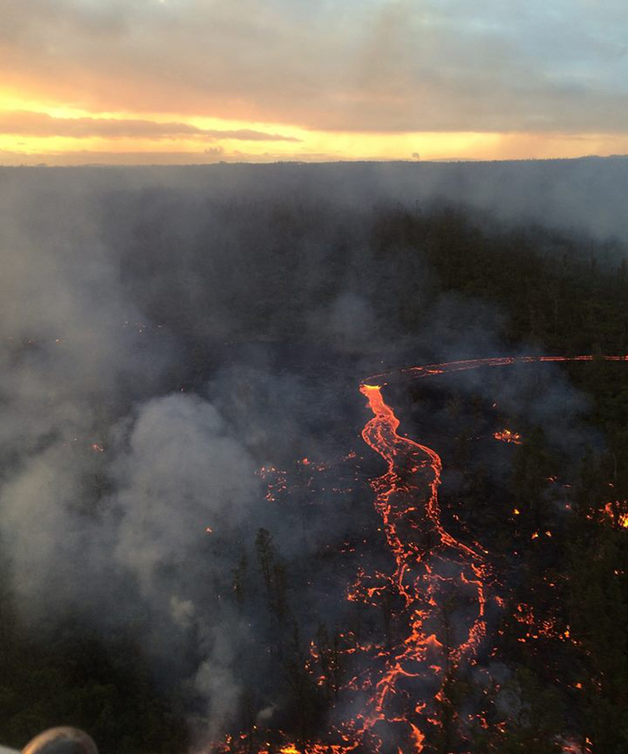
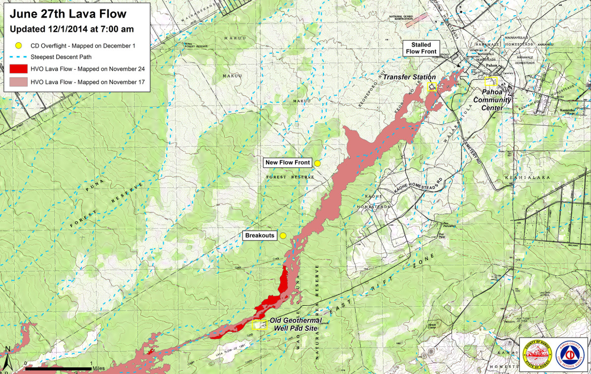
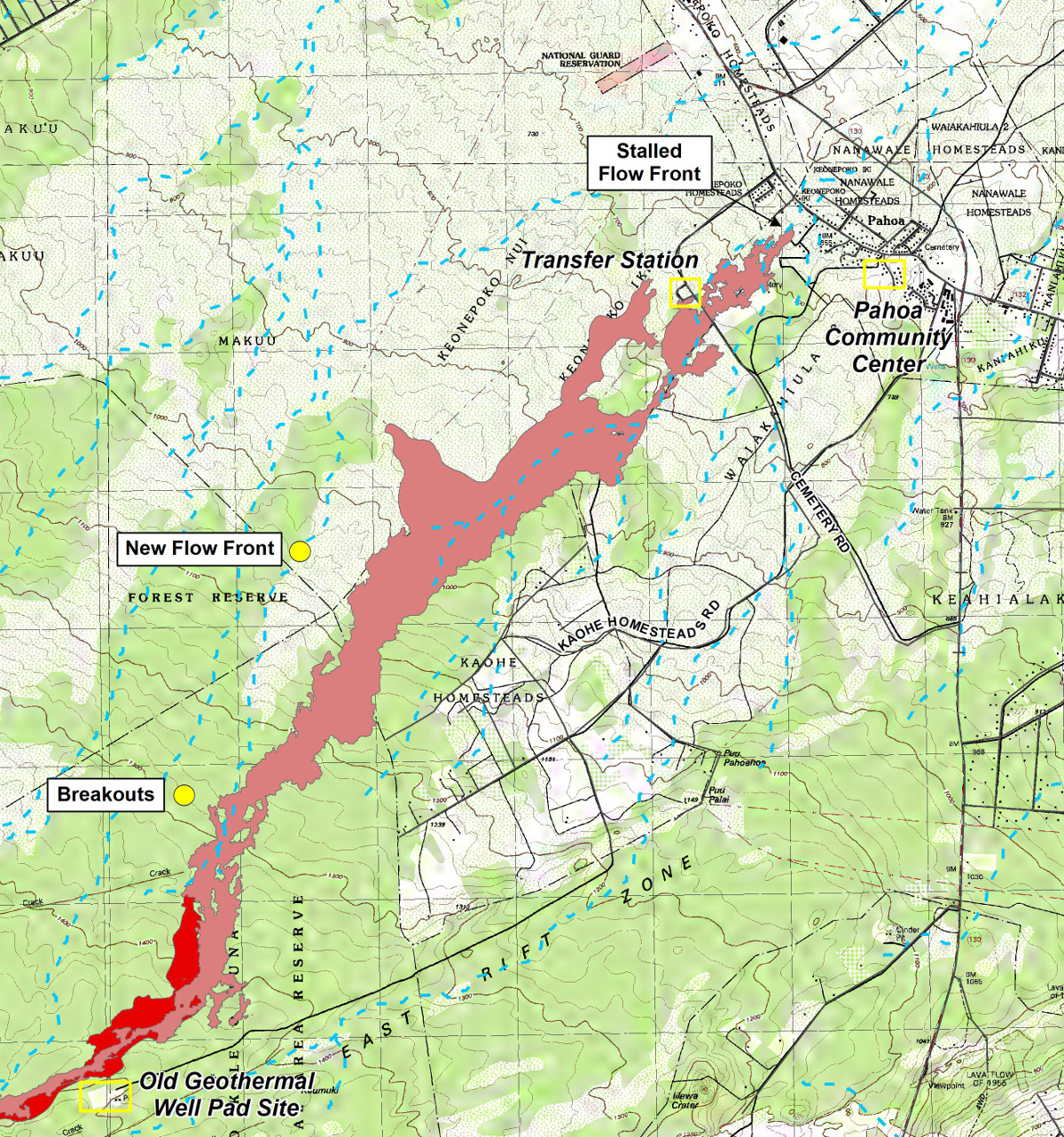
This morning’s helicopter assessment shows that the breakouts remain active and the furthest down slope breakout has become the new flow front. The active flow is located approximately 2.9 miles upslope of the Highway 130 and Pahoa Village Road intersection. The flow had advanced approximately 400 yards since yesterday. Current activity does not pose an immediate threat to area communities and Civil Defense and Hawaiian Volcano Observatory personnel are maintaining close observations of flow activity. Residents down slope will be kept informed of any changes in flow activity, advancement, and status.
Smoke conditions were light this morning in the immediate area with all smoke from burning vegetation being blown in a southeast direction. Smoke conditions may increase in some areas and residents that may be sensitive or have respiratory problems are advised to take precautions and to remain indoors.
The Pahoa Village Road remains open to all traffic and motorists are advised to exercise caution as some utility pole protection material remains in place. Everyone is asked to please respect the residents of the area who were affected by the lava flow and to not trespass on private property.
Once again we would like to thank everyone for your patience and understanding and your cooperation and assistance is greatly appreciated. Hawaii County Civil Defense on Dec. 1 at 7:45 a.m. HST